Clay City Topo Map Illinois
To zoom in, hover over the map of Clay City
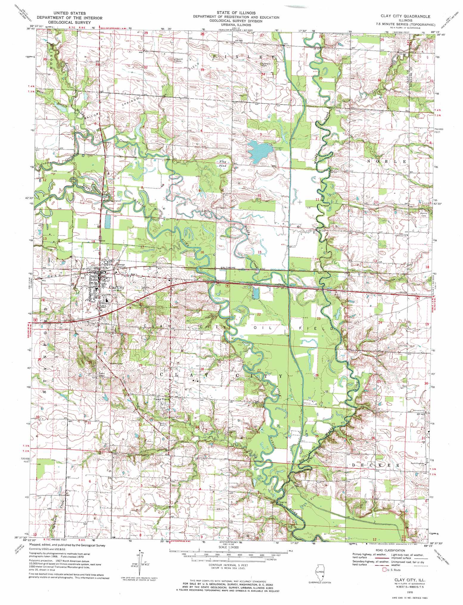
USGS Topo Quad 38088f3 - 1:24,000 scale
| Topo Map Name: | Clay City |
| USGS Topo Quad ID: | 38088f3 |
| Print Size: | ca. 21 1/4" wide x 27" high |
| Southeast Coordinates: | 38.625° N latitude / 88.25° W longitude |
| Map Center Coordinates: | 38.6875° N latitude / 88.3125° W longitude |
| U.S. State: | IL |
| Filename: | o38088f3.jpg |
| Download Map JPG Image: | Clay City topo map 1:24,000 scale |
| Map Type: | Topographic |
| Topo Series: | 7.5´ |
| Map Scale: | 1:24,000 |
| Source of Map Images: | United States Geological Survey (USGS) |
| Alternate Map Versions: |
Clay City IL 1970, updated 1971 Download PDF Buy paper map Clay City IL 1970, updated 1971 Download PDF Buy paper map Clay City IL 2012 Download PDF Buy paper map Clay City IL 2015 Download PDF Buy paper map |
1:24,000 Topo Quads surrounding Clay City
Hord |
Eberle |
Latona |
Newton |
Sainte Marie |
Louisville West |
Louisville East |
Sailor Springs |
Wakefield |
Dundas |
Xenia Ne |
Flora |
Clay City |
Noble |
Olney |
Johnsonville |
Cisne |
Enterprise |
Mount Erie |
West Salem |
Crisp |
Geff |
Fairfield |
Albion Nw |
Albion North |
> Back to 38088e1 at 1:100,000 scale
> Back to 38088a1 at 1:250,000 scale
> Back to U.S. Topo Maps home
Clay City topo map: Gazetteer
Clay City: Dams
Gaskin Lake Dam elevation 131m 429′Clay City: Populated Places
Camp Travis elevation 137m 449′Clay City elevation 132m 433′
Glenwood (historical) elevation 131m 429′
Maysville elevation 141m 462′
Clay City: Reservoirs
Gaskin Lake elevation 131m 429′Salt Pond elevation 129m 423′
Clay City: Streams
Big Muddy Creek elevation 124m 406′Flat Branch elevation 128m 419′
Indian Creek elevation 130m 426′
Little Muddy Creek elevation 125m 410′
Sugar Creek elevation 126m 413′
Clay City: Swamps
Flag Pond elevation 128m 419′Clay City digital topo map on disk
Buy this Clay City topo map showing relief, roads, GPS coordinates and other geographical features, as a high-resolution digital map file on DVD: