Geff Topo Map Illinois
To zoom in, hover over the map of Geff
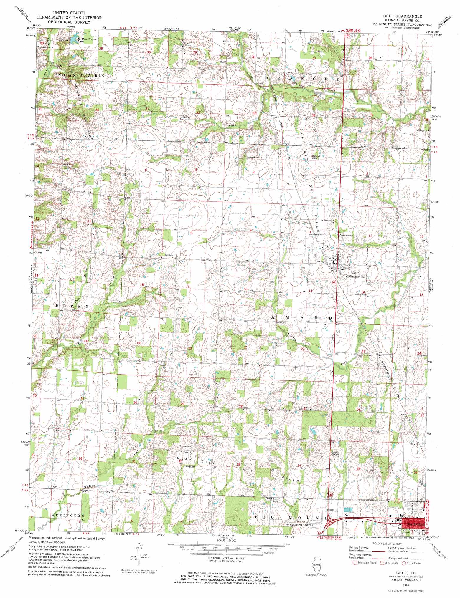
USGS Topo Quad 38088d4 - 1:24,000 scale
| Topo Map Name: | Geff |
| USGS Topo Quad ID: | 38088d4 |
| Print Size: | ca. 21 1/4" wide x 27" high |
| Southeast Coordinates: | 38.375° N latitude / 88.375° W longitude |
| Map Center Coordinates: | 38.4375° N latitude / 88.4375° W longitude |
| U.S. State: | IL |
| Filename: | o38088d4.jpg |
| Download Map JPG Image: | Geff topo map 1:24,000 scale |
| Map Type: | Topographic |
| Topo Series: | 7.5´ |
| Map Scale: | 1:24,000 |
| Source of Map Images: | United States Geological Survey (USGS) |
| Alternate Map Versions: |
Geff IL 1970, updated 1973 Download PDF Buy paper map Geff IL 2012 Download PDF Buy paper map Geff IL 2015 Download PDF Buy paper map |
1:24,000 Topo Quads surrounding Geff
Xenia |
Xenia Ne |
Flora |
Clay City |
Noble |
Orchardville |
Johnsonville |
Cisne |
Enterprise |
Mount Erie |
Shields |
Crisp |
Geff |
Fairfield |
Albion Nw |
Bluford |
Wayne City |
Boylestown |
Burnt Prairie |
Golden Gate |
Dahlgren |
Belle Prairie City |
Bungay |
Springerton |
Centerville |
> Back to 38088a1 at 1:100,000 scale
> Back to 38088a1 at 1:250,000 scale
> Back to U.S. Topo Maps home
Geff topo map: Gazetteer
Geff: Airports
Fairfield Municipal Airport elevation 128m 419′Geff: Parks
Wayne County Fairgrounds elevation 138m 452′Geff: Populated Places
Covington elevation 125m 410′Geff elevation 140m 459′
Geff: Post Offices
Pin Oak Post Office (historical) elevation 128m 419′Geff: Reservoirs
In-Dan-Wayne Lake elevation 146m 479′Geff: Streams
Hazel Branch elevation 124m 406′South Fork Deer Creek elevation 129m 423′
Geff digital topo map on disk
Buy this Geff topo map showing relief, roads, GPS coordinates and other geographical features, as a high-resolution digital map file on DVD: