Sailor Springs Topo Map Illinois
To zoom in, hover over the map of Sailor Springs
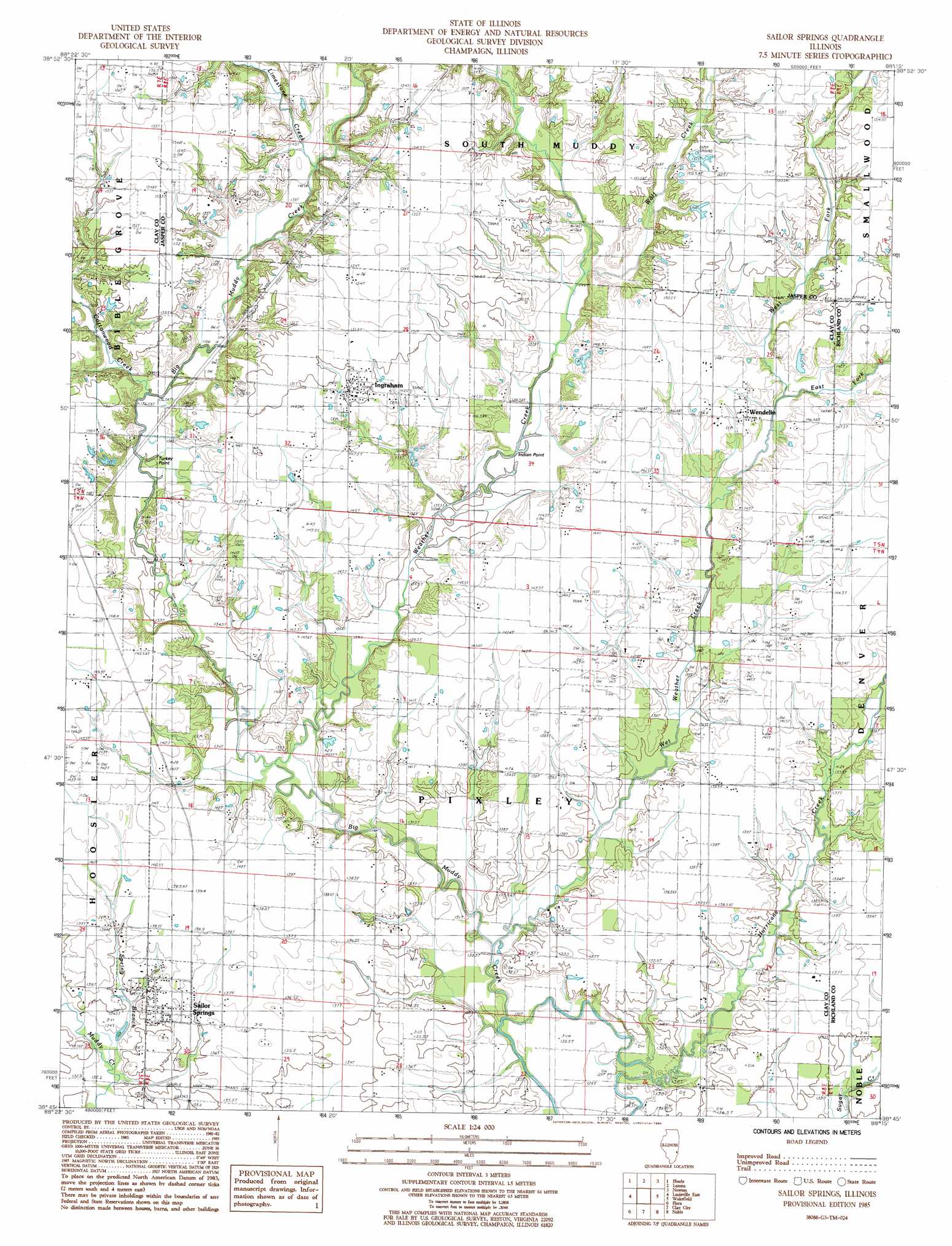
USGS Topo Quad 38088g3 - 1:24,000 scale
| Topo Map Name: | Sailor Springs |
| USGS Topo Quad ID: | 38088g3 |
| Print Size: | ca. 21 1/4" wide x 27" high |
| Southeast Coordinates: | 38.75° N latitude / 88.25° W longitude |
| Map Center Coordinates: | 38.8125° N latitude / 88.3125° W longitude |
| U.S. State: | IL |
| Filename: | o38088g3.jpg |
| Download Map JPG Image: | Sailor Springs topo map 1:24,000 scale |
| Map Type: | Topographic |
| Topo Series: | 7.5´ |
| Map Scale: | 1:24,000 |
| Source of Map Images: | United States Geological Survey (USGS) |
| Alternate Map Versions: |
Sailor Springs IL 1985, updated 1985 Download PDF Buy paper map Sailor Springs IL 2012 Download PDF Buy paper map Sailor Springs IL 2015 Download PDF Buy paper map |
1:24,000 Topo Quads surrounding Sailor Springs
Effingham South |
Dieterich |
Wheeler |
Rose Hill |
Yale |
Hord |
Eberle |
Latona |
Newton |
Sainte Marie |
Louisville West |
Louisville East |
Sailor Springs |
Wakefield |
Dundas |
Xenia Ne |
Flora |
Clay City |
Noble |
Olney |
Johnsonville |
Cisne |
Enterprise |
Mount Erie |
West Salem |
> Back to 38088e1 at 1:100,000 scale
> Back to 38088a1 at 1:250,000 scale
> Back to U.S. Topo Maps home
Sailor Springs topo map: Gazetteer
Sailor Springs: Populated Places
Ingraham elevation 148m 485′Sailor Springs elevation 133m 436′
Wendelin elevation 144m 472′
Sailor Springs: Post Offices
Ingraham Post Office elevation 150m 492′Sailor Springs Post Office elevation 136m 446′
Sailor Springs: Streams
Cottonwood Creek elevation 139m 456′East Fork Wetweather Creek elevation 144m 472′
Hurricane Creek elevation 129m 423′
Limestone Creek elevation 143m 469′
Spring Branch elevation 131m 429′
Weather Creek elevation 132m 433′
West Fork Wetweather Creek elevation 144m 472′
Wet Weather Creek elevation 131m 429′
Wolf Creek elevation 138m 452′
Sailor Springs: Summits
Indian Point elevation 137m 449′Turkey Point elevation 135m 442′
Sailor Springs digital topo map on disk
Buy this Sailor Springs topo map showing relief, roads, GPS coordinates and other geographical features, as a high-resolution digital map file on DVD: