Council Grove Topo Map Kansas
To zoom in, hover over the map of Council Grove
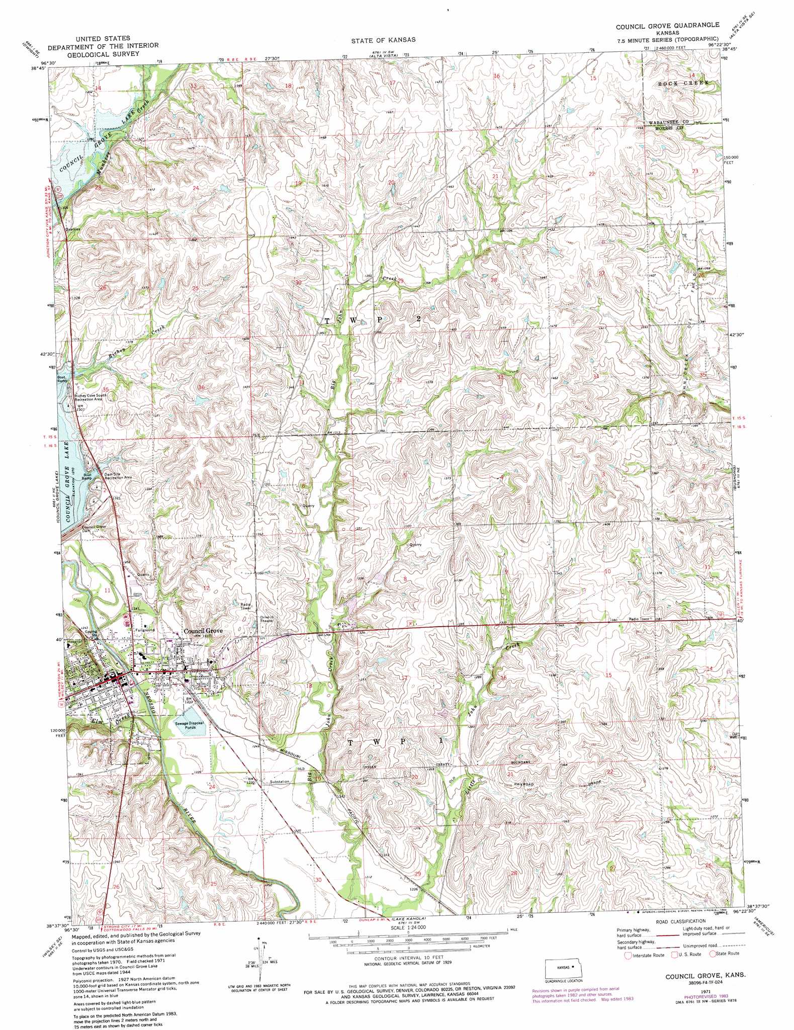
USGS Topo Quad 38096f4 - 1:24,000 scale
| Topo Map Name: | Council Grove |
| USGS Topo Quad ID: | 38096f4 |
| Print Size: | ca. 21 1/4" wide x 27" high |
| Southeast Coordinates: | 38.625° N latitude / 96.375° W longitude |
| Map Center Coordinates: | 38.6875° N latitude / 96.4375° W longitude |
| U.S. State: | KS |
| Filename: | o38096f4.jpg |
| Download Map JPG Image: | Council Grove topo map 1:24,000 scale |
| Map Type: | Topographic |
| Topo Series: | 7.5´ |
| Map Scale: | 1:24,000 |
| Source of Map Images: | United States Geological Survey (USGS) |
| Alternate Map Versions: |
Council Grove KS 1971, updated 1974 Download PDF Buy paper map Council Grove KS 1971, updated 1984 Download PDF Buy paper map Council Grove KS 2009 Download PDF Buy paper map Council Grove KS 2012 Download PDF Buy paper map Council Grove KS 2015 Download PDF Buy paper map |
1:24,000 Topo Quads surrounding Council Grove
White City Nw |
White City Ne |
Volland |
Allendorph |
Hessdale |
White City |
Dwight |
Alta Vista |
Alta Vista Se |
Lake Wabaunsee |
Wilsey |
Council Grove Lake |
Council Grove |
Bushong |
Allen |
Diamond Springs |
Wilsey Se |
Lake Kahola |
Americus |
Allen Sw |
Hymer |
Strong City |
Saffordville |
Plymouth |
Emporia |
> Back to 38096e1 at 1:100,000 scale
> Back to 38096a1 at 1:250,000 scale
> Back to U.S. Topo Maps home
Council Grove topo map: Gazetteer
Council Grove: Airports
Alexander Ranch Airport elevation 380m 1246′Council Grove: Oilfields
John Creek Oil Field elevation 426m 1397′Council Grove: Parks
Richey Cove South Recreation Area elevation 398m 1305′Council Grove: Populated Places
Council Grove elevation 377m 1236′Council Grove: Streams
Elm Creek elevation 369m 1210′Little John Creek elevation 367m 1204′
Munkers Creek elevation 390m 1279′
Council Grove digital topo map on disk
Buy this Council Grove topo map showing relief, roads, GPS coordinates and other geographical features, as a high-resolution digital map file on DVD: