Cedar Bluff Topo Map Kansas
To zoom in, hover over the map of Cedar Bluff
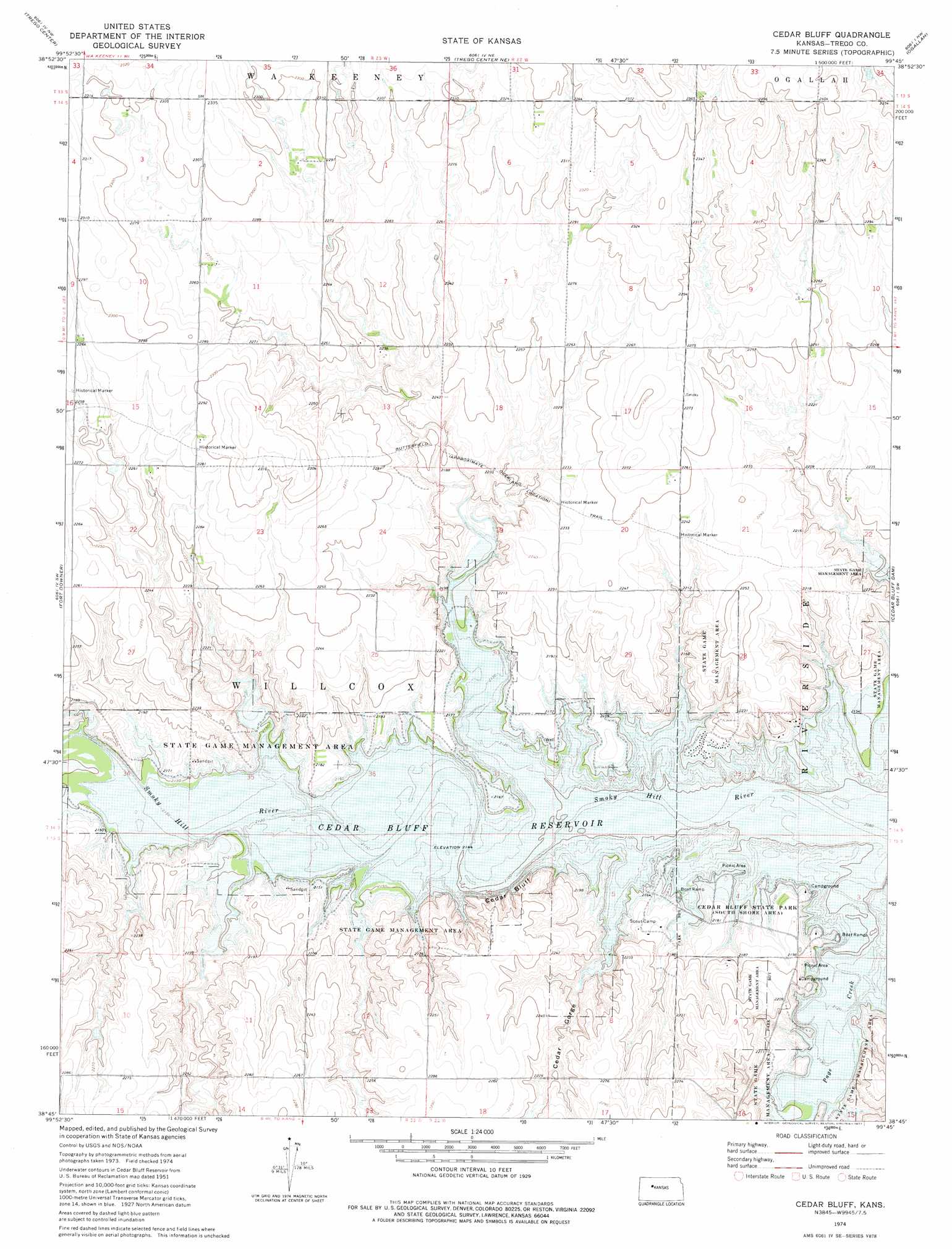
USGS Topo Quad 38099g7 - 1:24,000 scale
| Topo Map Name: | Cedar Bluff |
| USGS Topo Quad ID: | 38099g7 |
| Print Size: | ca. 21 1/4" wide x 27" high |
| Southeast Coordinates: | 38.75° N latitude / 99.75° W longitude |
| Map Center Coordinates: | 38.8125° N latitude / 99.8125° W longitude |
| U.S. State: | KS |
| Filename: | o38099g7.jpg |
| Download Map JPG Image: | Cedar Bluff topo map 1:24,000 scale |
| Map Type: | Topographic |
| Topo Series: | 7.5´ |
| Map Scale: | 1:24,000 |
| Source of Map Images: | United States Geological Survey (USGS) |
| Alternate Map Versions: |
Cedar Bluff KS 1974, updated 1977 Download PDF Buy paper map Cedar Bluff KS 2010 Download PDF Buy paper map Cedar Bluff KS 2012 Download PDF Buy paper map Cedar Bluff KS 2016 Download PDF Buy paper map |
1:24,000 Topo Quads surrounding Cedar Bluff
Collyer |
Wa Keeney West |
Wa Keeney East |
Hill City 4 Sw |
Hill City 4 Se |
Castle Rock Ne |
Trego Center |
Trego Center Ne |
Ogallah |
Ellis |
Gibson Creek |
Fort Downer |
Cedar Bluff |
Cedar Bluff Dam |
Ellis Se |
Arnold |
Ransom |
Osgood |
Brownell |
Mccracken Ne |
Utica Se |
Ransom Sw |
Ransom Se |
Mccracken Sw |
Mccracken |
> Back to 38099e1 at 1:100,000 scale
> Back to 38098a1 at 1:250,000 scale
> Back to U.S. Topo Maps home
Cedar Bluff topo map: Gazetteer
Cedar Bluff: Cliffs
Cedar Bluff elevation 659m 2162′Cedar Bluff: Valleys
Cedar Gorge elevation 655m 2148′Cedar Bluff digital topo map on disk
Buy this Cedar Bluff topo map showing relief, roads, GPS coordinates and other geographical features, as a high-resolution digital map file on DVD: