Cheraw Topo Map Colorado
To zoom in, hover over the map of Cheraw
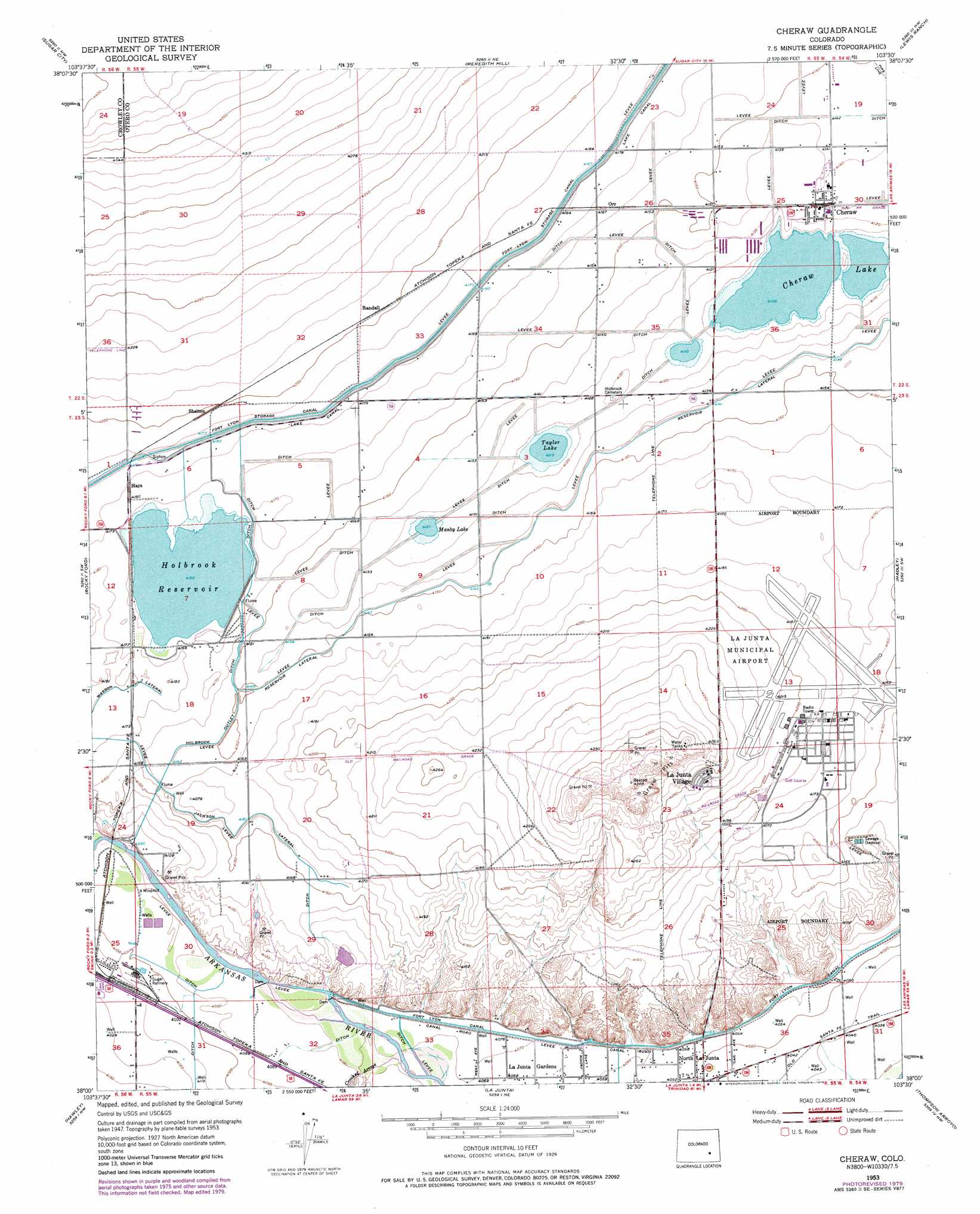
USGS Topo Quad 38103a5 - 1:24,000 scale
| Topo Map Name: | Cheraw |
| USGS Topo Quad ID: | 38103a5 |
| Print Size: | ca. 21 1/4" wide x 27" high |
| Southeast Coordinates: | 38° N latitude / 103.5° W longitude |
| Map Center Coordinates: | 38.0625° N latitude / 103.5625° W longitude |
| U.S. State: | CO |
| Filename: | o38103a5.jpg |
| Download Map JPG Image: | Cheraw topo map 1:24,000 scale |
| Map Type: | Topographic |
| Topo Series: | 7.5´ |
| Map Scale: | 1:24,000 |
| Source of Map Images: | United States Geological Survey (USGS) |
| Alternate Map Versions: |
Cheraw CO 1953, updated 1954 Download PDF Buy paper map Cheraw CO 1953, updated 1974 Download PDF Buy paper map Cheraw CO 1953, updated 1979 Download PDF Buy paper map Cheraw CO 2010 Download PDF Buy paper map Cheraw CO 2013 Download PDF Buy paper map Cheraw CO 2016 Download PDF Buy paper map |
1:24,000 Topo Quads surrounding Cheraw
Nero Hill |
Lake Henry |
Todd Point |
Houston Lakes |
Arlington |
Ordway |
Sugar City |
Meredith Hill |
Lewis Ranch |
Mcintosh Ranch |
Manzanola |
Rocky Ford |
Cheraw |
Hadley |
Cornelia |
Timpas Ne |
Hawley |
La Junta |
Thompson Arroyo |
Hackamore Ranch |
Timpas |
La Junta Sw |
La Junta Se |
Higbee |
Turkey Canyon |
> Back to 38103a1 at 1:100,000 scale
> Back to 38102a1 at 1:250,000 scale
> Back to U.S. Topo Maps home
Cheraw topo map: Gazetteer
Cheraw: Airports
La Junta Municipal Airport elevation 1285m 4215′Cheraw: Canals
Holbrook Outlet Ditch elevation 1266m 4153′Jackson Lateral elevation 1271m 4169′
Wasson Lateral elevation 1270m 4166′
Cheraw: Dams
Holbrook Dam elevation 1269m 4163′Cheraw: Lakes
Cheraw Lake elevation 1252m 4107′Manby Lake elevation 1257m 4124′
Taylor Lake elevation 1254m 4114′
Cheraw: Populated Places
Cheraw elevation 1259m 4130′Hays elevation 1275m 4183′
La Junta Village elevation 1295m 4248′
Orr elevation 1266m 4153′
Randall elevation 1282m 4206′
Shelton elevation 1281m 4202′
Cheraw: Reservoirs
Holbrook Reservoir elevation 1269m 4163′Cheraw: Streams
Crooked Arroyo elevation 1241m 4071′Cheraw digital topo map on disk
Buy this Cheraw topo map showing relief, roads, GPS coordinates and other geographical features, as a high-resolution digital map file on DVD: