Portuguese Mountain Nw Topo Map Nevada
To zoom in, hover over the map of Portuguese Mountain Nw
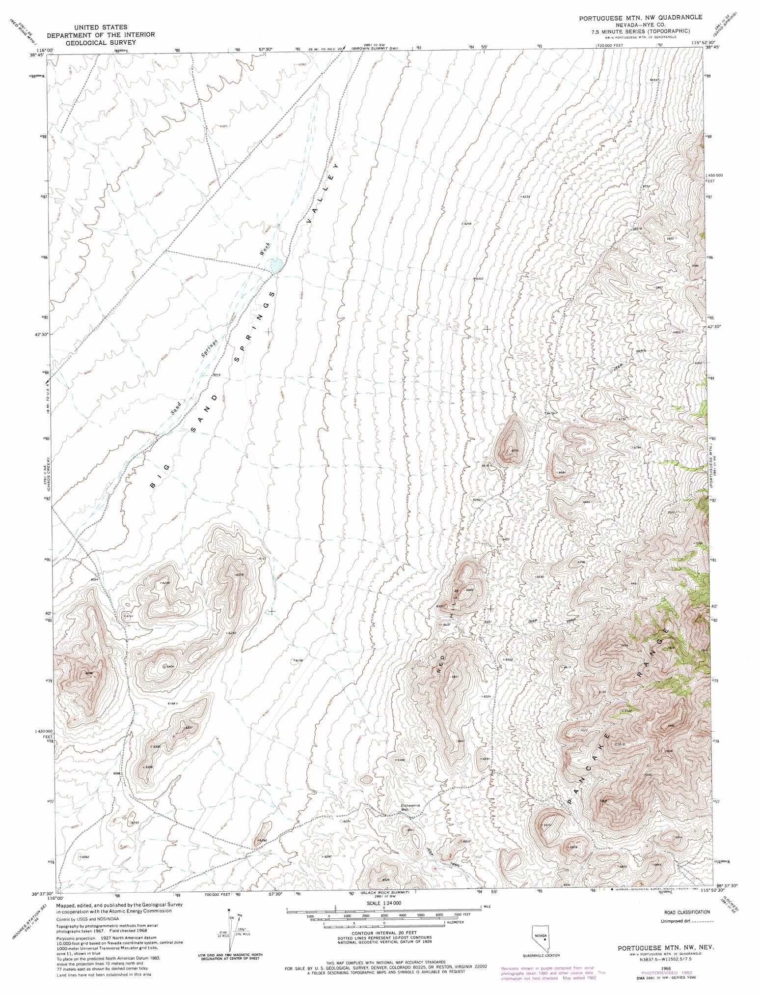
USGS Topo Quad 38115f8 - 1:24,000 scale
| Topo Map Name: | Portuguese Mountain Nw |
| USGS Topo Quad ID: | 38115f8 |
| Print Size: | ca. 21 1/4" wide x 27" high |
| Southeast Coordinates: | 38.625° N latitude / 115.875° W longitude |
| Map Center Coordinates: | 38.6875° N latitude / 115.9375° W longitude |
| U.S. State: | NV |
| Filename: | o38115f8.jpg |
| Download Map JPG Image: | Portuguese Mountain Nw topo map 1:24,000 scale |
| Map Type: | Topographic |
| Topo Series: | 7.5´ |
| Map Scale: | 1:24,000 |
| Source of Map Images: | United States Geological Survey (USGS) |
| Alternate Map Versions: |
Portuguese Mtn NW NV 1968, updated 1973 Download PDF Buy paper map Portuguese Mtn NW NV 1968, updated 1982 Download PDF Buy paper map Portuguese Mountain NW NV 2012 Download PDF Buy paper map Portuguese Mountain NW NV 2014 Download PDF Buy paper map |
1:24,000 Topo Quads surrounding Portuguese Mountain Nw
Park Mountain |
Summit Station |
Brown Summit Nw |
Brown Summit |
Duckwater |
Pritchards Station |
Red Ring Mountain |
Brown Summit Sw |
Sand Spring |
Bradshaw Spring |
Moores Station |
Chaos Creek |
Portuguese Mountain Nw |
Portuguese Mountain |
Meteorite Crater |
Moores Station Sw |
Moores Station Se |
Black Rock Summit |
Lockes |
Blue Eagle Springs Sw |
Palisade Mesa |
Lunar Crater |
The Wall |
The Wall Ne |
Christian Spring |
> Back to 38115e1 at 1:100,000 scale
> Back to 38114a1 at 1:250,000 scale
> Back to U.S. Topo Maps home
Portuguese Mountain Nw topo map: Gazetteer
Portuguese Mountain Nw: Summits
Red Hills elevation 1956m 6417′Portuguese Mountain Nw: Wells
Etcheverria Well elevation 1927m 6322′Olevia Well elevation 2071m 6794′
Portuguese Mountain Nw digital topo map on disk
Buy this Portuguese Mountain Nw topo map showing relief, roads, GPS coordinates and other geographical features, as a high-resolution digital map file on DVD: