Good Hope Topo Map Ohio
To zoom in, hover over the map of Good Hope
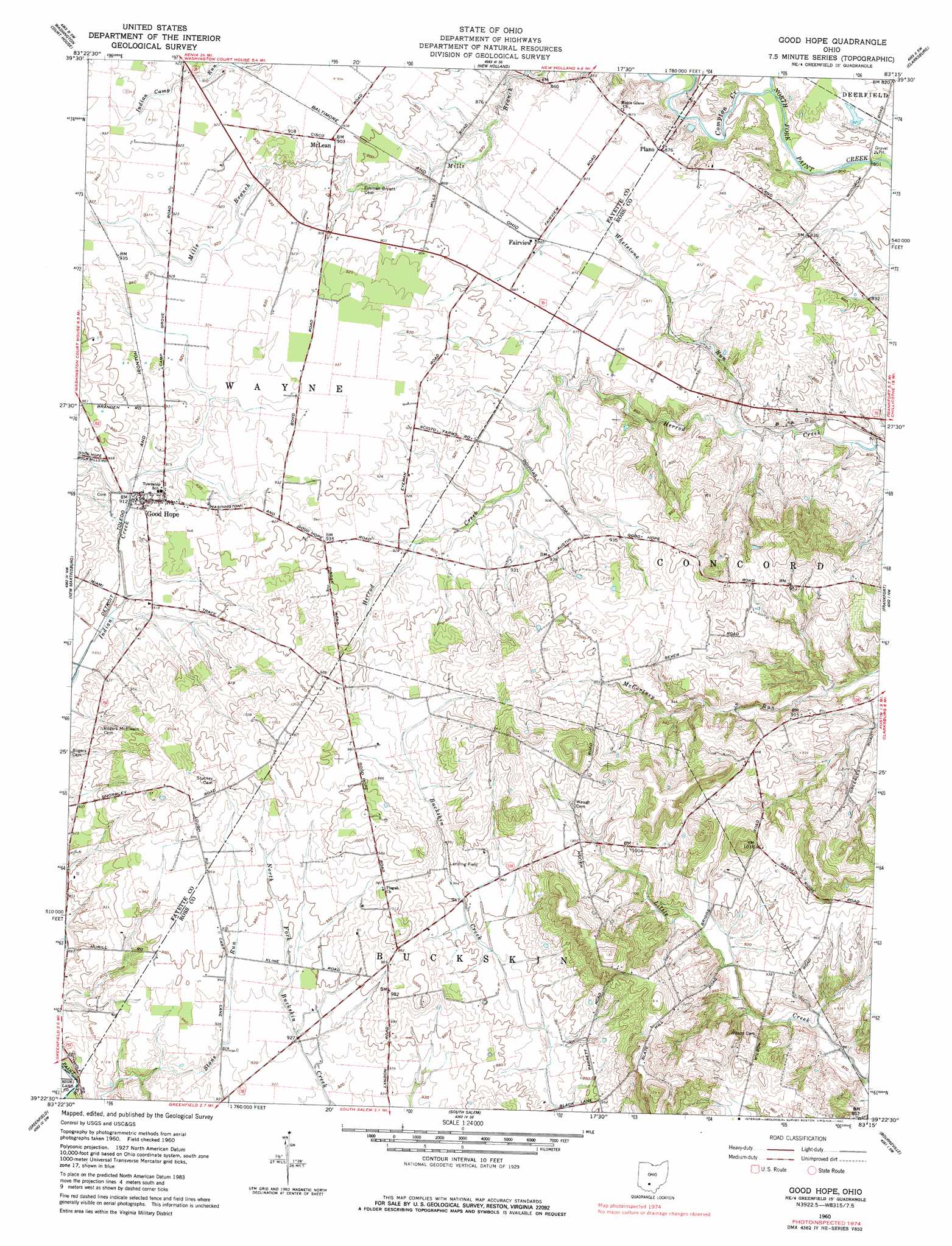
USGS Topo Quad 39083d3 - 1:24,000 scale
| Topo Map Name: | Good Hope |
| USGS Topo Quad ID: | 39083d3 |
| Print Size: | ca. 21 1/4" wide x 27" high |
| Southeast Coordinates: | 39.375° N latitude / 83.25° W longitude |
| Map Center Coordinates: | 39.4375° N latitude / 83.3125° W longitude |
| U.S. State: | OH |
| Filename: | o39083d3.jpg |
| Download Map JPG Image: | Good Hope topo map 1:24,000 scale |
| Map Type: | Topographic |
| Topo Series: | 7.5´ |
| Map Scale: | 1:24,000 |
| Source of Map Images: | United States Geological Survey (USGS) |
| Alternate Map Versions: |
Good Hope OH 1960, updated 1962 Download PDF Buy paper map Good Hope OH 1960, updated 1980 Download PDF Buy paper map Good Hope OH 2010 Download PDF Buy paper map Good Hope OH 2013 Download PDF Buy paper map Good Hope OH 2016 Download PDF Buy paper map |
1:24,000 Topo Quads surrounding Good Hope
Jeffersonville |
Midway |
Mount Sterling |
Five Points |
Darbyville |
Milledgeville |
Washington Court House |
New Holland |
Clarksburg |
Williamsport |
Memphis |
New Martinsburg |
Good Hope |
Frankfort |
Andersonville |
Leesburg |
Greenfield |
South Salem |
Bourneville |
Chillicothe West |
Hillsboro |
Rainsboro |
Bainbridge |
Morgantown |
Summithill |
> Back to 39083a1 at 1:100,000 scale
> Back to 39082a1 at 1:250,000 scale
> Back to U.S. Topo Maps home
Good Hope topo map: Gazetteer
Good Hope: Populated Places
Fairview elevation 269m 882′Good Hope elevation 281m 921′
Heglers (historical) elevation 244m 800′
McLean elevation 275m 902′
Plano elevation 267m 875′
Thornton (historical) elevation 294m 964′
Good Hope: Post Offices
Good Hope Post Office (historical) elevation 280m 918′McLean Post Office (historical) elevation 276m 905′
Thornton Post Office (historical) elevation 294m 964′
Good Hope: Streams
Compton Creek elevation 241m 790′Mills Branch elevation 250m 820′
Whetstone Run elevation 247m 810′
Good Hope: Summits
Slate Hill elevation 376m 1233′Good Hope digital topo map on disk
Buy this Good Hope topo map showing relief, roads, GPS coordinates and other geographical features, as a high-resolution digital map file on DVD:
 map DVD")