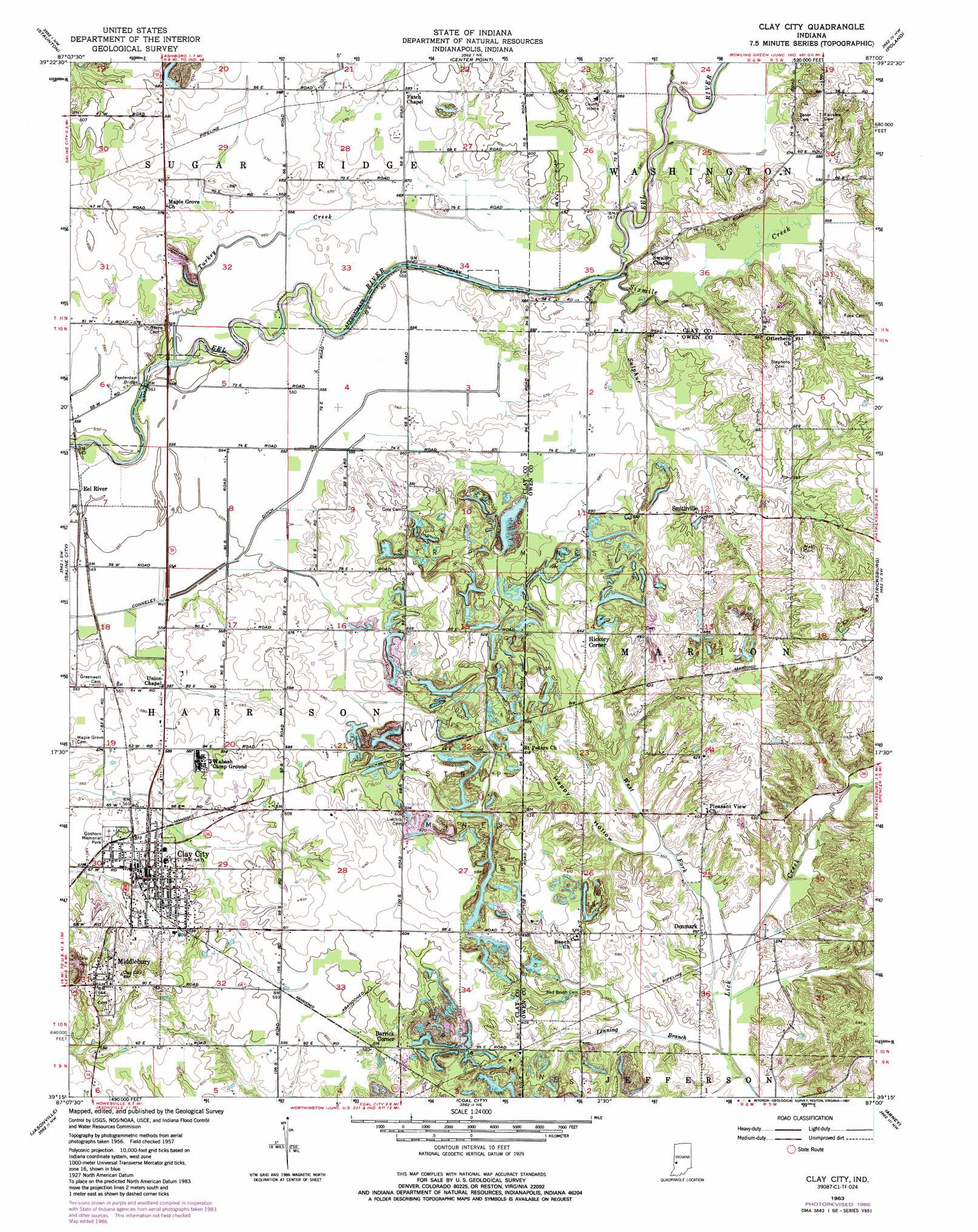
Clay City Topo Map Indiana
To zoom in, hover over the map of Clay City
USGS Topo Quad 39087c1 - 1:24,000 scale
| Topo Map Name: | Clay City |
| USGS Topo Quad ID: | 39087c1 |
| Print Size: | ca. 21 1/4" wide x 27" high |
| Southeast Coordinates: | 39.25° N latitude / 87° W longitude |
| Map Center Coordinates: | 39.3125° N latitude / 87.0625° W longitude |
| U.S. State: | IN |
| Filename: | o39087c1.jpg |
| Download Map JPG Image: | Clay City topo map 1:24,000 scale |
| Map Type: | Topographic |
| Topo Series: | 7.5´ |
| Map Scale: | 1:24,000 |
| Source of Map Images: | United States Geological Survey (USGS) |
| Alternate Map Versions: |
Clay City IN 1957, updated 1958 Download PDF Buy paper map Clay City IN 1957, updated 1973 Download PDF Buy paper map Clay City IN 1963, updated 1987 Download PDF Buy paper map Clay City IN 2010 Download PDF Buy paper map Clay City IN 2013 Download PDF Buy paper map Clay City IN 2016 Download PDF Buy paper map |
1:24,000 Topo Quads surrounding Clay City
Rosedale |
Brazil West |
Brazil East |
Reelsville |
Cloverdale |
Seelyville |
Staunton |
Center Point |
Poland |
Cataract |
Lewis |
Saline City |
Clay City |
Patricksburg |
Spencer |
Hymera |
Jasonville |
Coal City |
Arney |
Freedom |
Dugger |
Linton |
Switz City |
Bloomfield |
Solsberry |
> Back to 39087a1 at 1:100,000 scale
> Back to 39086a1 at 1:250,000 scale
> Back to U.S. Topo Maps home
Clay City topo map: Gazetteer
Clay City: Bridges
Feederdam Bridge elevation 163m 534′Clay City: Canals
Letsinger Ditch elevation 178m 583′Shelkett Ditch elevation 177m 580′
Clay City: Populated Places
Barrick Corner elevation 180m 590′Clay City elevation 181m 593′
Danville elevation 181m 593′
Denmark elevation 167m 547′
Eel River elevation 168m 551′
Hickory Corner elevation 196m 643′
Middlebury elevation 204m 669′
Smithville elevation 180m 590′
Clay City: Streams
Hog Creek elevation 167m 547′Lenning Branch elevation 161m 528′
Sixmile Creek elevation 172m 564′
Sulphur Creek elevation 169m 554′
Turkey Creek elevation 162m 531′
West Fork Lick Creek elevation 162m 531′
Clay City: Valleys
Happy Hollow elevation 167m 547′Clay City digital topo map on disk
Buy this Clay City topo map showing relief, roads, GPS coordinates and other geographical features, as a high-resolution digital map file on DVD:
Northern Illinois, Northern Indiana & Southwestern Michigan
Buy digital topo maps: Northern Illinois, Northern Indiana & Southwestern Michigan