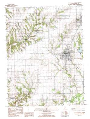
Roodhouse West Topo Map Illinois
To zoom in, hover over the map of Roodhouse West
USGS Topo Quad 39090d4 - 1:24,000 scale
| Topo Map Name: | Roodhouse West |
| USGS Topo Quad ID: | 39090d4 |
| Print Size: | ca. 21 1/4" wide x 27" high |
| Southeast Coordinates: | 39.375° N latitude / 90.375° W longitude |
| Map Center Coordinates: | 39.4375° N latitude / 90.4375° W longitude |
| U.S. State: | IL |
| Filename: | o39090d4.jpg |
| Download Map JPG Image: | Roodhouse West topo map 1:24,000 scale |
| Map Type: | Topographic |
| Topo Series: | 7.5´ |
| Map Scale: | 1:24,000 |
| Source of Map Images: | United States Geological Survey (USGS) |
| Alternate Map Versions: |
Roodhouse West IL 1983, updated 1984 Download PDF Buy paper map Roodhouse West IL 2012 Download PDF Buy paper map Roodhouse West IL 2015 Download PDF Buy paper map |
1:24,000 Topo Quads surrounding Roodhouse West
> Back to 39090a1 at 1:100,000 scale
> Back to 39090a1 at 1:250,000 scale
> Back to U.S. Topo Maps home
Roodhouse West topo map: Gazetteer
Roodhouse West: Dams
White Hall Reservoir Dam elevation 173m 567′Roodhouse West: Parks
Conrad Park elevation 176m 577′Lions Park elevation 166m 544′
Tunison Park elevation 170m 557′
Veterans of Foreign Wars Park elevation 175m 574′
White Hall Historic District elevation 175m 574′
Whiteside Park elevation 174m 570′
Roodhouse West: Populated Places
Belltown elevation 151m 495′Hanks Station elevation 165m 541′
Patterson elevation 207m 679′
Walkerville elevation 175m 574′
White Hall elevation 174m 570′
Roodhouse West: Reservoirs
White Hall Reservoir elevation 173m 567′Roodhouse West: Streams
Seminary Creek elevation 138m 452′Whitaker Creek elevation 138m 452′
Roodhouse West digital topo map on disk
Buy this Roodhouse West topo map showing relief, roads, GPS coordinates and other geographical features, as a high-resolution digital map file on DVD:


