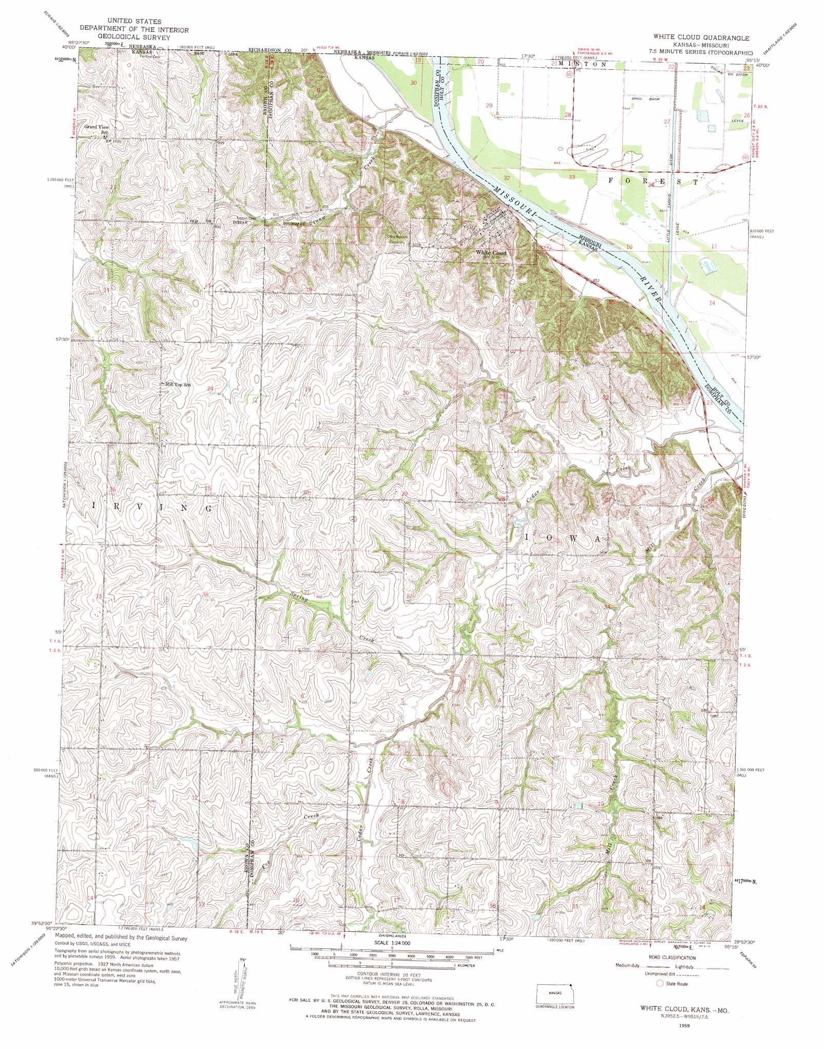
White Cloud Topo Map Kansas
To zoom in, hover over the map of White Cloud
USGS Topo Quad 39095h3 - 1:24,000 scale
| Topo Map Name: | White Cloud |
| USGS Topo Quad ID: | 39095h3 |
| Print Size: | ca. 21 1/4" wide x 27" high |
| Southeast Coordinates: | 39.875° N latitude / 95.25° W longitude |
| Map Center Coordinates: | 39.9375° N latitude / 95.3125° W longitude |
| U.S. States: | KS, MO |
| Filename: | o39095h3.jpg |
| Download Map JPG Image: | White Cloud topo map 1:24,000 scale |
| Map Type: | Topographic |
| Topo Series: | 7.5´ |
| Map Scale: | 1:24,000 |
| Source of Map Images: | United States Geological Survey (USGS) |
| Alternate Map Versions: |
White Cloud KS 1959, updated 1960 Download PDF Buy paper map White Cloud KS 1959, updated 1961 Download PDF Buy paper map White Cloud KS 2009 Download PDF Buy paper map White Cloud KS 2012 Download PDF Buy paper map White Cloud KS 2016 Download PDF Buy paper map |
1:24,000 Topo Quads surrounding White Cloud
Barada |
Corning |
Craig |
Mound City |
Maitland |
Falls City |
Rulo |
Big Lake |
Kimsey Creek |
New Point |
Reserve |
Highland Nw |
White Cloud |
Oregon |
Forbes |
Hiawatha |
Robinson |
Highland |
Sparks |
Troy |
Horton |
Everest |
Denton |
Bendena |
Atchison Ne |
> Back to 39095e1 at 1:100,000 scale
> Back to 39094a1 at 1:250,000 scale
> Back to U.S. Topo Maps home
White Cloud topo map: Gazetteer
White Cloud: Canals
Fivemile Lane elevation 258m 846′White Cloud: Populated Places
White Cloud elevation 269m 882′White Cloud: Streams
Cedar Creek elevation 258m 846′Fox Creek elevation 280m 918′
Spring Creek elevation 272m 892′
Squaw Creek elevation 258m 846′
White Cloud digital topo map on disk
Buy this White Cloud topo map showing relief, roads, GPS coordinates and other geographical features, as a high-resolution digital map file on DVD: