Bendena Topo Map Kansas
To zoom in, hover over the map of Bendena
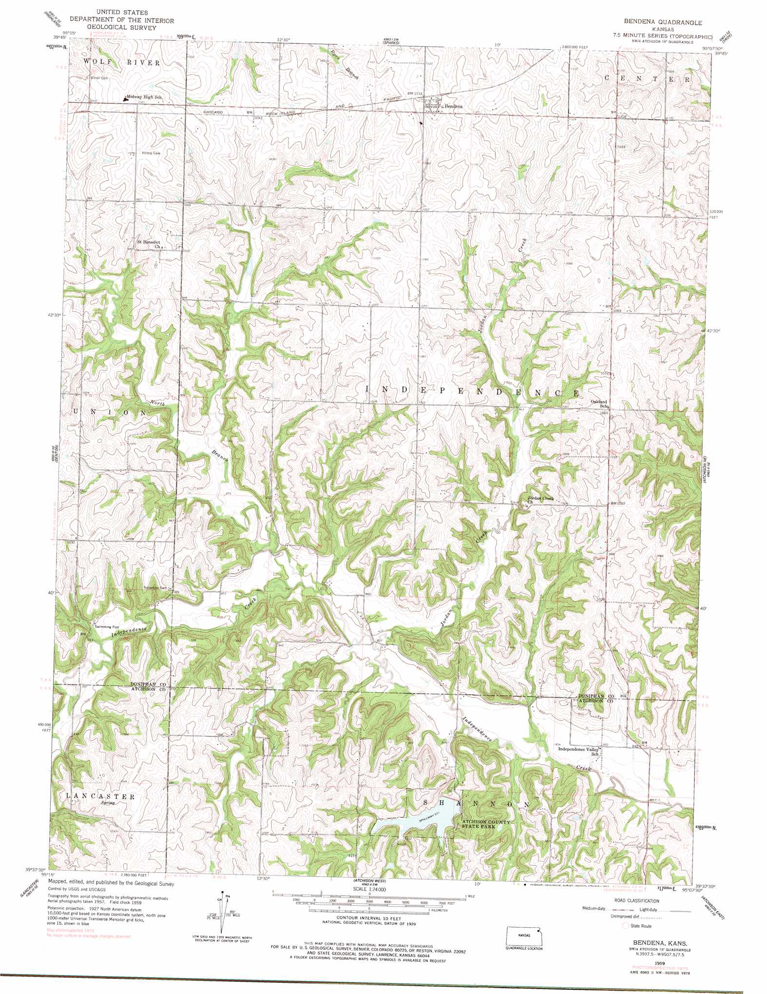
USGS Topo Quad 39095f2 - 1:24,000 scale
| Topo Map Name: | Bendena |
| USGS Topo Quad ID: | 39095f2 |
| Print Size: | ca. 21 1/4" wide x 27" high |
| Southeast Coordinates: | 39.625° N latitude / 95.125° W longitude |
| Map Center Coordinates: | 39.6875° N latitude / 95.1875° W longitude |
| U.S. State: | KS |
| Filename: | o39095f2.jpg |
| Download Map JPG Image: | Bendena topo map 1:24,000 scale |
| Map Type: | Topographic |
| Topo Series: | 7.5´ |
| Map Scale: | 1:24,000 |
| Source of Map Images: | United States Geological Survey (USGS) |
| Alternate Map Versions: |
Bendena KS 1959, updated 1960 Download PDF Buy paper map Bendena KS 1959, updated 1977 Download PDF Buy paper map Bendena KS 2009 Download PDF Buy paper map Bendena KS 2012 Download PDF Buy paper map Bendena KS 2015 Download PDF Buy paper map |
1:24,000 Topo Quads surrounding Bendena
Highland Nw |
White Cloud |
Oregon |
Forbes |
Amazonia |
Robinson |
Highland |
Sparks |
Troy |
Wathena |
Everest |
Denton |
Bendena |
Atchison Ne |
Halls |
Effingham |
Lancaster |
Atchison West |
Atchison East |
De Kalb |
Half Mound |
Nortonville |
Potter |
Oak Mills |
Weston |
> Back to 39095e1 at 1:100,000 scale
> Back to 39094a1 at 1:250,000 scale
> Back to U.S. Topo Maps home
Bendena topo map: Gazetteer
Bendena: Parks
Atchison County State Park elevation 273m 895′Atchison State Fishing Lake and Widlife Area elevation 273m 895′
Bendena: Populated Places
Bendena elevation 339m 1112′Bendena: Streams
Jordan Creek elevation 249m 816′North Branch Independence Creek elevation 253m 830′
Bendena digital topo map on disk
Buy this Bendena topo map showing relief, roads, GPS coordinates and other geographical features, as a high-resolution digital map file on DVD: