Cattle Gulch Topo Map Colorado
To zoom in, hover over the map of Cattle Gulch
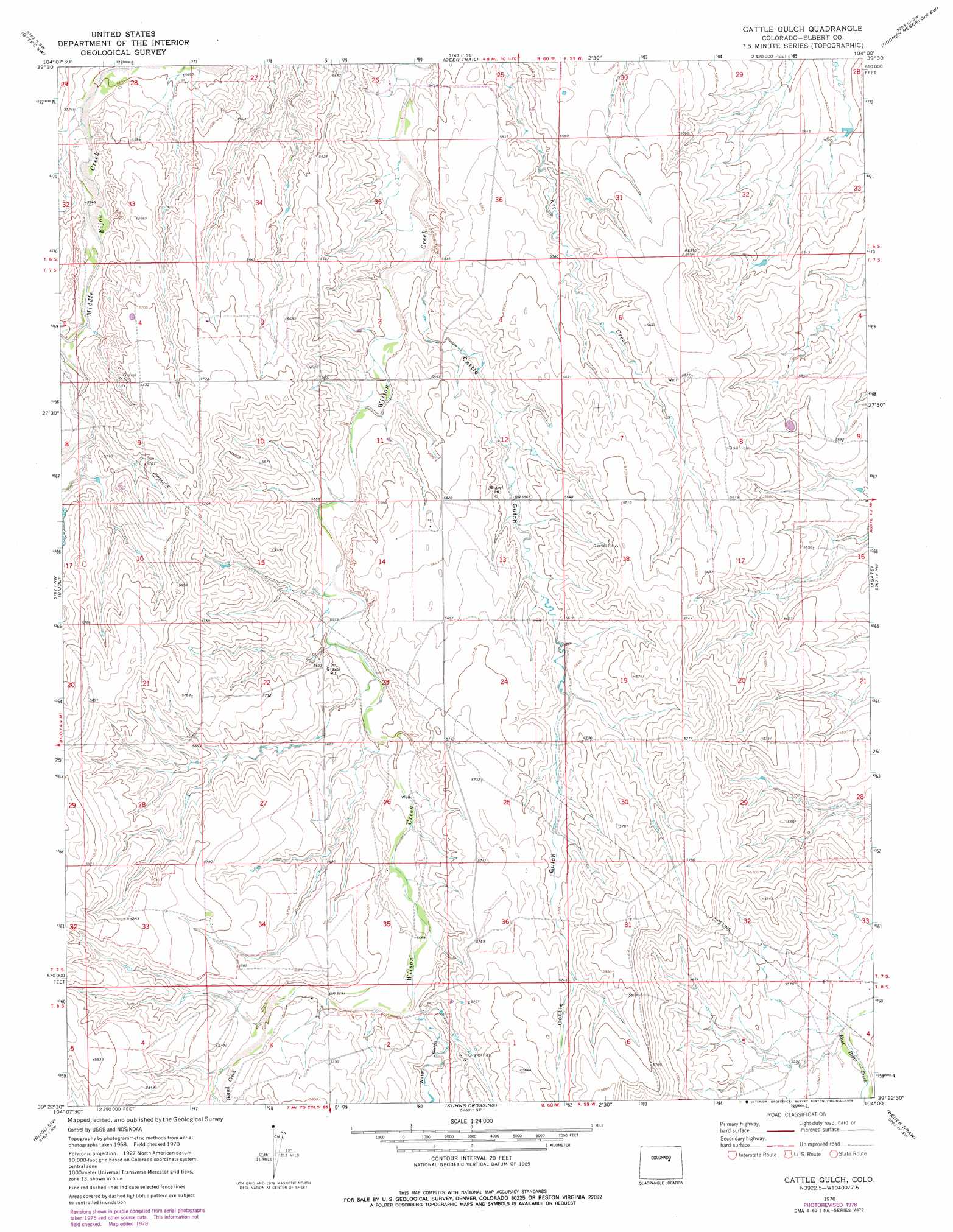
USGS Topo Quad 39104d1 - 1:24,000 scale
| Topo Map Name: | Cattle Gulch |
| USGS Topo Quad ID: | 39104d1 |
| Print Size: | ca. 21 1/4" wide x 27" high |
| Southeast Coordinates: | 39.375° N latitude / 104° W longitude |
| Map Center Coordinates: | 39.4375° N latitude / 104.0625° W longitude |
| U.S. State: | CO |
| Filename: | o39104d1.jpg |
| Download Map JPG Image: | Cattle Gulch topo map 1:24,000 scale |
| Map Type: | Topographic |
| Topo Series: | 7.5´ |
| Map Scale: | 1:24,000 |
| Source of Map Images: | United States Geological Survey (USGS) |
| Alternate Map Versions: |
Cattle Gulch CO 1970, updated 1973 Download PDF Buy paper map Cattle Gulch CO 1970, updated 1973 Download PDF Buy paper map Cattle Gulch CO 1970, updated 1979 Download PDF Buy paper map Cattle Gulch CO 2010 Download PDF Buy paper map Cattle Gulch CO 2013 Download PDF Buy paper map Cattle Gulch CO 2016 Download PDF Buy paper map |
1:24,000 Topo Quads surrounding Cattle Gulch
Strasburg |
Byers |
Peoria |
Noonen Reservoir |
Cottonwood Valley North |
Strasburg Se |
Byers Sw |
Deer Trail |
Noonen Reservoir Sw |
Cottonwood Valley South |
Kiowa Ne |
Bijou |
Cattle Gulch |
Agate |
Barking Dog Spring |
Big Gulch |
Bijou Sw |
Kuhns Crossing |
Beuck Draw |
River Bend |
Fondis |
Ramah North |
Simla |
Matheson |
Matheson Ne |
> Back to 39104a1 at 1:100,000 scale
> Back to 39104a1 at 1:250,000 scale
> Back to U.S. Topo Maps home
Cattle Gulch topo map: Gazetteer
Cattle Gulch: Streams
Bland Creek elevation 1744m 5721′Cattle Gulch: Valleys
Cattle Gulch elevation 1667m 5469′Water Gulch elevation 1728m 5669′
Cattle Gulch digital topo map on disk
Buy this Cattle Gulch topo map showing relief, roads, GPS coordinates and other geographical features, as a high-resolution digital map file on DVD: