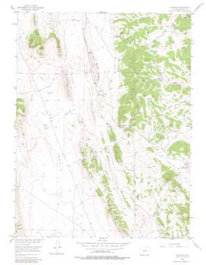
Elkhorn Topo Map Colorado
To zoom in, hover over the map of Elkhorn
USGS Topo Quad 39105b7 - 1:24,000 scale
| Topo Map Name: | Elkhorn |
| USGS Topo Quad ID: | 39105b7 |
| Print Size: | ca. 21 1/4" wide x 27" high |
| Southeast Coordinates: | 39.125° N latitude / 105.75° W longitude |
| Map Center Coordinates: | 39.1875° N latitude / 105.8125° W longitude |
| U.S. State: | CO |
| Filename: | o39105b7.jpg |
| Download Map JPG Image: | Elkhorn topo map 1:24,000 scale |
| Map Type: | Topographic |
| Topo Series: | 7.5´ |
| Map Scale: | 1:24,000 |
| Source of Map Images: | United States Geological Survey (USGS) |
| Alternate Map Versions: |
Elkhorn CO 1956, updated 1957 Download PDF Buy paper map Elkhorn CO 1956, updated 1957 Download PDF Buy paper map Elkhorn CO 1956, updated 1973 Download PDF Buy paper map Elkhorn CO 1956, updated 1980 Download PDF Buy paper map Elkhorn CO 2010 Download PDF Buy paper map Elkhorn CO 2013 Download PDF Buy paper map Elkhorn CO 2016 Download PDF Buy paper map |
1:24,000 Topo Quads surrounding Elkhorn
> Back to 39105a1 at 1:100,000 scale
> Back to 39104a1 at 1:250,000 scale
> Back to U.S. Topo Maps home
Elkhorn topo map: Gazetteer
Elkhorn: Basins
The Basin elevation 2794m 9166′Elkhorn: Lakes
Playa Lakes elevation 2799m 9183′Elkhorn: Ridges
Link Spring Ridge elevation 2897m 9504′Mexican Ridge elevation 2859m 9379′
Elkhorn: Springs
Association Spring elevation 2819m 9248′Elkhorn Spring elevation 2913m 9557′
Link Spring elevation 2844m 9330′
Lone Tree Spring elevation 2878m 9442′
Elkhorn: Summits
Logan Hill elevation 2996m 9829′Elkhorn: Valleys
Elkhorn Gulch elevation 2931m 9616′Garcia Gulch elevation 2810m 9219′
Elkhorn digital topo map on disk
Buy this Elkhorn topo map showing relief, roads, GPS coordinates and other geographical features, as a high-resolution digital map file on DVD:


