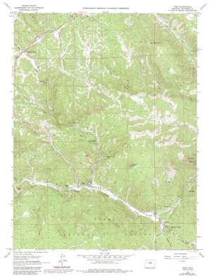
Pine Topo Map Colorado
To zoom in, hover over the map of Pine
USGS Topo Quad 39105d3 - 1:24,000 scale
| Topo Map Name: | Pine |
| USGS Topo Quad ID: | 39105d3 |
| Print Size: | ca. 21 1/4" wide x 27" high |
| Southeast Coordinates: | 39.375° N latitude / 105.25° W longitude |
| Map Center Coordinates: | 39.4375° N latitude / 105.3125° W longitude |
| U.S. State: | CO |
| Filename: | o39105d3.jpg |
| Download Map JPG Image: | Pine topo map 1:24,000 scale |
| Map Type: | Topographic |
| Topo Series: | 7.5´ |
| Map Scale: | 1:24,000 |
| Source of Map Images: | United States Geological Survey (USGS) |
| Alternate Map Versions: |
Pine CO 1945, updated 1955 Download PDF Buy paper map Pine CO 1945, updated 1955 Download PDF Buy paper map Pine CO 1945, updated 1962 Download PDF Buy paper map Pine CO 1945, updated 1962 Download PDF Buy paper map Pine CO 1948 Download PDF Buy paper map Pine CO 1965, updated 1967 Download PDF Buy paper map Pine CO 1965, updated 1973 Download PDF Buy paper map Pine CO 1965, updated 1973 Download PDF Buy paper map Pine CO 1965, updated 1984 Download PDF Buy paper map Pine CO 1965, updated 1985 Download PDF Buy paper map Pine CO 1994, updated 1998 Download PDF Buy paper map Pine CO 1994, updated 2001 Download PDF Buy paper map Pine CO 2011 Download PDF Buy paper map Pine CO 2013 Download PDF Buy paper map Pine CO 2016 Download PDF Buy paper map |
| FStopo: | US Forest Service topo Pine is available: Download FStopo PDF Download FStopo TIF |
1:24,000 Topo Quads surrounding Pine
> Back to 39105a1 at 1:100,000 scale
> Back to 39104a1 at 1:250,000 scale
> Back to U.S. Topo Maps home
Pine topo map: Gazetteer
Pine: Dams
Baehr Dam elevation 2096m 6876′Crystal Lake Dam elevation 2067m 6781′
Pine: Mines
Alpha Mine elevation 2068m 6784′Arlington Mine elevation 2577m 8454′
Barker Mine elevation 2580m 8464′
Becky Sharp Mine elevation 2509m 8231′
Buffalo Mine elevation 2095m 6873′
Luster Lode Quarry elevation 2064m 6771′
Osiris Property Mine elevation 2301m 7549′
Raleigh Park Mine elevation 2161m 7089′
White Gap Quarry elevation 2063m 6768′
Pine: Populated Places
Buffalo Creek elevation 2061m 6761′Ferndale elevation 2000m 6561′
Glenelk elevation 2371m 7778′
Indian Springs Village elevation 2195m 7201′
Pine Grove elevation 2078m 6817′
Riverview elevation 2025m 6643′
Shaffers Crossing elevation 2414m 7919′
Sphinx Park elevation 2146m 7040′
Pine: Reservoirs
Baehr Reservoir elevation 2096m 6876′Crystal Lake elevation 2063m 6768′
Pine: Streams
Buffalo Creek elevation 2010m 6594′Elk Creek elevation 2049m 6722′
West Last Resort Creek elevation 2127m 6978′
West Resort Creek elevation 2127m 6978′
Pine: Summits
Banner Peak elevation 2574m 8444′Cathedral Spires elevation 2602m 8536′
Riley Peak elevation 2854m 9363′
Pine: Valleys
Buck Gulch elevation 2096m 6876′Goat Park Gulch elevation 2207m 7240′
Gooseberry Gulch elevation 2360m 7742′
Marsh Gulch elevation 2172m 7125′
Miller Gulch elevation 2028m 6653′
Pine Gulch elevation 2065m 6774′
Roland Gulch elevation 2111m 6925′
Sand Draw elevation 2030m 6660′
Schuyler Gulch elevation 2146m 7040′
Shattuck Gulch elevation 2296m 7532′
Spring Gulch elevation 2035m 6676′
Pine digital topo map on disk
Buy this Pine topo map showing relief, roads, GPS coordinates and other geographical features, as a high-resolution digital map file on DVD:


