Round Mountain Topo Map Colorado
To zoom in, hover over the map of Round Mountain
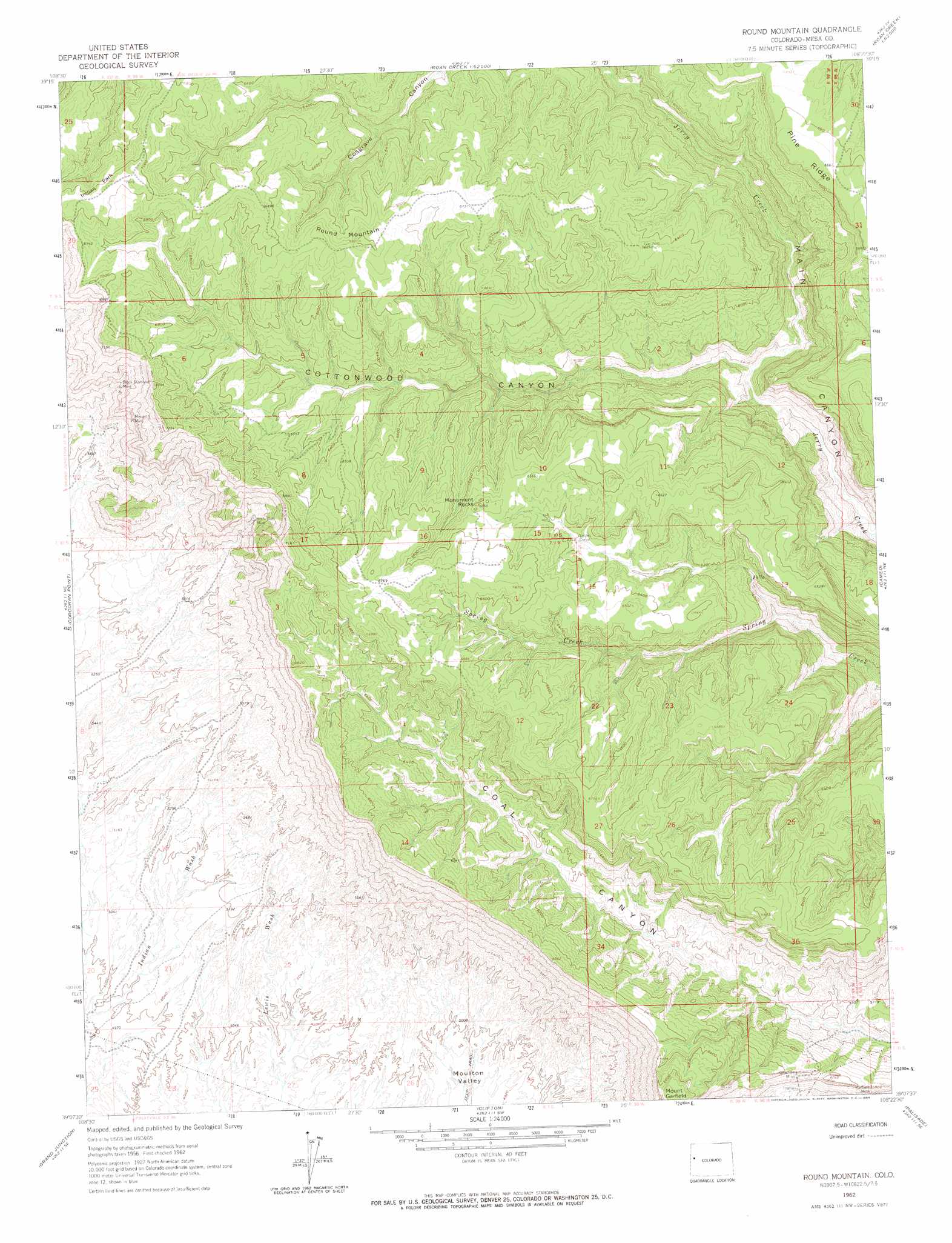
USGS Topo Quad 39108b4 - 1:24,000 scale
| Topo Map Name: | Round Mountain |
| USGS Topo Quad ID: | 39108b4 |
| Print Size: | ca. 21 1/4" wide x 27" high |
| Southeast Coordinates: | 39.125° N latitude / 108.375° W longitude |
| Map Center Coordinates: | 39.1875° N latitude / 108.4375° W longitude |
| U.S. State: | CO |
| Filename: | o39108b4.jpg |
| Download Map JPG Image: | Round Mountain topo map 1:24,000 scale |
| Map Type: | Topographic |
| Topo Series: | 7.5´ |
| Map Scale: | 1:24,000 |
| Source of Map Images: | United States Geological Survey (USGS) |
| Alternate Map Versions: |
Round Mountain CO 1962, updated 1964 Download PDF Buy paper map Round Mountain CO 2010 Download PDF Buy paper map Round Mountain CO 2013 Download PDF Buy paper map Round Mountain CO 2016 Download PDF Buy paper map |
1:24,000 Topo Quads surrounding Round Mountain
Garvey Canyon |
Middle Dry Fork |
The Saddle |
Long Point |
Red Pinnacle |
Ruby Lee Reservoir |
Corcoran Peak |
Winter Flats |
Wagon Track Ridge |
De Beque |
Fruita |
Corcoran Point |
Round Mountain |
Cameo |
Mesa |
Colorado National Monument |
Grand Junction |
Clifton |
Palisade |
Lands End |
Glade Park |
Island Mesa |
Whitewater |
Juniata Reservoir |
Indian Point |
> Back to 39108a1 at 1:100,000 scale
> Back to 39108a1 at 1:250,000 scale
> Back to U.S. Topo Maps home
Round Mountain topo map: Gazetteer
Round Mountain: Flats
Indian Park elevation 2134m 7001′Round Mountain: Mines
Black Diamond Mine elevation 1893m 6210′Book Cliff Mine elevation 1837m 6026′
Boyer Mine elevation 1819m 5967′
Boyer Peacock Mine elevation 1947m 6387′
Garfield Mine elevation 1783m 5849′
Gearhart Mine elevation 1822m 5977′
Monarch Mine elevation 1883m 6177′
Old Black Diamond Mine elevation 1861m 6105′
Peacock Mine elevation 1918m 6292′
William Mine elevation 2119m 6952′
Round Mountain: Pillars
Monument Rocks elevation 2018m 6620′Round Mountain: Ridges
Pine Ridge elevation 2031m 6663′Round Mountain: Summits
Round Mountain elevation 2076m 6811′Round Mountain: Valleys
Cottonwood Canyon elevation 1610m 5282′Round Mountain digital topo map on disk
Buy this Round Mountain topo map showing relief, roads, GPS coordinates and other geographical features, as a high-resolution digital map file on DVD: