Bull Fork Topo Map Colorado
To zoom in, hover over the map of Bull Fork
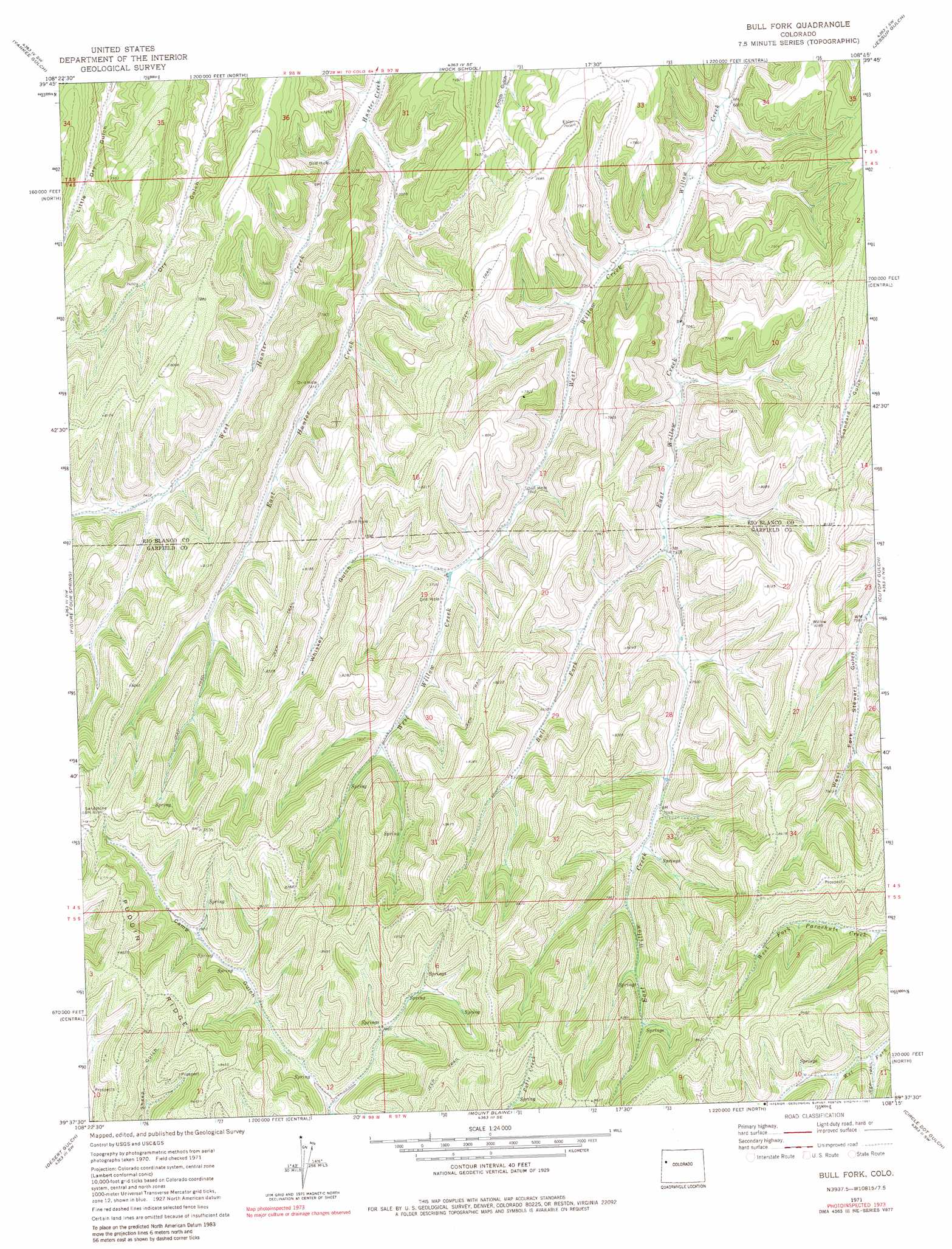
USGS Topo Quad 39108f3 - 1:24,000 scale
| Topo Map Name: | Bull Fork |
| USGS Topo Quad ID: | 39108f3 |
| Print Size: | ca. 21 1/4" wide x 27" high |
| Southeast Coordinates: | 39.625° N latitude / 108.25° W longitude |
| Map Center Coordinates: | 39.6875° N latitude / 108.3125° W longitude |
| U.S. State: | CO |
| Filename: | o39108f3.jpg |
| Download Map JPG Image: | Bull Fork topo map 1:24,000 scale |
| Map Type: | Topographic |
| Topo Series: | 7.5´ |
| Map Scale: | 1:24,000 |
| Source of Map Images: | United States Geological Survey (USGS) |
| Alternate Map Versions: |
Bull Fork CO 1971, updated 1974 Download PDF Buy paper map Bull Fork CO 1971, updated 1974 Download PDF Buy paper map Bull Fork CO 1971, updated 1981 Download PDF Buy paper map Bull Fork CO 2010 Download PDF Buy paper map Bull Fork CO 2013 Download PDF Buy paper map Bull Fork CO 2016 Download PDF Buy paper map |
1:24,000 Topo Quads surrounding Bull Fork
Sagebrush Hill |
Wolf Ridge |
Square S Ranch |
Greasewood Gulch |
Segar Mountain |
Black Cabin Gulch |
Yankee Gulch |
Rock School |
Jessup Gulch |
No Name Ridge |
Razorback Ridge |
Figure Four Spring |
Bull Fork |
Cutoff Gulch |
Mccarthy Gulch |
Henderson Ridge |
Desert Gulch |
Mount Blaine |
Circle Dot Gulch |
Forked Gulch |
Middle Dry Fork |
The Saddle |
Long Point |
Red Pinnacle |
Parachute |
> Back to 39108e1 at 1:100,000 scale
> Back to 39108a1 at 1:250,000 scale
> Back to U.S. Topo Maps home
Bull Fork topo map: Gazetteer
Bull Fork: Ridges
Puddin Ridge elevation 2580m 8464′Bull Fork: Streams
Bull Fork elevation 2230m 7316′East Hunter Creek elevation 2105m 6906′
East Willow Creek elevation 2111m 6925′
West Hunter Creek elevation 2105m 6906′
West Willow Creek elevation 2111m 6925′
Bull Fork: Valleys
Whiskey Gulch elevation 2265m 7431′Bull Fork digital topo map on disk
Buy this Bull Fork topo map showing relief, roads, GPS coordinates and other geographical features, as a high-resolution digital map file on DVD: