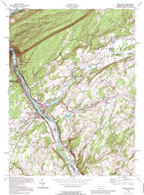
Portland Topo Map New Jersey
To zoom in, hover over the map of Portland
USGS Topo Quad 40075h1 - 1:24,000 scale
| Topo Map Name: | Portland |
| USGS Topo Quad ID: | 40075h1 |
| Print Size: | ca. 21 1/4" wide x 27" high |
| Southeast Coordinates: | 40.875° N latitude / 75° W longitude |
| Map Center Coordinates: | 40.9375° N latitude / 75.0625° W longitude |
| U.S. States: | NJ, PA |
| Filename: | o40075h1.jpg |
| Download Map JPG Image: | Portland topo map 1:24,000 scale |
| Map Type: | Topographic |
| Topo Series: | 7.5´ |
| Map Scale: | 1:24,000 |
| Source of Map Images: | United States Geological Survey (USGS) |
| Alternate Map Versions: |
Portland PA 1955, updated 1957 Download PDF Buy paper map Portland PA 1955, updated 1964 Download PDF Buy paper map Portland PA 1955, updated 1969 Download PDF Buy paper map Portland PA 1955, updated 1974 Download PDF Buy paper map Portland PA 1955, updated 1984 Download PDF Buy paper map Portland PA 1955, updated 1984 Download PDF Buy paper map Portland PA 1992, updated 1995 Download PDF Buy paper map Portland PA 1997, updated 1999 Download PDF Buy paper map Portland PA 2011 Download PDF Buy paper map Portland PA 2013 Download PDF Buy paper map Portland PA 2016 Download PDF Buy paper map |
1:24,000 Topo Quads surrounding Portland
> Back to 40075e1 at 1:100,000 scale
> Back to 40074a1 at 1:250,000 scale
> Back to U.S. Topo Maps home
Portland topo map: Gazetteer
Portland: Airports
Mount Pleasant Landing Strip elevation 239m 784′Portland: Cliffs
Indian Head elevation 213m 698′Indian Ladder elevation 104m 341′
Portland: Dams
Alice Lake Dam elevation 179m 587′Columbia Dam elevation 98m 321′
Delaware Lake Dam elevation 141m 462′
Locust Lake Dam elevation 143m 469′
Lower Reservoir Dam elevation 245m 803′
Rocco Bunino Dam elevation 108m 354′
Portland: Forests
Worthington State Forest elevation 331m 1085′Portland: Gaps
Delaware Water Gap elevation 102m 334′Portland: Islands
Arrow Island elevation 91m 298′Portland: Lakes
Agros Lake elevation 174m 570′Portland: Populated Places
Brownings elevation 111m 364′Columbia elevation 95m 311′
Delaware elevation 91m 298′
Dunnfield elevation 99m 324′
Hainesburg elevation 98m 321′
Hemlock Glen elevation 191m 626′
Hill Yard elevation 109m 357′
Knowlton elevation 215m 705′
Marshfield Station elevation 90m 295′
Mount Bethel elevation 160m 524′
Mount Pleasant elevation 232m 761′
Mount Vernon elevation 239m 784′
Polkville elevation 178m 583′
Portland elevation 89m 291′
Ramseysburg elevation 88m 288′
Slateford elevation 110m 360′
Vail elevation 106m 347′
Walnut Valley elevation 109m 357′
Warrington elevation 109m 357′
Portland: Reservoirs
Columbia Lake elevation 98m 321′Delaware Lake elevation 141m 462′
Lake Susquehanna elevation 108m 354′
Locust Lake elevation 143m 469′
Upper Yards Creek Reservoir elevation 245m 803′
Portland: Streams
Delawanna Creek elevation 77m 252′Jacoby Creek elevation 85m 278′
Paulins Kill elevation 80m 262′
Slateford Creek elevation 86m 282′
Stony Brook elevation 86m 282′
Yards Creek elevation 91m 298′
Portland: Summits
Mount Tammany elevation 465m 1525′Portland digital topo map on disk
Buy this Portland topo map showing relief, roads, GPS coordinates and other geographical features, as a high-resolution digital map file on DVD:
Atlantic Coast (NY, NJ, PA, DE, MD, VA, NC)
Buy digital topo maps: Atlantic Coast (NY, NJ, PA, DE, MD, VA, NC)


