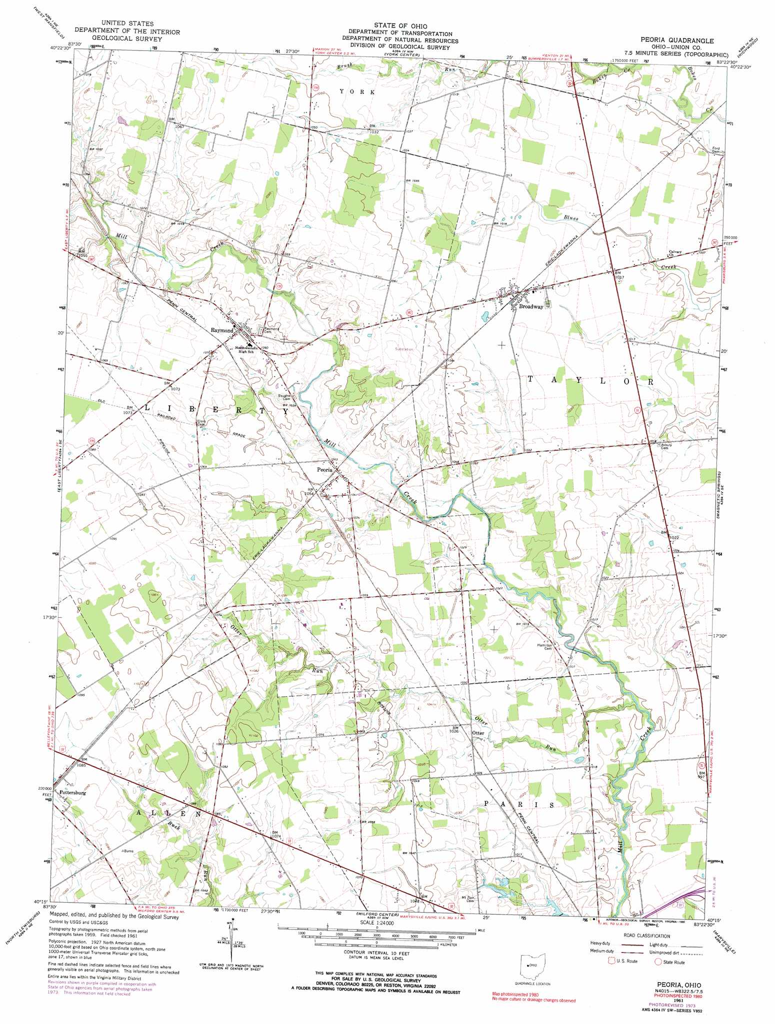
Peoria Topo Map Ohio
To zoom in, hover over the map of Peoria
USGS Topo Quad 40083c4 - 1:24,000 scale
| Topo Map Name: | Peoria |
| USGS Topo Quad ID: | 40083c4 |
| Print Size: | ca. 21 1/4" wide x 27" high |
| Southeast Coordinates: | 40.25° N latitude / 83.375° W longitude |
| Map Center Coordinates: | 40.3125° N latitude / 83.4375° W longitude |
| U.S. State: | OH |
| Filename: | o40083c4.jpg |
| Download Map JPG Image: | Peoria topo map 1:24,000 scale |
| Map Type: | Topographic |
| Topo Series: | 7.5´ |
| Map Scale: | 1:24,000 |
| Source of Map Images: | United States Geological Survey (USGS) |
| Alternate Map Versions: |
Peoria OH 1961, updated 1962 Download PDF Buy paper map Peoria OH 1961, updated 1972 Download PDF Buy paper map Peoria OH 1961, updated 1974 Download PDF Buy paper map Peoria OH 1961, updated 1990 Download PDF Buy paper map Peoria OH 2010 Download PDF Buy paper map Peoria OH 2013 Download PDF Buy paper map Peoria OH 2016 Download PDF Buy paper map |
1:24,000 Topo Quads surrounding Peoria
Silver Creek |
Mount Victory |
La Rue |
New Bloomington |
Marion West |
Rushsylvania |
West Mansfield |
York Center |
Richwood |
Prospect |
Zanesfield |
East Liberty |
Peoria |
Magnetic Springs |
Ostrander |
Kingscreek |
North Lewisburg |
Milford Center |
Marysville |
Shawnee Hills |
Urbana East |
Mechanicsburg |
Plumwood |
Plain City |
Hilliard |
> Back to 40083a1 at 1:100,000 scale
> Back to 40082a1 at 1:250,000 scale
> Back to U.S. Topo Maps home
Peoria topo map: Gazetteer
Peoria: Populated Places
Broadway elevation 313m 1026′Otter elevation 310m 1017′
Peoria elevation 314m 1030′
Raymond elevation 326m 1069′
Taylor Centre (historical) elevation 310m 1017′
Peoria: Post Offices
Broadway Post Office elevation 313m 1026′Peoria Post Office (historical) elevation 314m 1030′
Raymond Post Office elevation 326m 1069′
Taylor Centre Post Office (historical) elevation 310m 1017′
Peoria: Streams
Bear Swamp Run elevation 323m 1059′Otter Run elevation 304m 997′
Peoria: Swamps
Bear Swamp (historical) elevation 333m 1092′Peoria digital topo map on disk
Buy this Peoria topo map showing relief, roads, GPS coordinates and other geographical features, as a high-resolution digital map file on DVD:
 map DVD")