Kirkpatrick Topo Map Indiana
To zoom in, hover over the map of Kirkpatrick
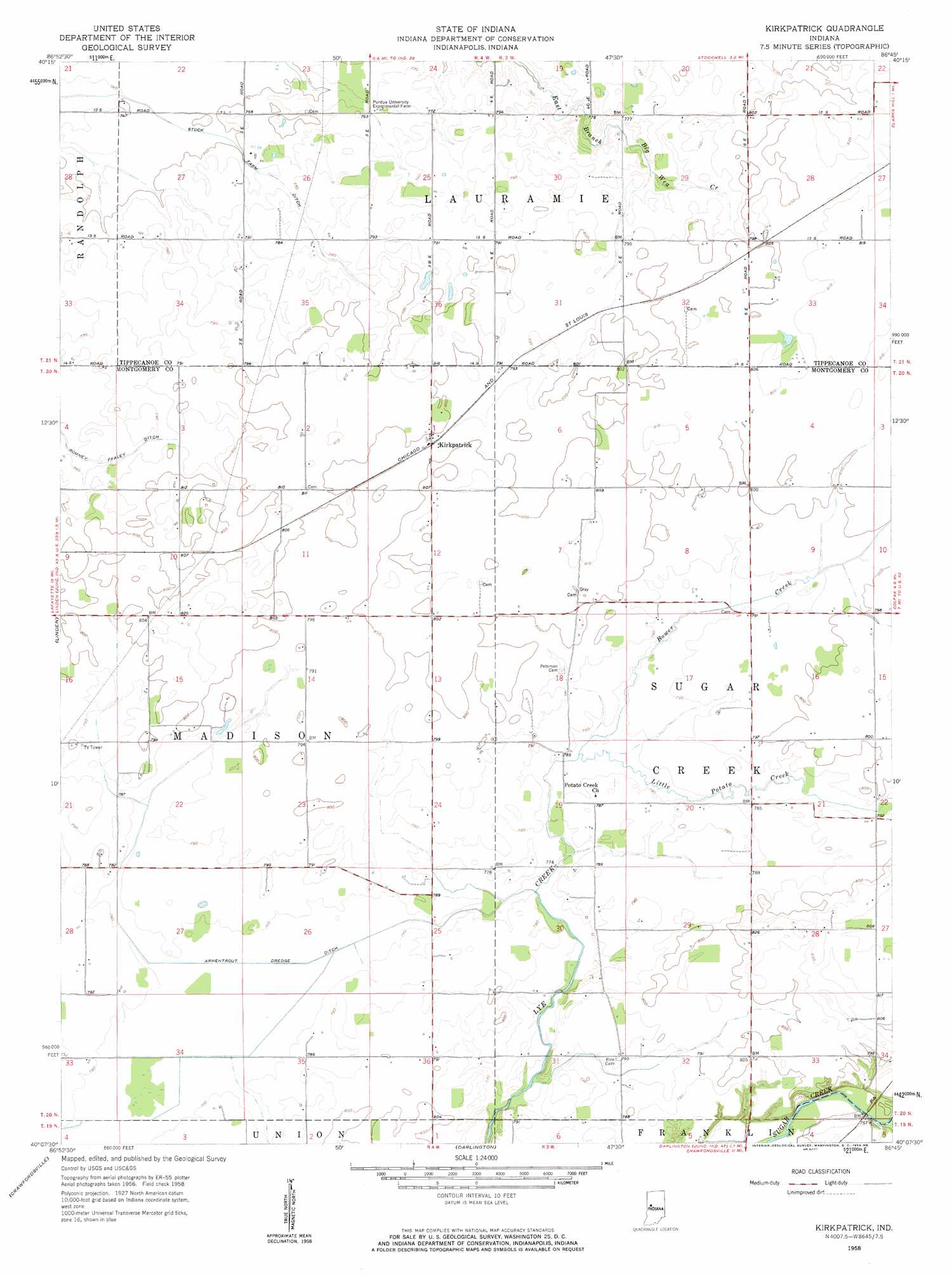
USGS Topo Quad 40086b7 - 1:24,000 scale
| Topo Map Name: | Kirkpatrick |
| USGS Topo Quad ID: | 40086b7 |
| Print Size: | ca. 21 1/4" wide x 27" high |
| Southeast Coordinates: | 40.125° N latitude / 86.75° W longitude |
| Map Center Coordinates: | 40.1875° N latitude / 86.8125° W longitude |
| U.S. State: | IN |
| Filename: | o40086b7.jpg |
| Download Map JPG Image: | Kirkpatrick topo map 1:24,000 scale |
| Map Type: | Topographic |
| Topo Series: | 7.5´ |
| Map Scale: | 1:24,000 |
| Source of Map Images: | United States Geological Survey (USGS) |
| Alternate Map Versions: |
Kirkpatrick IN 1958, updated 1959 Download PDF Buy paper map Kirkpatrick IN 2010 Download PDF Buy paper map Kirkpatrick IN 2013 Download PDF Buy paper map Kirkpatrick IN 2016 Download PDF Buy paper map |
1:24,000 Topo Quads surrounding Kirkpatrick
Otterbein |
Lafayette West |
Lafayette East |
Pyrmont |
Rossville |
Westpoint |
Romney |
Stockwell |
Mulberry |
Frankfort |
Wingate |
Linden |
Kirkpatrick |
Colfax |
Thorntown |
Waynetown |
Crawfordsville |
Darlington |
Shannondale |
Hazelrigg |
Alamo |
New Market |
Ladoga |
New Ross |
Lizton |
> Back to 40086a1 at 1:100,000 scale
> Back to 40086a1 at 1:250,000 scale
> Back to U.S. Topo Maps home
Kirkpatrick topo map: Gazetteer
Kirkpatrick: Canals
Armentrout Dredge Ditch elevation 238m 780′Stock Farm Ditch elevation 229m 751′
Kirkpatrick: Populated Places
Kirkpatrick elevation 243m 797′Kirkpatrick: Streams
Little Potato Creek elevation 236m 774′Lye Creek Drain elevation 235m 770′
Kirkpatrick digital topo map on disk
Buy this Kirkpatrick topo map showing relief, roads, GPS coordinates and other geographical features, as a high-resolution digital map file on DVD:
Northern Illinois, Northern Indiana & Southwestern Michigan
Buy digital topo maps: Northern Illinois, Northern Indiana & Southwestern Michigan