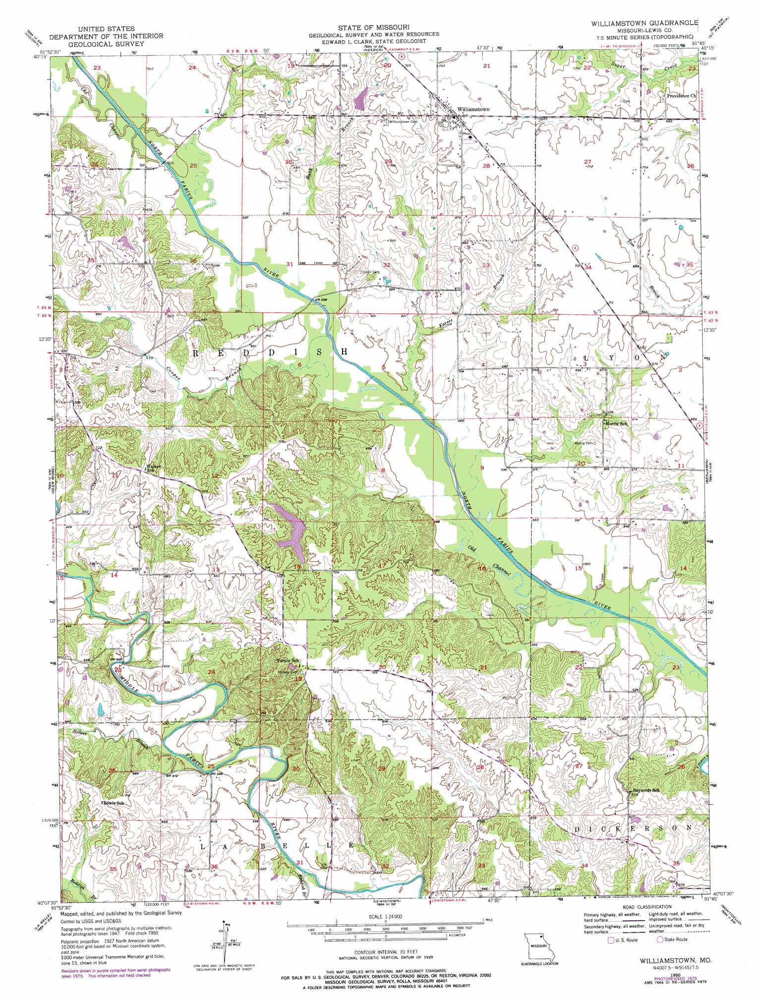
Williamstown Topo Map Missouri
To zoom in, hover over the map of Williamstown
USGS Topo Quad 40091b7 - 1:24,000 scale
| Topo Map Name: | Williamstown |
| USGS Topo Quad ID: | 40091b7 |
| Print Size: | ca. 21 1/4" wide x 27" high |
| Southeast Coordinates: | 40.125° N latitude / 91.75° W longitude |
| Map Center Coordinates: | 40.1875° N latitude / 91.8125° W longitude |
| U.S. State: | MO |
| Filename: | o40091b7.jpg |
| Download Map JPG Image: | Williamstown topo map 1:24,000 scale |
| Map Type: | Topographic |
| Topo Series: | 7.5´ |
| Map Scale: | 1:24,000 |
| Source of Map Images: | United States Geological Survey (USGS) |
| Alternate Map Versions: |
Williamstown MO 1950, updated 1967 Download PDF Buy paper map Williamstown MO 1950, updated 1977 Download PDF Buy paper map Williamstown MO 1951 Download PDF Buy paper map Williamstown MO 2012 Download PDF Buy paper map Williamstown MO 2014 Download PDF Buy paper map |
1:24,000 Topo Quads surrounding Williamstown
Arbela |
Wyaconda |
Medill |
Kahoka |
Wayland |
Rutledge |
Colony |
Neeper |
Saint Patrick |
Kahoka Se |
Knox City |
Deer Ridge |
Williamstown |
Benjamin |
Canton |
Edina Se |
La Belle |
Lewistown |
Monticello |
La Grange |
Bethel |
Newark |
Nelsonville |
Durham |
Maywood |
> Back to 40091a1 at 1:100,000 scale
> Back to 40090a1 at 1:250,000 scale
> Back to U.S. Topo Maps home
Williamstown topo map: Gazetteer
Williamstown: Areas
Egypt elevation 201m 659′Williamstown: Bridges
McLain Bridge elevation 183m 600′Williamstown: Dams
Catfish Lake Dam elevation 201m 659′Deer Ridge Community Lake Dam elevation 201m 659′
H T Lake Dam elevation 197m 646′
Ronald Lay Lake Dam elevation 212m 695′
Stice Lake Dam elevation 214m 702′
Wurtzburger Lake Dam elevation 208m 682′
Williamstown: Populated Places
Midway elevation 220m 721′Williamstown elevation 220m 721′
Williamstown: Reservoirs
Catfish Lake elevation 201m 659′Deer Ridge Community Lake elevation 201m 659′
H T Lake elevation 197m 646′
Ronald Lay Lake elevation 212m 695′
Stice Lake elevation 214m 702′
Wurtzburger Lake elevation 208m 682′
Williamstown: Streams
Buck Branch elevation 181m 593′Cooper Branch elevation 178m 583′
Forsee Branch elevation 177m 580′
Hilbert Branch elevation 177m 580′
Old Channel North Fabius River elevation 176m 577′
Reddish Branch elevation 177m 580′
Williamstown digital topo map on disk
Buy this Williamstown topo map showing relief, roads, GPS coordinates and other geographical features, as a high-resolution digital map file on DVD: