Shenandoah East Topo Map Iowa
To zoom in, hover over the map of Shenandoah East
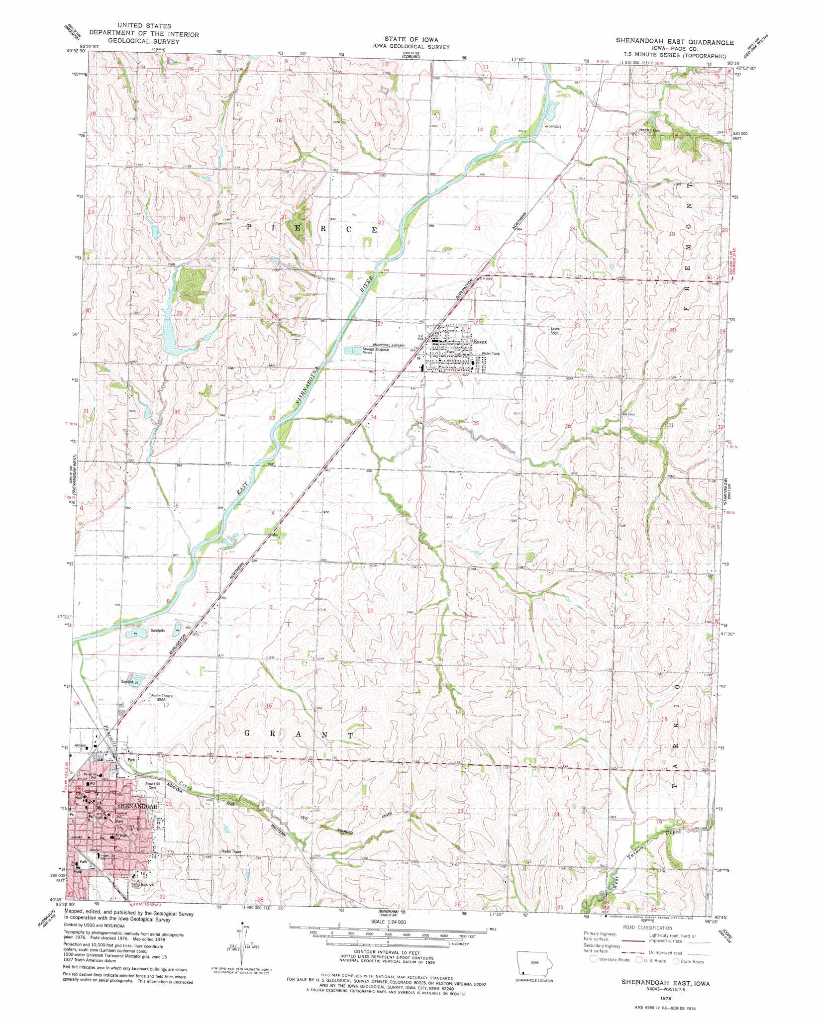
USGS Topo Quad 40095g3 - 1:24,000 scale
| Topo Map Name: | Shenandoah East |
| USGS Topo Quad ID: | 40095g3 |
| Print Size: | ca. 21 1/4" wide x 27" high |
| Southeast Coordinates: | 40.75° N latitude / 95.25° W longitude |
| Map Center Coordinates: | 40.8125° N latitude / 95.3125° W longitude |
| U.S. State: | IA |
| Filename: | o40095g3.jpg |
| Download Map JPG Image: | Shenandoah East topo map 1:24,000 scale |
| Map Type: | Topographic |
| Topo Series: | 7.5´ |
| Map Scale: | 1:24,000 |
| Source of Map Images: | United States Geological Survey (USGS) |
| Alternate Map Versions: |
Shenandoah East IA 1978, updated 1978 Download PDF Buy paper map Shenandoah East IA 2010 Download PDF Buy paper map Shenandoah East IA 2013 Download PDF Buy paper map Shenandoah East IA 2015 Download PDF Buy paper map |
1:24,000 Topo Quads surrounding Shenandoah East
Malvern |
Emerson |
Walles |
Red Oak North |
Wallin |
Tabor Ne |
Imogene |
Coburg |
Red Oak South |
Stanton |
Randolph |
Shenandoah West |
Shenandoah East |
Stanton Sw |
Clarinda North |
Riverton |
Farragut |
Bingham |
Coin |
Clarinda South |
Mcelroy Creek |
Farmers City |
Westboro |
Blanchard |
Clearmont |
> Back to 40095e1 at 1:100,000 scale
> Back to 40094a1 at 1:250,000 scale
> Back to U.S. Topo Maps home
Shenandoah East topo map: Gazetteer
Shenandoah East: Parks
Pierce Creek Recreation Area elevation 318m 1043′Sportsmans Park elevation 295m 967′
Shenandoah East: Populated Places
Essex elevation 302m 990′Shenandoah elevation 299m 980′
Shenandoah East: Post Offices
Essex Post Office elevation 304m 997′Shenandoah Post Office elevation 298m 977′
Shenandoah East: Streams
Eightmile Branch elevation 299m 980′Fourmile Creek elevation 293m 961′
Rocky Branch elevation 295m 967′
Shenandoah East digital topo map on disk
Buy this Shenandoah East topo map showing relief, roads, GPS coordinates and other geographical features, as a high-resolution digital map file on DVD: