Malvern Topo Map Iowa
To zoom in, hover over the map of Malvern
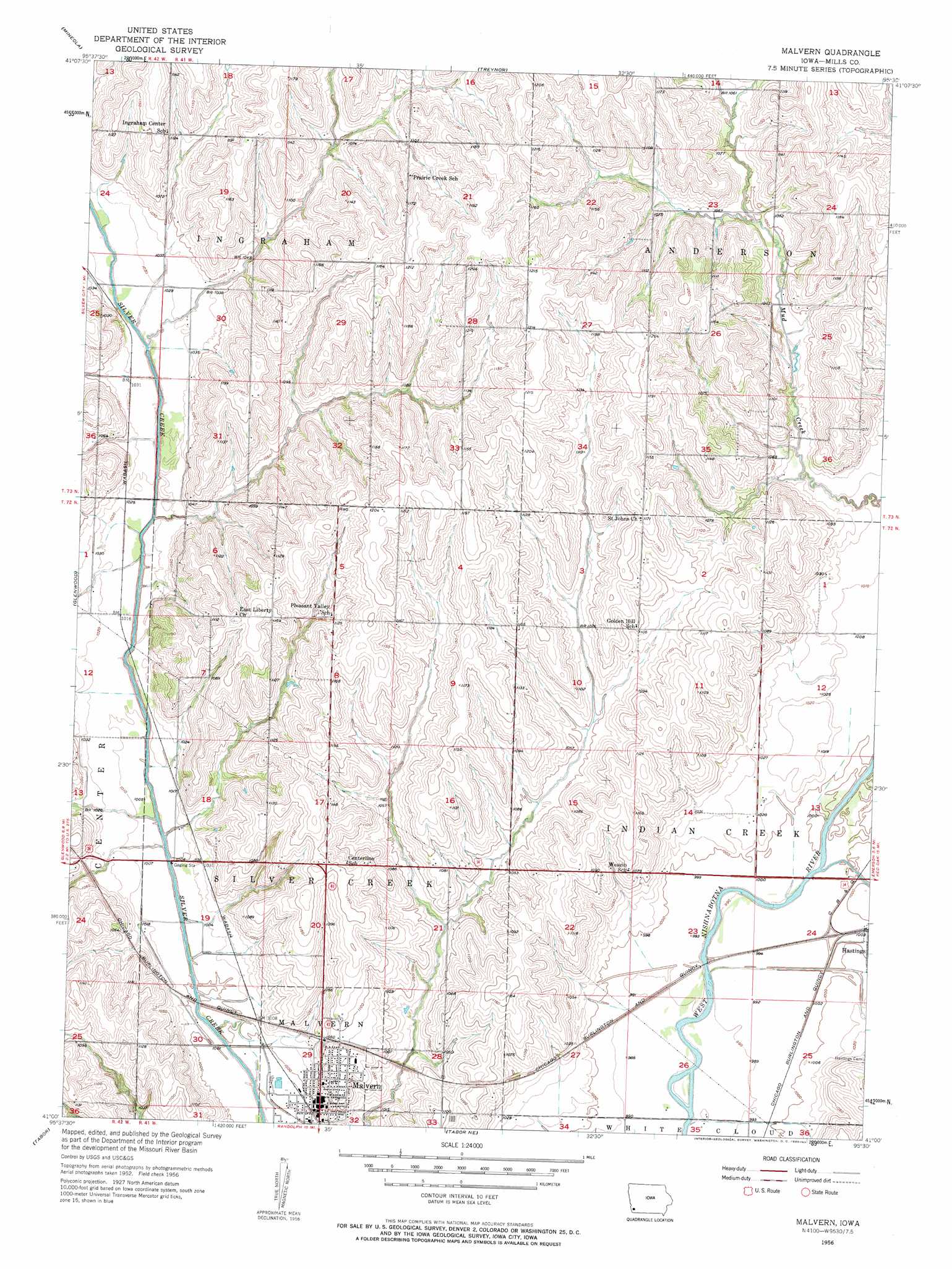
USGS Topo Quad 41095a5 - 1:24,000 scale
| Topo Map Name: | Malvern |
| USGS Topo Quad ID: | 41095a5 |
| Print Size: | ca. 21 1/4" wide x 27" high |
| Southeast Coordinates: | 41° N latitude / 95.5° W longitude |
| Map Center Coordinates: | 41.0625° N latitude / 95.5625° W longitude |
| U.S. State: | IA |
| Filename: | o41095a5.jpg |
| Download Map JPG Image: | Malvern topo map 1:24,000 scale |
| Map Type: | Topographic |
| Topo Series: | 7.5´ |
| Map Scale: | 1:24,000 |
| Source of Map Images: | United States Geological Survey (USGS) |
| Alternate Map Versions: |
Malvern IA 1956, updated 1958 Download PDF Buy paper map Malvern IA 1956, updated 1958 Download PDF Buy paper map Malvern IA 2010 Download PDF Buy paper map Malvern IA 2013 Download PDF Buy paper map Malvern IA 2015 Download PDF Buy paper map |
1:24,000 Topo Quads surrounding Malvern
Council Bluffs North |
Mcclelland |
Taylor |
Oakland |
Avoca Se |
Council Bluffs South |
Mineola |
Treynor |
Carson |
Carson Ne |
Pacific Junction |
Glenwood |
Malvern |
Emerson |
Walles |
Rock Bluff |
Tabor |
Tabor Ne |
Imogene |
Coburg |
Mcpaul |
Tabor Sw |
Randolph |
Shenandoah West |
Shenandoah East |
> Back to 41095a1 at 1:100,000 scale
> Back to 41094a1 at 1:250,000 scale
> Back to U.S. Topo Maps home
Malvern topo map: Gazetteer
Malvern: Parks
Pioneer Log Cabin Home Historical Marker elevation 311m 1020′Ray Thomas Wildlife Preserve elevation 325m 1066′
Malvern: Populated Places
Malvern elevation 307m 1007′Malvern: Post Offices
Benton Post Office (historical) elevation 324m 1062′Jewell Post Office (historical) elevation 345m 1131′
Malvern Post Office elevation 305m 1000′
Malvern: Streams
Indian Creek elevation 301m 987′Osborne Creek elevation 304m 997′
Malvern digital topo map on disk
Buy this Malvern topo map showing relief, roads, GPS coordinates and other geographical features, as a high-resolution digital map file on DVD: