Tabor Ne Topo Map Iowa
To zoom in, hover over the map of Tabor Ne
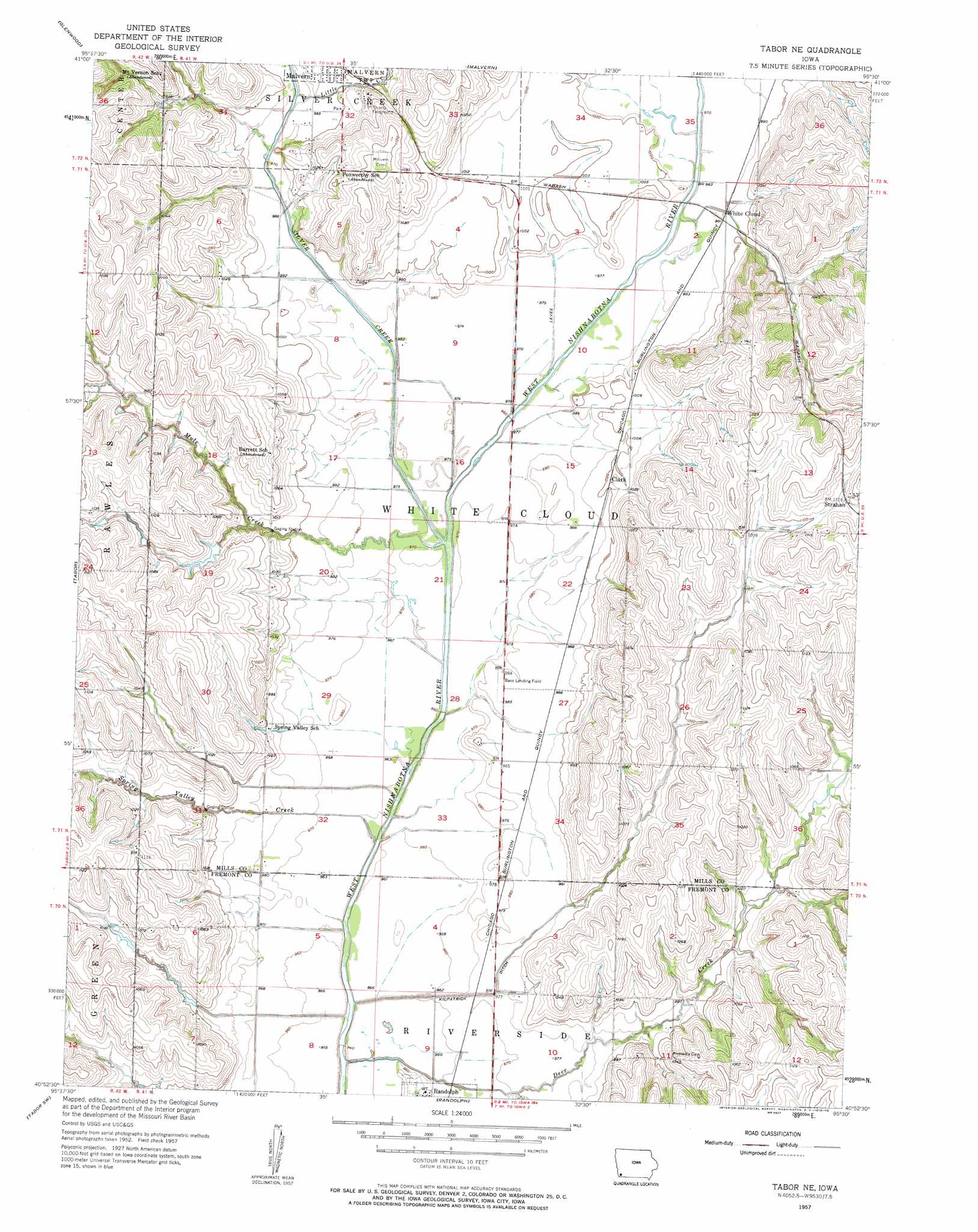
USGS Topo Quad 40095h5 - 1:24,000 scale
| Topo Map Name: | Tabor Ne |
| USGS Topo Quad ID: | 40095h5 |
| Print Size: | ca. 21 1/4" wide x 27" high |
| Southeast Coordinates: | 40.875° N latitude / 95.5° W longitude |
| Map Center Coordinates: | 40.9375° N latitude / 95.5625° W longitude |
| U.S. State: | IA |
| Filename: | o40095h5.jpg |
| Download Map JPG Image: | Tabor Ne topo map 1:24,000 scale |
| Map Type: | Topographic |
| Topo Series: | 7.5´ |
| Map Scale: | 1:24,000 |
| Source of Map Images: | United States Geological Survey (USGS) |
| Alternate Map Versions: |
Tabor NE IA 1957, updated 1958 Download PDF Buy paper map Tabor NE IA 2010 Download PDF Buy paper map Tabor NE IA 2013 Download PDF Buy paper map Tabor NE IA 2015 Download PDF Buy paper map |
1:24,000 Topo Quads surrounding Tabor Ne
Council Bluffs South |
Mineola |
Treynor |
Carson |
Carson Ne |
Pacific Junction |
Glenwood |
Malvern |
Emerson |
Walles |
Rock Bluff |
Tabor |
Tabor Ne |
Imogene |
Coburg |
Mcpaul |
Tabor Sw |
Randolph |
Shenandoah West |
Shenandoah East |
Nebraska City |
Sidney |
Riverton |
Farragut |
Bingham |
> Back to 40095e1 at 1:100,000 scale
> Back to 40094a1 at 1:250,000 scale
> Back to U.S. Topo Maps home
Tabor Ne topo map: Gazetteer
Tabor Ne: Airports
Bass Landing Field elevation 299m 980′Tabor Ne: Canals
Kilpatrick Ditch elevation 289m 948′Tabor Ne: Populated Places
Clark elevation 307m 1007′White Cloud elevation 302m 990′
Tabor Ne: Post Offices
Clark Post Office (historical) elevation 307m 1007′Whitecloud Post Office (historical) elevation 302m 990′
Tabor Ne: Streams
Deer Creek elevation 289m 948′Little Creek elevation 298m 977′
Mule Creek elevation 292m 958′
Silver Creek elevation 292m 958′
Spring Valley Creek elevation 289m 948′
Tabor Ne digital topo map on disk
Buy this Tabor Ne topo map showing relief, roads, GPS coordinates and other geographical features, as a high-resolution digital map file on DVD: