Exeter Topo Map Nebraska
To zoom in, hover over the map of Exeter
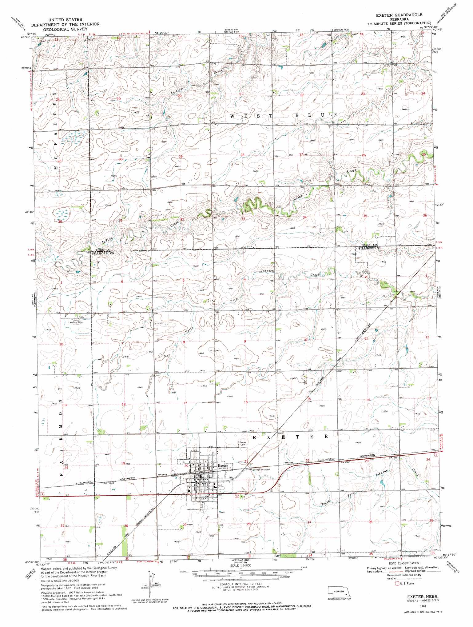
USGS Topo Quad 40097f4 - 1:24,000 scale
| Topo Map Name: | Exeter |
| USGS Topo Quad ID: | 40097f4 |
| Print Size: | ca. 21 1/4" wide x 27" high |
| Southeast Coordinates: | 40.625° N latitude / 97.375° W longitude |
| Map Center Coordinates: | 40.6875° N latitude / 97.4375° W longitude |
| U.S. State: | NE |
| Filename: | O40097f4.jpg |
| Download Map JPG Image: | Exeter topo map 1:24,000 scale |
| Map Type: | Topographic |
| Topo Series: | 7.5´ |
| Map Scale: | 1:24,000 |
| Source of Map Images: | United States Geological Survey (USGS) |
| Alternate Map Versions: |
Exeter NE 1969, updated 1971 Download PDF Buy paper map Exeter NE 2011 Download PDF Buy paper map Exeter NE 2014 Download PDF Buy paper map |
1:24,000 Topo Quads surrounding Exeter
Bradshaw |
York North |
Waco |
Utica |
Staplehurst |
York Sw |
York South |
Utica Sw |
Beaver Crossing |
Goehner |
Grafton |
Fairmont |
Exeter |
Friend |
Dorchester Nw |
Geneva Sw |
Geneva |
Friend Sw |
Friend Se |
Dorchester Sw |
Shickley |
Strang |
Ohiowa |
Tobias |
Western |
> Back to 40097e1 at 1:100,000 scale
> Back to 40096a1 at 1:250,000 scale
> Back to U.S. Topo Maps home
Exeter topo map: Gazetteer
Exeter: Parks
Exeter Historical Marker elevation 491m 1610′Hidden Marsh State Wildlife Management Area elevation 491m 1610′
Exeter: Populated Places
Exeter elevation 491m 1610′Exeter: Post Offices
Exeter Post Office elevation 491m 1610′Exeter digital topo map on disk
Buy this Exeter topo map showing relief, roads, GPS coordinates and other geographical features, as a high-resolution digital map file on DVD: