Grafton Topo Map Nebraska
To zoom in, hover over the map of Grafton
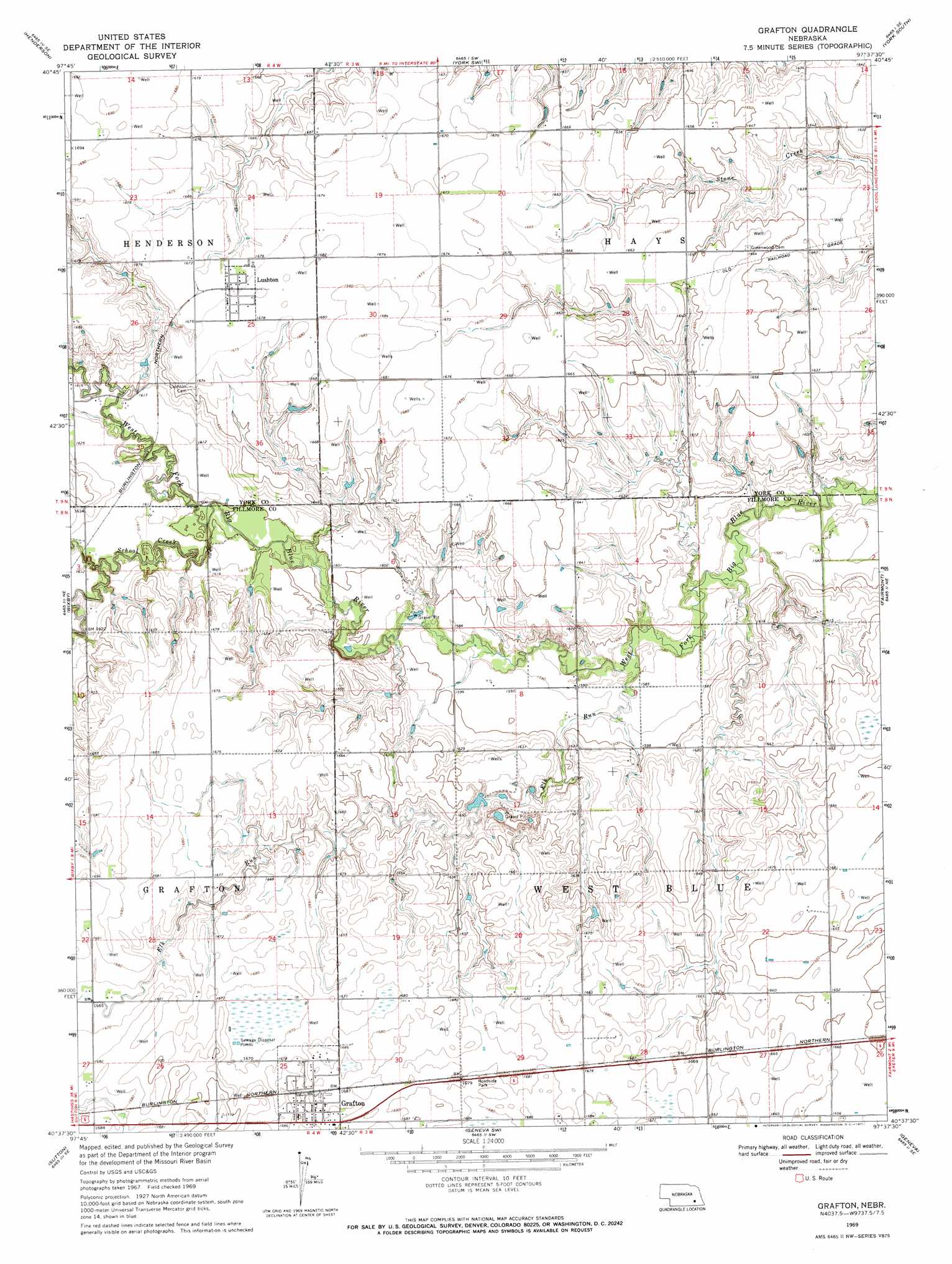
USGS Topo Quad 40097f6 - 1:24,000 scale
| Topo Map Name: | Grafton |
| USGS Topo Quad ID: | 40097f6 |
| Print Size: | ca. 21 1/4" wide x 27" high |
| Southeast Coordinates: | 40.625° N latitude / 97.625° W longitude |
| Map Center Coordinates: | 40.6875° N latitude / 97.6875° W longitude |
| U.S. State: | NE |
| Filename: | O40097f6.jpg |
| Download Map JPG Image: | Grafton topo map 1:24,000 scale |
| Map Type: | Topographic |
| Topo Series: | 7.5´ |
| Map Scale: | 1:24,000 |
| Source of Map Images: | United States Geological Survey (USGS) |
| Alternate Map Versions: |
Grafton NE 1969, updated 1971 Download PDF Buy paper map Grafton NE 2011 Download PDF Buy paper map Grafton NE 2014 Download PDF Buy paper map |
1:24,000 Topo Quads surrounding Grafton
Hampton |
Henderson Ne |
Bradshaw |
York North |
Waco |
Aurora East |
Henderson |
York Sw |
York South |
Utica Sw |
Stockham |
Bixby |
Grafton |
Fairmont |
Exeter |
Saronville |
Sutton |
Geneva Sw |
Geneva |
Friend Sw |
Edgar Nw |
Ong |
Shickley |
Strang |
Ohiowa |
> Back to 40097e1 at 1:100,000 scale
> Back to 40096a1 at 1:250,000 scale
> Back to U.S. Topo Maps home
Grafton topo map: Gazetteer
Grafton: Dams
Stuckey Dam elevation 505m 1656′Grafton: Parks
Bluebill State Wildlife Management Area elevation 512m 1679′Marsh Hawk State Wildlife Management Area elevation 508m 1666′
Grafton: Populated Places
Grafton elevation 515m 1689′Lushton elevation 511m 1676′
Grafton: Post Offices
Grafton Post Office elevation 515m 1689′Lushton Post Office (historical) elevation 511m 1676′
Grafton: Reservoirs
Stuckey Reservoir elevation 505m 1656′Grafton: Streams
Elk Run elevation 477m 1564′School Creek elevation 484m 1587′
Grafton digital topo map on disk
Buy this Grafton topo map showing relief, roads, GPS coordinates and other geographical features, as a high-resolution digital map file on DVD: