Mascot Topo Map Nebraska
To zoom in, hover over the map of Mascot
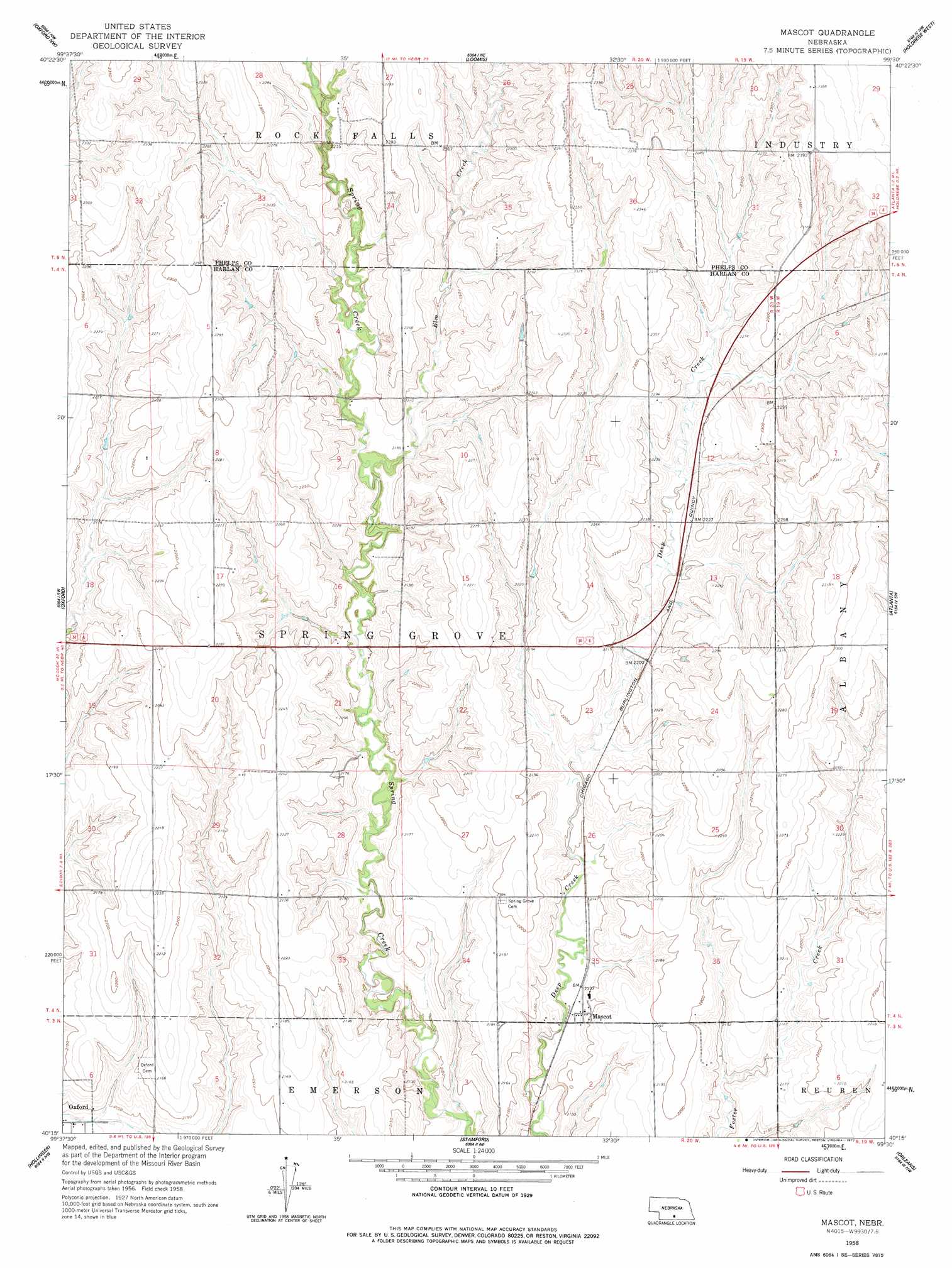
USGS Topo Quad 40099c5 - 1:24,000 scale
| Topo Map Name: | Mascot |
| USGS Topo Quad ID: | 40099c5 |
| Print Size: | ca. 21 1/4" wide x 27" high |
| Southeast Coordinates: | 40.25° N latitude / 99.5° W longitude |
| Map Center Coordinates: | 40.3125° N latitude / 99.5625° W longitude |
| U.S. State: | NE |
| Filename: | O40099c5.jpg |
| Download Map JPG Image: | Mascot topo map 1:24,000 scale |
| Map Type: | Topographic |
| Topo Series: | 7.5´ |
| Map Scale: | 1:24,000 |
| Source of Map Images: | United States Geological Survey (USGS) |
| Alternate Map Versions: |
Mascot NE 1958, updated 1960 Download PDF Buy paper map Mascot NE 1958, updated 1977 Download PDF Buy paper map Mascot NE 2011 Download PDF Buy paper map Mascot NE 2014 Download PDF Buy paper map |
1:24,000 Topo Quads surrounding Mascot
Elwood |
Bertrand |
Bertrand Se |
Elm Creek Sw |
Elm Creek Se |
Arapahoe Ne |
Oxford Nw |
Loomis |
Holdrege West |
Holdrege East |
Edison |
Oxford |
Mascot |
Atlanta |
Ragan |
Beaver City |
Hollinger |
Stamford |
Orleans |
Huntley |
Beaver City Se |
Precept |
Stamford Se |
Alma Sw |
Alma |
> Back to 40099a1 at 1:100,000 scale
> Back to 40098a1 at 1:250,000 scale
> Back to U.S. Topo Maps home
Mascot topo map: Gazetteer
Mascot: Dams
Drake Dam elevation 650m 2132′Lueking Dam elevation 662m 2171′
Mascot: Populated Places
Mascot elevation 650m 2132′Mascot: Post Offices
Mascot Post Office (historical) elevation 650m 2132′Mascot: Reservoirs
Drake Reservoir elevation 650m 2132′Lueking Reservoir elevation 662m 2171′
Mascot: Streams
Elm Creek elevation 657m 2155′Mascot digital topo map on disk
Buy this Mascot topo map showing relief, roads, GPS coordinates and other geographical features, as a high-resolution digital map file on DVD: