Wild Horse Spring Topo Map Nebraska
To zoom in, hover over the map of Wild Horse Spring
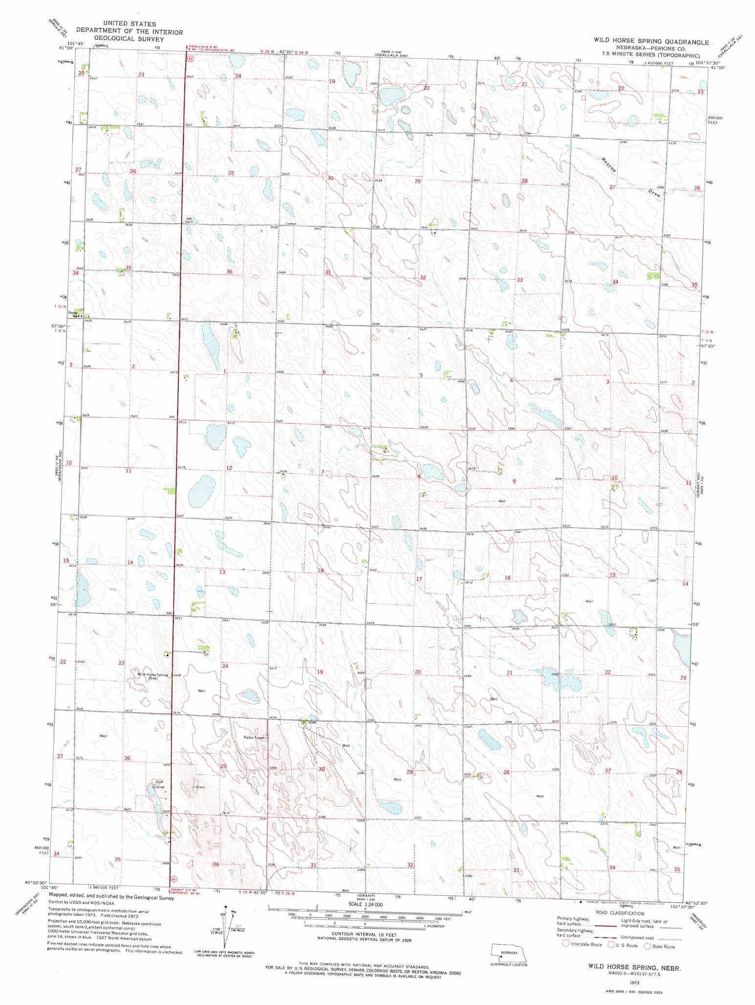
USGS Topo Quad 40101h6 - 1:24,000 scale
| Topo Map Name: | Wild Horse Spring |
| USGS Topo Quad ID: | 40101h6 |
| Print Size: | ca. 21 1/4" wide x 27" high |
| Southeast Coordinates: | 40.875° N latitude / 101.625° W longitude |
| Map Center Coordinates: | 40.9375° N latitude / 101.6875° W longitude |
| U.S. State: | NE |
| Filename: | O40101h6.jpg |
| Download Map JPG Image: | Wild Horse Spring topo map 1:24,000 scale |
| Map Type: | Topographic |
| Topo Series: | 7.5´ |
| Map Scale: | 1:24,000 |
| Source of Map Images: | United States Geological Survey (USGS) |
| Alternate Map Versions: |
Wild Horse Spring NE 1973, updated 1977 Download PDF Buy paper map Wild Horse Spring NE 2011 Download PDF Buy paper map Wild Horse Spring NE 2014 Download PDF Buy paper map |
1:24,000 Topo Quads surrounding Wild Horse Spring
Brule Nw |
Brule Ne |
Ogallala |
Keystone |
Nevens |
Brule |
Brule Se |
Ogallala Sw |
Ogallala Se |
Paxton Sw |
Brandon Nw |
Brandon Ne |
Wild Horse Spring |
Grant Ne |
Elsie Nw |
Brandon |
Brandon Se |
Grant |
Madrid |
Elsie |
Lamar Nw |
Lamar Ne |
Imperial Nw |
Imperial Ne |
Dittons Creek Nw |
> Back to 40101e1 at 1:100,000 scale
> Back to 40100a1 at 1:250,000 scale
> Back to U.S. Topo Maps home
Wild Horse Spring topo map: Gazetteer
Wild Horse Spring: Parks
Wild Horse Spring Historical Marker elevation 1039m 3408′Wild Horse Spring: Springs
Wild Horse Spring elevation 1039m 3408′Wild Horse Spring digital topo map on disk
Buy this Wild Horse Spring topo map showing relief, roads, GPS coordinates and other geographical features, as a high-resolution digital map file on DVD: