Stoneham Se Topo Map Colorado
To zoom in, hover over the map of Stoneham Se
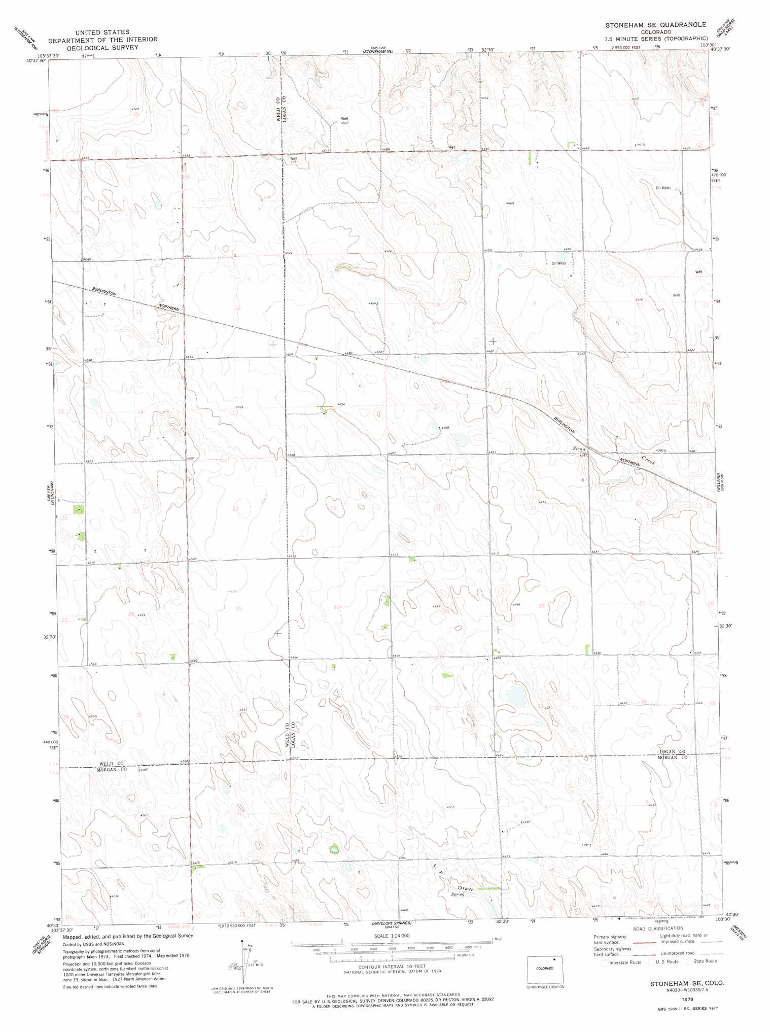
USGS Topo Quad 40103e5 - 1:24,000 scale
| Topo Map Name: | Stoneham Se |
| USGS Topo Quad ID: | 40103e5 |
| Print Size: | ca. 21 1/4" wide x 27" high |
| Southeast Coordinates: | 40.5° N latitude / 103.5° W longitude |
| Map Center Coordinates: | 40.5625° N latitude / 103.5625° W longitude |
| U.S. State: | CO |
| Filename: | o40103e5.jpg |
| Download Map JPG Image: | Stoneham Se topo map 1:24,000 scale |
| Map Type: | Topographic |
| Topo Series: | 7.5´ |
| Map Scale: | 1:24,000 |
| Source of Map Images: | United States Geological Survey (USGS) |
| Alternate Map Versions: |
Stoneham SE CO 1978, updated 1978 Download PDF Buy paper map Stoneham SE CO 2011 Download PDF Buy paper map Stoneham SE CO 2013 Download PDF Buy paper map Stoneham SE CO 2016 Download PDF Buy paper map |
1:24,000 Topo Quads surrounding Stoneham Se
Gatehook Spring |
Avalo |
Avalo Se |
Westplains |
North Sterling Reservoir |
Raymer Ne |
Stoneham Nw |
Stoneham Ne |
Wild Horse Lake |
Atwood Ne |
Raymer |
Stoneham |
Stoneham Se |
Willard |
Atwood |
Peace Valley School |
Dead Horse Springs |
Antelope Springs |
Messex |
Merino |
Fort Morgan |
Brush West |
Brush East |
Merino Sw |
Merino Se |
> Back to 40103e1 at 1:100,000 scale
> Back to 40102a1 at 1:250,000 scale
> Back to U.S. Topo Maps home
No gazetteer data is available for the Stoneham Se topo map sheet.
Stoneham Se digital topo map on disk
Buy this Stoneham Se topo map showing relief, roads, GPS coordinates and other geographical features, as a high-resolution digital map file on DVD: