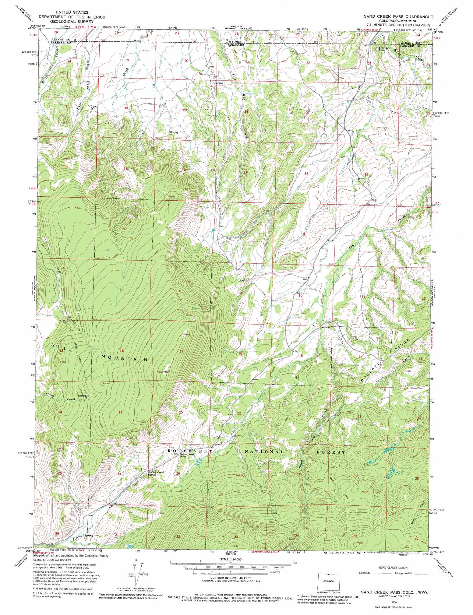
Sand Creek Pass Topo Map Colorado
To zoom in, hover over the map of Sand Creek Pass
USGS Topo Quad 40105h7 - 1:24,000 scale
| Topo Map Name: | Sand Creek Pass |
| USGS Topo Quad ID: | 40105h7 |
| Print Size: | ca. 21 1/4" wide x 27" high |
| Southeast Coordinates: | 40.875° N latitude / 105.75° W longitude |
| Map Center Coordinates: | 40.9375° N latitude / 105.8125° W longitude |
| U.S. States: | CO, WY |
| Filename: | o40105h7.jpg |
| Download Map JPG Image: | Sand Creek Pass topo map 1:24,000 scale |
| Map Type: | Topographic |
| Topo Series: | 7.5´ |
| Map Scale: | 1:24,000 |
| Source of Map Images: | United States Geological Survey (USGS) |
| Alternate Map Versions: |
Sand Creek Pass CO 1967, updated 1971 Download PDF Buy paper map Sand Creek Pass CO 1967, updated 1971 Download PDF Buy paper map Sand Creek Pass CO 1967, updated 1980 Download PDF Buy paper map Sand Creek Pass CO 1967, updated 1980 Download PDF Buy paper map Sand Creek Pass CO 2011 Download PDF Buy paper map Sand Creek Pass CO 2013 Download PDF Buy paper map Sand Creek Pass CO 2016 Download PDF Buy paper map |
| FStopo: | US Forest Service topo Sand Creek Pass is available: Download FStopo PDF Download FStopo TIF |
1:24,000 Topo Quads surrounding Sand Creek Pass
Lake Owen |
Sodergreen Lake |
Caldwell Lake |
Hutton Lake |
Red Buttes |
Woods Landing |
Jelm Mountain |
Downey Lakes |
Johnson Ranch |
Best Ranch |
Old Roach |
Crazy Mountain |
Sand Creek Pass |
Eaton Reservoir |
Diamond Peak |
Shipman Mountain |
Glendevey |
Deadman |
South Bald Mountain |
Red Feather Lakes |
Johnny Moore Mountain |
Rawah Lakes |
Boston Peak |
Kinikinik |
Rustic |
> Back to 40105e1 at 1:100,000 scale
> Back to 40104a1 at 1:250,000 scale
> Back to U.S. Topo Maps home
Sand Creek Pass topo map: Gazetteer
Sand Creek Pass: Canals
Wilson Ditch elevation 2737m 8979′Sand Creek Pass: Gaps
Sand Creek Pass elevation 2735m 8973′Sand Creek Pass: Springs
Jimmy Creek Spring elevation 2672m 8766′Sand Creek Pass: Summits
Bull Mountain elevation 3074m 10085′Chimney Rock elevation 2386m 7828′
Sand Creek Pass digital topo map on disk
Buy this Sand Creek Pass topo map showing relief, roads, GPS coordinates and other geographical features, as a high-resolution digital map file on DVD: