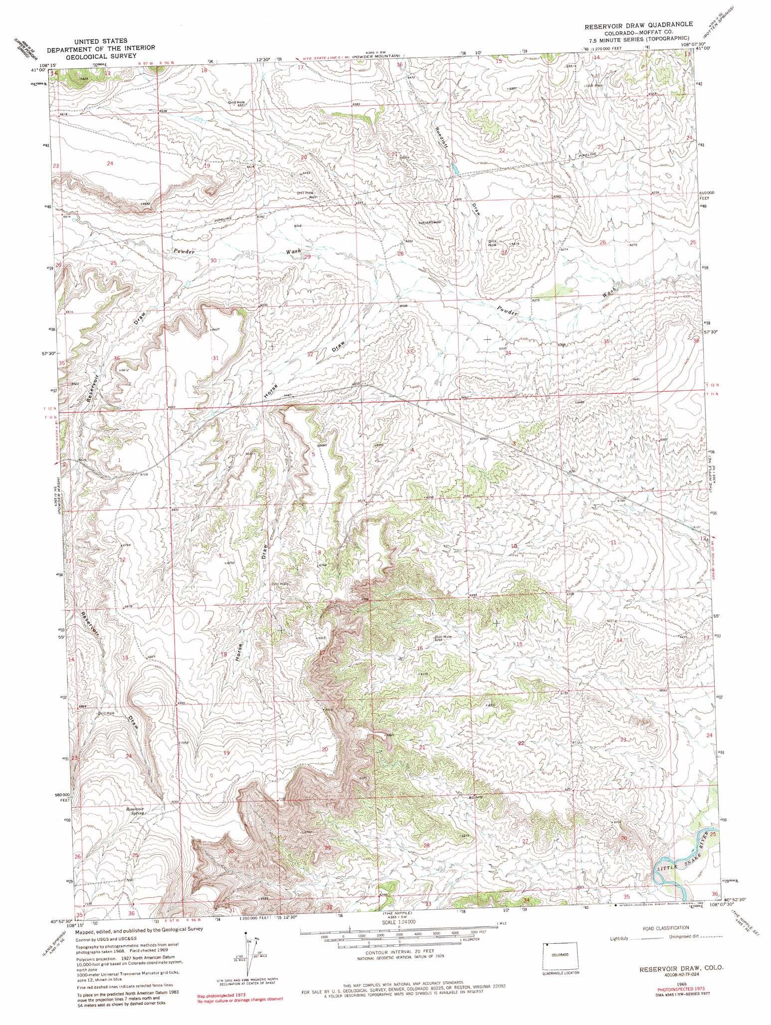
Reservoir Draw Topo Map Colorado
To zoom in, hover over the map of Reservoir Draw
USGS Topo Quad 40108h2 - 1:24,000 scale
| Topo Map Name: | Reservoir Draw |
| USGS Topo Quad ID: | 40108h2 |
| Print Size: | ca. 21 1/4" wide x 27" high |
| Southeast Coordinates: | 40.875° N latitude / 108.125° W longitude |
| Map Center Coordinates: | 40.9375° N latitude / 108.1875° W longitude |
| U.S. State: | CO |
| Filename: | o40108h2.jpg |
| Download Map JPG Image: | Reservoir Draw topo map 1:24,000 scale |
| Map Type: | Topographic |
| Topo Series: | 7.5´ |
| Map Scale: | 1:24,000 |
| Source of Map Images: | United States Geological Survey (USGS) |
| Alternate Map Versions: |
Reservoir Draw CO 1969, updated 1972 Download PDF Buy paper map Reservoir Draw CO 1969, updated 1972 Download PDF Buy paper map Reservoir Draw CO 1969, updated 1986 Download PDF Buy paper map Reservoir Draw CO 2010 Download PDF Buy paper map Reservoir Draw CO 2013 Download PDF Buy paper map Reservoir Draw CO 2016 Download PDF Buy paper map |
1:24,000 Topo Quads surrounding Reservoir Draw
Cow Creek Reservoir |
Monument Valley |
Prehistoric Rim |
Powder Mountain Ne |
Dripping Rock Spring |
Cow Creek Reservoir Sw |
Upper Powder Spring |
Powder Mountain |
Rotten Springs |
Mcpherson Springs |
Coffee Pot Spring |
Powder Wash |
Reservoir Draw |
The Nipple Ne |
Bighole Butte |
Sheepherder Springs |
Lang Spring |
The Nipple |
The Nipple Se |
Mayberry Spring |
Clay Buttes |
Sevenmile Draw |
Ninemile Hill |
Bald Mountain |
Adobe Springs |
> Back to 40108e1 at 1:100,000 scale
> Back to 40108a1 at 1:250,000 scale
> Back to U.S. Topo Maps home
Reservoir Draw topo map: Gazetteer
Reservoir Draw: Springs
Reservoir Spring elevation 2154m 7066′Reservoir Draw: Valleys
Horse Draw elevation 1925m 6315′Reservoir Draw elevation 1941m 6368′
Ruedloff Draw elevation 1918m 6292′
Reservoir Draw digital topo map on disk
Buy this Reservoir Draw topo map showing relief, roads, GPS coordinates and other geographical features, as a high-resolution digital map file on DVD: