Delcer Buttes Topo Map Nevada
To zoom in, hover over the map of Delcer Buttes
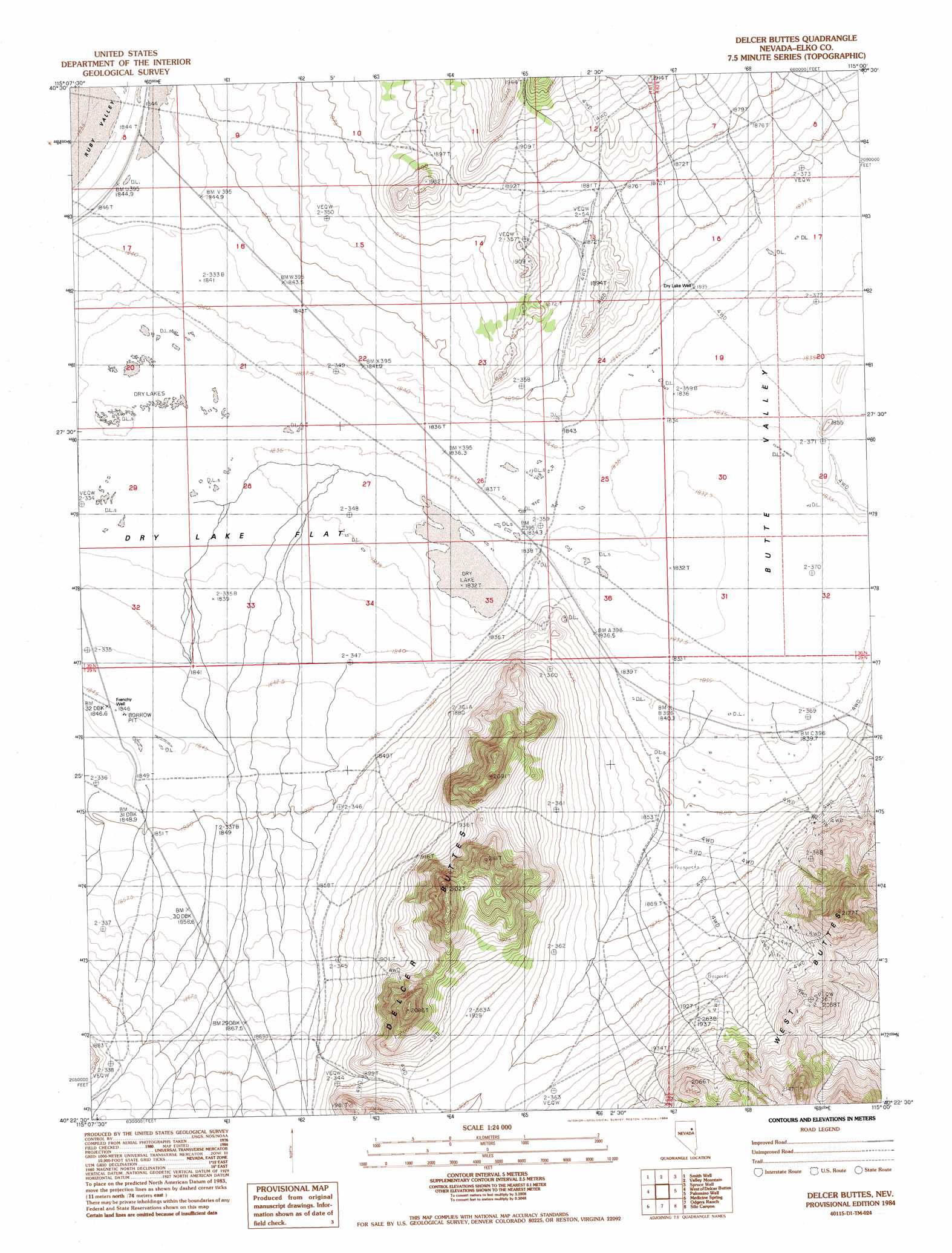
USGS Topo Quad 40115d1 - 1:24,000 scale
| Topo Map Name: | Delcer Buttes |
| USGS Topo Quad ID: | 40115d1 |
| Print Size: | ca. 21 1/4" wide x 27" high |
| Southeast Coordinates: | 40.375° N latitude / 115° W longitude |
| Map Center Coordinates: | 40.4375° N latitude / 115.0625° W longitude |
| U.S. State: | NV |
| Filename: | o40115d1.jpg |
| Download Map JPG Image: | Delcer Buttes topo map 1:24,000 scale |
| Map Type: | Topographic |
| Topo Series: | 7.5´ |
| Map Scale: | 1:24,000 |
| Source of Map Images: | United States Geological Survey (USGS) |
| Alternate Map Versions: |
Delcer Buttes NV 1984, updated 1984 Download PDF Buy paper map Delcer Buttes NV 2012 Download PDF Buy paper map Delcer Buttes NV 2014 Download PDF Buy paper map |
1:24,000 Topo Quads surrounding Delcer Buttes
Verdi Peak |
Ruby City Creek |
Arizona Spring |
Spruce Mountain Nw |
Chase Spring |
Ruby Valley School |
Smith Well |
Valley Mountain |
Spruce Well |
Spruce Mountain |
Franklin Lake Ne |
West Of Delcer Buttes |
Delcer Buttes |
Palomino Well |
Palomino Ridge |
Franklin Lake Se |
Medicine Spring |
Odgers Ranch |
Silo Canyon |
Currie Gardens |
Ruby Lake Ne |
High Bald Peaks |
High Bald Peaks Ne |
Mount Taylor |
Mcdermid Ranch |
> Back to 40115a1 at 1:100,000 scale
> Back to 40114a1 at 1:250,000 scale
> Back to U.S. Topo Maps home
Delcer Buttes topo map: Gazetteer
Delcer Buttes: Flats
Dry Lake Flat elevation 1837m 6026′Delcer Buttes: Summits
Delcer Buttes elevation 2032m 6666′Delcer Buttes: Wells
Dry Lake Well elevation 1840m 6036′Frenchy Well elevation 1847m 6059′
Delcer Buttes digital topo map on disk
Buy this Delcer Buttes topo map showing relief, roads, GPS coordinates and other geographical features, as a high-resolution digital map file on DVD: