Medicine Spring Topo Map Nevada
To zoom in, hover over the map of Medicine Spring
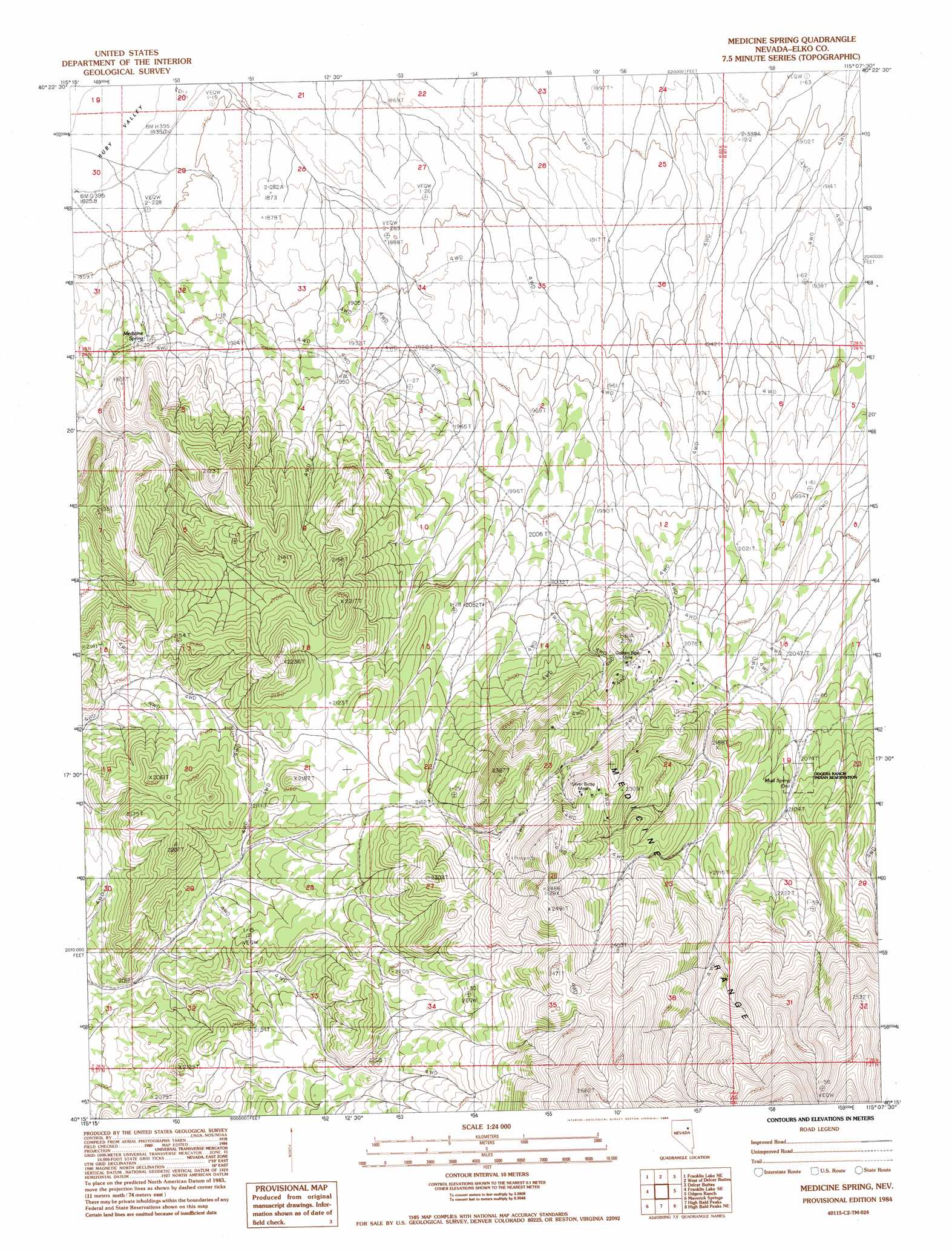
USGS Topo Quad 40115c2 - 1:24,000 scale
| Topo Map Name: | Medicine Spring |
| USGS Topo Quad ID: | 40115c2 |
| Print Size: | ca. 21 1/4" wide x 27" high |
| Southeast Coordinates: | 40.25° N latitude / 115.125° W longitude |
| Map Center Coordinates: | 40.3125° N latitude / 115.1875° W longitude |
| U.S. State: | NV |
| Filename: | o40115c2.jpg |
| Download Map JPG Image: | Medicine Spring topo map 1:24,000 scale |
| Map Type: | Topographic |
| Topo Series: | 7.5´ |
| Map Scale: | 1:24,000 |
| Source of Map Images: | United States Geological Survey (USGS) |
| Alternate Map Versions: |
Medicine Spring NV 1984, updated 1984 Download PDF Buy paper map Medicine Spring NV 2012 Download PDF Buy paper map Medicine Spring NV 2014 Download PDF Buy paper map |
1:24,000 Topo Quads surrounding Medicine Spring
Ruby Dome |
Ruby Valley School |
Smith Well |
Valley Mountain |
Spruce Well |
Franklin Lake Nw |
Franklin Lake Ne |
West Of Delcer Buttes |
Delcer Buttes |
Palomino Well |
Franklin Lake Sw |
Franklin Lake Se |
Medicine Spring |
Odgers Ranch |
Silo Canyon |
Ruby Lake Nw |
Ruby Lake Ne |
High Bald Peaks |
High Bald Peaks Ne |
Mount Taylor |
Station Butte |
Ruby Lake Se |
Pot Spring |
High Bald Peaks Se |
Paris Creek |
> Back to 40115a1 at 1:100,000 scale
> Back to 40114a1 at 1:250,000 scale
> Back to U.S. Topo Maps home
Medicine Spring topo map: Gazetteer
Medicine Spring: Mines
Golden Pipe Mine elevation 2143m 7030′Silver Butte Mine elevation 2315m 7595′
Medicine Spring: Springs
Medicine Spring elevation 1885m 6184′Mud Spring elevation 2089m 6853′
Medicine Spring digital topo map on disk
Buy this Medicine Spring topo map showing relief, roads, GPS coordinates and other geographical features, as a high-resolution digital map file on DVD: