Emerson Pass Topo Map Nevada
To zoom in, hover over the map of Emerson Pass
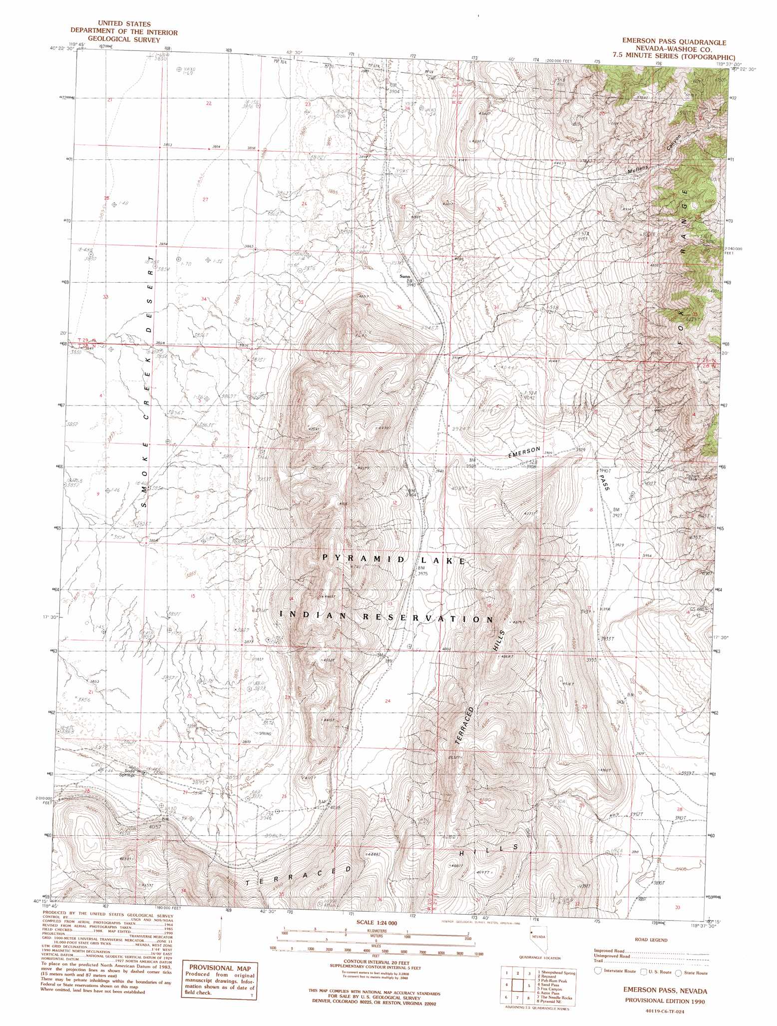
USGS Topo Quad 40119c6 - 1:24,000 scale
| Topo Map Name: | Emerson Pass |
| USGS Topo Quad ID: | 40119c6 |
| Print Size: | ca. 21 1/4" wide x 27" high |
| Southeast Coordinates: | 40.25° N latitude / 119.625° W longitude |
| Map Center Coordinates: | 40.3125° N latitude / 119.6875° W longitude |
| U.S. State: | NV |
| Filename: | o40119c6.jpg |
| Download Map JPG Image: | Emerson Pass topo map 1:24,000 scale |
| Map Type: | Topographic |
| Topo Series: | 7.5´ |
| Map Scale: | 1:24,000 |
| Source of Map Images: | United States Geological Survey (USGS) |
| Alternate Map Versions: |
Emerson Pass NV 1990, updated 1990 Download PDF Buy paper map Emerson Pass NV 2011 Download PDF Buy paper map Emerson Pass NV 2014 Download PDF Buy paper map |
1:24,000 Topo Quads surrounding Emerson Pass
Smoke Creek Ranch |
Salt Marsh |
Hog Spring |
Smith Canyon |
West Of Empire |
Red Rock Canyon |
Sheepshead Spring |
Reynard |
Pah-Rum Peak |
San Emidio Desert North |
Parker Canyon |
Sand Pass |
Emerson Pass |
Fox Canyon |
San Emidio Desert South |
Flanigan |
Astor Pass |
The Needle Rocks |
Pyramid Ne |
Tohakum Peak Nw |
State Line Peak |
Spanish Flat |
Pyramid Sw |
Dove Creek |
> Back to 40119a1 at 1:100,000 scale
> Back to 40118a1 at 1:250,000 scale
> Back to U.S. Topo Maps home
Emerson Pass topo map: Gazetteer
Emerson Pass: Gaps
Emerson Pass elevation 1210m 3969′Emerson Pass: Mines
Packard Mine elevation 1373m 4504′Sano Mine elevation 1292m 4238′
Emerson Pass: Populated Places
Sano elevation 1203m 3946′Emerson Pass: Springs
Soda Springs elevation 1187m 3894′Emerson Pass: Valleys
Mullens Canyon elevation 1401m 4596′Emerson Pass digital topo map on disk
Buy this Emerson Pass topo map showing relief, roads, GPS coordinates and other geographical features, as a high-resolution digital map file on DVD: