Manlius Topo Map Illinois
To zoom in, hover over the map of Manlius
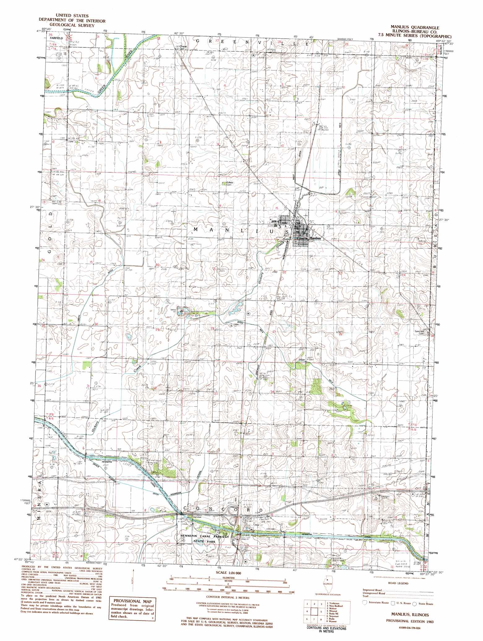
USGS Topo Quad 41089d6 - 1:24,000 scale
| Topo Map Name: | Manlius |
| USGS Topo Quad ID: | 41089d6 |
| Print Size: | ca. 21 1/4" wide x 27" high |
| Southeast Coordinates: | 41.375° N latitude / 89.625° W longitude |
| Map Center Coordinates: | 41.4375° N latitude / 89.6875° W longitude |
| U.S. State: | IL |
| Filename: | o41089d6.jpg |
| Download Map JPG Image: | Manlius topo map 1:24,000 scale |
| Map Type: | Topographic |
| Topo Series: | 7.5´ |
| Map Scale: | 1:24,000 |
| Source of Map Images: | United States Geological Survey (USGS) |
| Alternate Map Versions: |
Manlius IL 1983, updated 1984 Download PDF Buy paper map Manlius IL 2012 Download PDF Buy paper map Manlius IL 2015 Download PDF Buy paper map |
1:24,000 Topo Quads surrounding Manlius
Prophetstown |
Tampico |
Hahnaman |
Harmon |
Walton |
Hooppole |
Yorktown |
New Bedford |
Walnut |
Ohio |
Annawan |
Mineral |
Manlius |
Buoane |
Princeton North |
Kewanee North |
Neponset |
Buda |
Wyanet |
Princeton South |
Kewanee South |
Elmira |
Bradford |
Whitefield |
Putnam |
> Back to 41089a1 at 1:100,000 scale
> Back to 41088a1 at 1:250,000 scale
> Back to U.S. Topo Maps home
Manlius topo map: Gazetteer
Manlius: Canals
Devils Slough Ditch elevation 190m 623′Ditch Number 4 elevation 201m 659′
Ditch Number 5 elevation 210m 688′
Ditch Number 6 elevation 201m 659′
Hasbrook Lateral Ditch elevation 192m 629′
Smith Ditch elevation 192m 629′
West Ditch elevation 211m 692′
Manlius: Crossings
Interchange 45 elevation 198m 649′Manlius: Parks
Hennepin Canal Parkway State Park elevation 197m 646′Manlius: Populated Places
Manlius elevation 214m 702′Manlius: Post Offices
Manlius Post Office elevation 215m 705′Manlius: Streams
Hickory Creek elevation 192m 629′Manlius digital topo map on disk
Buy this Manlius topo map showing relief, roads, GPS coordinates and other geographical features, as a high-resolution digital map file on DVD:
Northern Illinois, Northern Indiana & Southwestern Michigan
Buy digital topo maps: Northern Illinois, Northern Indiana & Southwestern Michigan