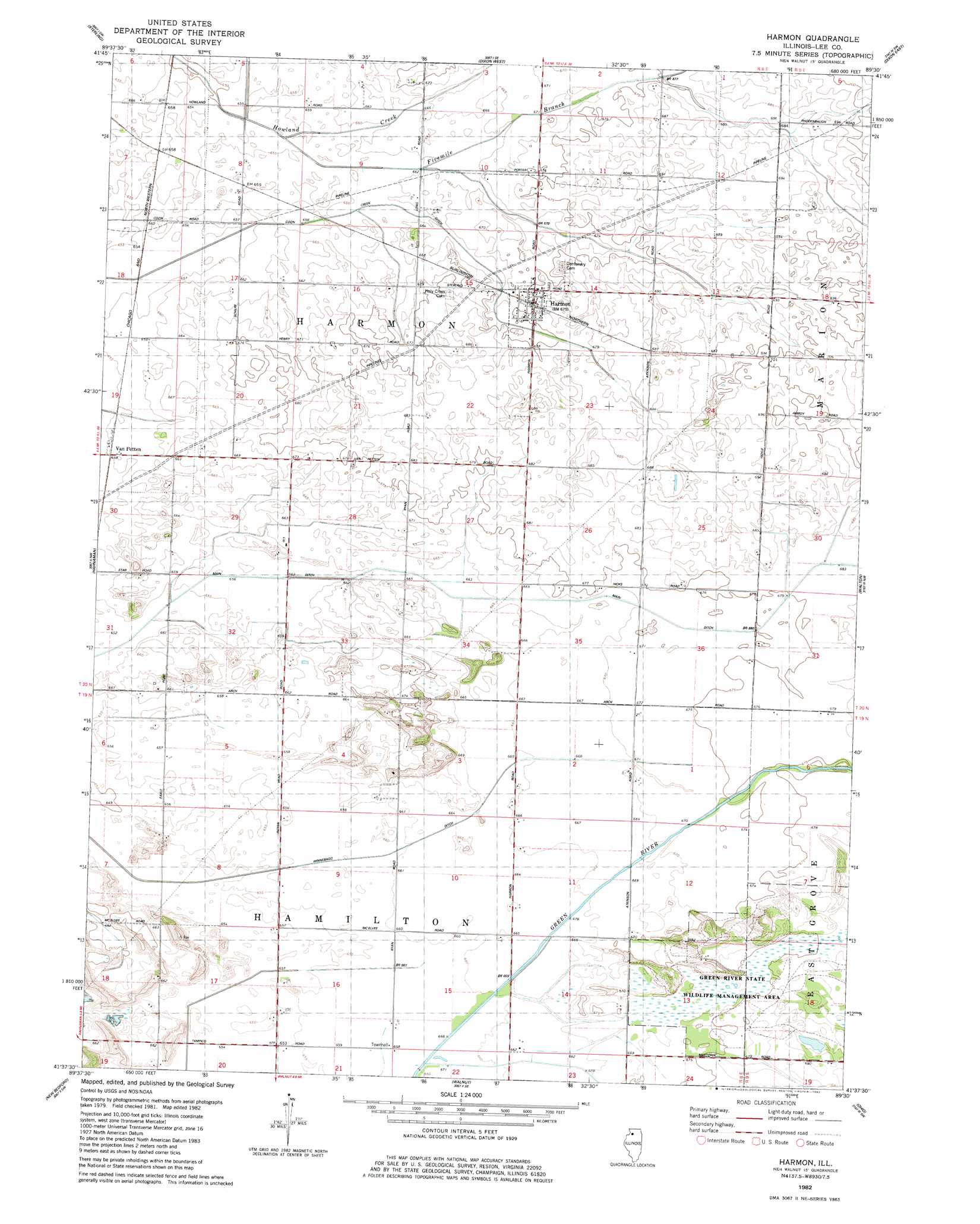
Harmon Topo Map Illinois
To zoom in, hover over the map of Harmon
USGS Topo Quad 41089f5 - 1:24,000 scale
| Topo Map Name: | Harmon |
| USGS Topo Quad ID: | 41089f5 |
| Print Size: | ca. 21 1/4" wide x 27" high |
| Southeast Coordinates: | 41.625° N latitude / 89.5° W longitude |
| Map Center Coordinates: | 41.6875° N latitude / 89.5625° W longitude |
| U.S. State: | IL |
| Filename: | o41089f5.jpg |
| Download Map JPG Image: | Harmon topo map 1:24,000 scale |
| Map Type: | Topographic |
| Topo Series: | 7.5´ |
| Map Scale: | 1:24,000 |
| Source of Map Images: | United States Geological Survey (USGS) |
| Alternate Map Versions: |
Harmon IL 1982, updated 1982 Download PDF Buy paper map Harmon IL 1982, updated 1982 Download PDF Buy paper map Harmon IL 2012 Download PDF Buy paper map Harmon IL 2015 Download PDF Buy paper map |
1:24,000 Topo Quads surrounding Harmon
Milledgeville |
Hazelhurst |
Polo |
Grand Detour |
Daysville |
Como |
Sterling |
Dixon West |
Dixon East |
Franklin Grove |
Tampico |
Hahnaman |
Harmon |
Walton |
Amboy |
Yorktown |
New Bedford |
Walnut |
Ohio |
Lamoille |
Mineral |
Manlius |
Buoane |
Princeton North |
Malden |
> Back to 41089e1 at 1:100,000 scale
> Back to 41088a1 at 1:250,000 scale
> Back to U.S. Topo Maps home
Harmon topo map: Gazetteer
Harmon: Canals
Coon Creek Ditch elevation 198m 649′Five Mile Branch Ditch elevation 202m 662′
Main Ditch elevation 200m 656′
Harmon: Parks
Green River State Wildlife Management Area elevation 207m 679′Harmon: Populated Places
Harmon elevation 206m 675′Van Petten elevation 200m 656′
Harmon: Streams
Fivemile Branch elevation 199m 652′Harmon digital topo map on disk
Buy this Harmon topo map showing relief, roads, GPS coordinates and other geographical features, as a high-resolution digital map file on DVD:
Northern Illinois, Northern Indiana & Southwestern Michigan
Buy digital topo maps: Northern Illinois, Northern Indiana & Southwestern Michigan