Belle Plaine Sw Topo Map Iowa
To zoom in, hover over the map of Belle Plaine Sw
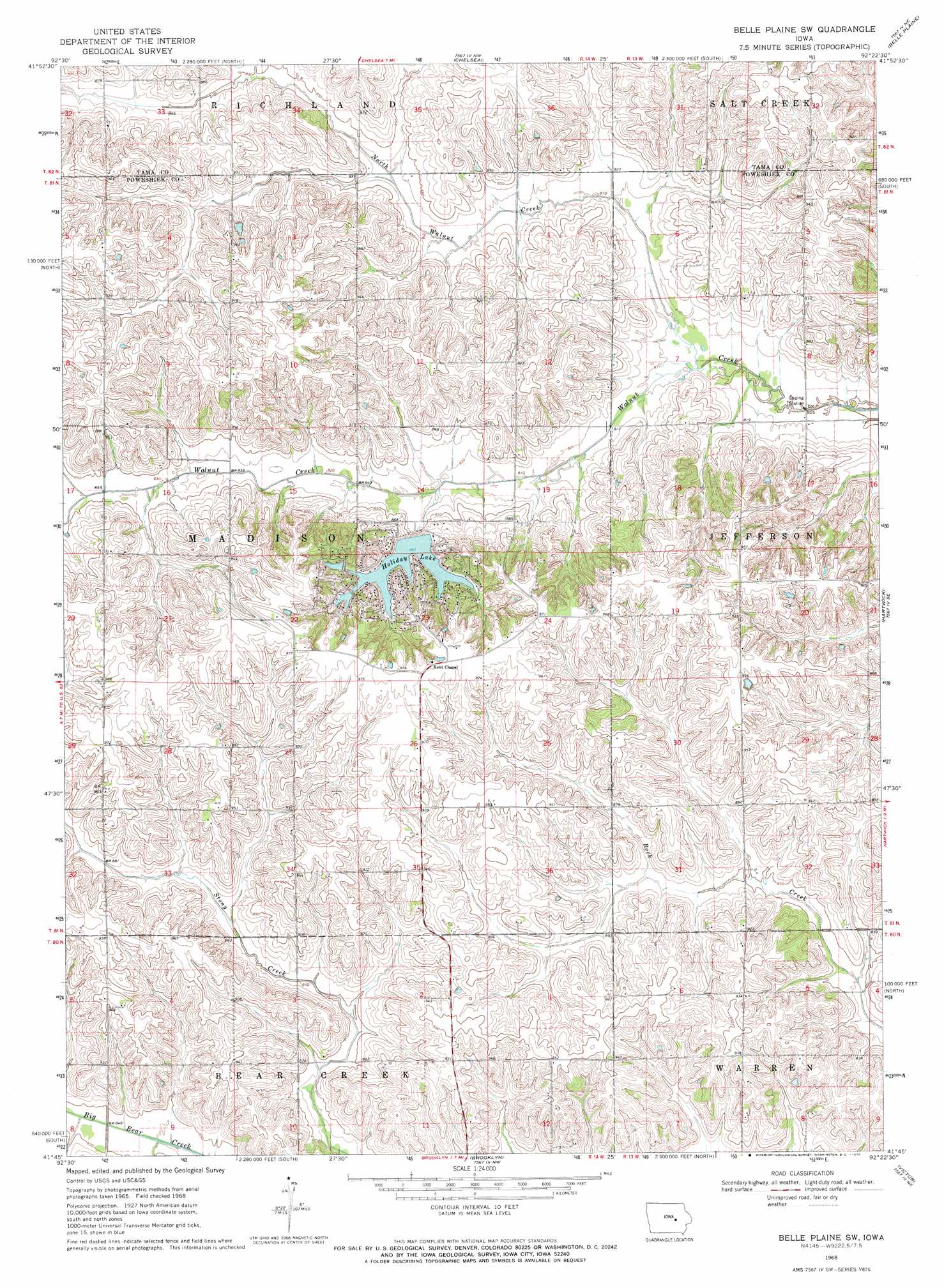
USGS Topo Quad 41092g4 - 1:24,000 scale
| Topo Map Name: | Belle Plaine Sw |
| USGS Topo Quad ID: | 41092g4 |
| Print Size: | ca. 21 1/4" wide x 27" high |
| Southeast Coordinates: | 41.75° N latitude / 92.375° W longitude |
| Map Center Coordinates: | 41.8125° N latitude / 92.4375° W longitude |
| U.S. State: | IA |
| Filename: | o41092g4.jpg |
| Download Map JPG Image: | Belle Plaine Sw topo map 1:24,000 scale |
| Map Type: | Topographic |
| Topo Series: | 7.5´ |
| Map Scale: | 1:24,000 |
| Source of Map Images: | United States Geological Survey (USGS) |
| Alternate Map Versions: |
Belle Plaine SW IA 1968, updated 1970 Download PDF Buy paper map Belle Plaine SW IA 2010 Download PDF Buy paper map Belle Plaine SW IA 2013 Download PDF Buy paper map Belle Plaine SW IA 2015 Download PDF Buy paper map |
1:24,000 Topo Quads surrounding Belle Plaine Sw
Garwin |
Gladbrook Se |
Clutier |
Elberon |
Keystone North |
Montour |
Tama |
Chelsea |
Belle Plaine |
Keystone South |
Grinnell North |
Sheridan |
Belle Plaine Sw |
Hartwick |
Ladora |
Grinnell South |
Malcom |
Brooklyn |
Victor |
Williamsburg Nw |
Searsboro |
Montezuma |
Barnes City |
Deep River |
Millersburg |
> Back to 41092e1 at 1:100,000 scale
> Back to 41092a1 at 1:250,000 scale
> Back to U.S. Topo Maps home
Belle Plaine Sw topo map: Gazetteer
Belle Plaine Sw: Dams
Holiday Lake Dam elevation 272m 892′Belle Plaine Sw: Lakes
Holiday Lake elevation 263m 862′Belle Plaine Sw: Streams
North Walnut Creek elevation 244m 800′Belle Plaine Sw digital topo map on disk
Buy this Belle Plaine Sw topo map showing relief, roads, GPS coordinates and other geographical features, as a high-resolution digital map file on DVD: