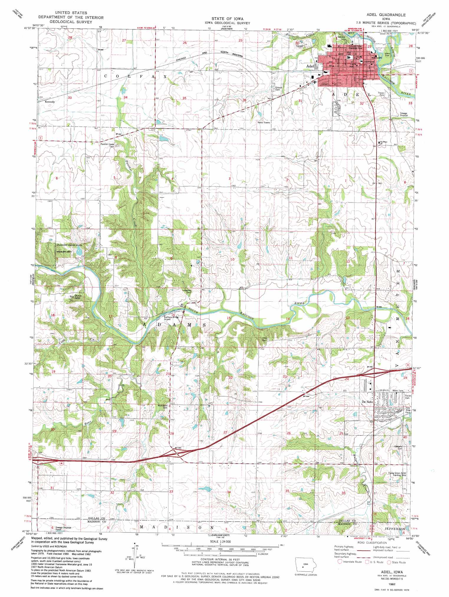
Adel Topo Map Iowa
To zoom in, hover over the map of Adel
USGS Topo Quad 41094e1 - 1:24,000 scale
| Topo Map Name: | Adel |
| USGS Topo Quad ID: | 41094e1 |
| Print Size: | ca. 21 1/4" wide x 27" high |
| Southeast Coordinates: | 41.5° N latitude / 94° W longitude |
| Map Center Coordinates: | 41.5625° N latitude / 94.0625° W longitude |
| U.S. State: | IA |
| Filename: | o41094e1.jpg |
| Download Map JPG Image: | Adel topo map 1:24,000 scale |
| Map Type: | Topographic |
| Topo Series: | 7.5´ |
| Map Scale: | 1:24,000 |
| Source of Map Images: | United States Geological Survey (USGS) |
| Alternate Map Versions: |
Adel IA 1982, updated 1983 Download PDF Buy paper map Adel IA 2010 Download PDF Buy paper map Adel IA 2013 Download PDF Buy paper map Adel IA 2015 Download PDF Buy paper map |
1:24,000 Topo Quads surrounding Adel
Yale |
Dawson |
Perry |
Woodward |
Granger |
Panora |
Adel Nw |
Panther |
Dallas Center |
Grimes |
Stuart North |
Redfield |
Adel |
Waukee |
Commerce |
Stuart South |
Earlham West |
Earlham East |
Saint Charles Nw |
Cumming |
Arbor Hill |
Pitzer |
Winterset |
Patterson |
Saint Charles |
> Back to 41094e1 at 1:100,000 scale
> Back to 41094a1 at 1:250,000 scale
> Back to U.S. Topo Maps home
Adel topo map: Gazetteer
Adel: Airports
Flying Green Acres Landing Strip elevation 312m 1023′Adel: Bridges
Adel Bridge elevation 272m 892′Bulger Creek Bridge elevation 268m 879′
Adel: Crossings
Interchange 104 elevation 310m 1017′Interchange 106 elevation 325m 1066′
Interchange 110 elevation 298m 977′
Adel: Parks
Adel Island Park elevation 268m 879′Kinnick-Feller Riverside Park elevation 270m 885′
Pleasant Valley State Wildlife Area elevation 312m 1023′
Adel: Populated Places
Adel elevation 272m 892′De Soto elevation 287m 941′
Garretville elevation 326m 1069′
Kennedy elevation 290m 951′
Quarry elevation 317m 1040′
River Vista Trailer Park elevation 270m 885′
Adel: Post Offices
Adel Post Office elevation 281m 921′Chattanooga Post Office (historical) elevation 325m 1066′
De Soto Post Office elevation 287m 941′
Kennedy Post Office (historical) elevation 290m 951′
Adel: Streams
Bear Creek elevation 268m 879′Coal Creek elevation 270m 885′
Mill Slough elevation 265m 869′
Panther Creek elevation 268m 879′
Adel digital topo map on disk
Buy this Adel topo map showing relief, roads, GPS coordinates and other geographical features, as a high-resolution digital map file on DVD: