Woodward Topo Map Iowa
To zoom in, hover over the map of Woodward
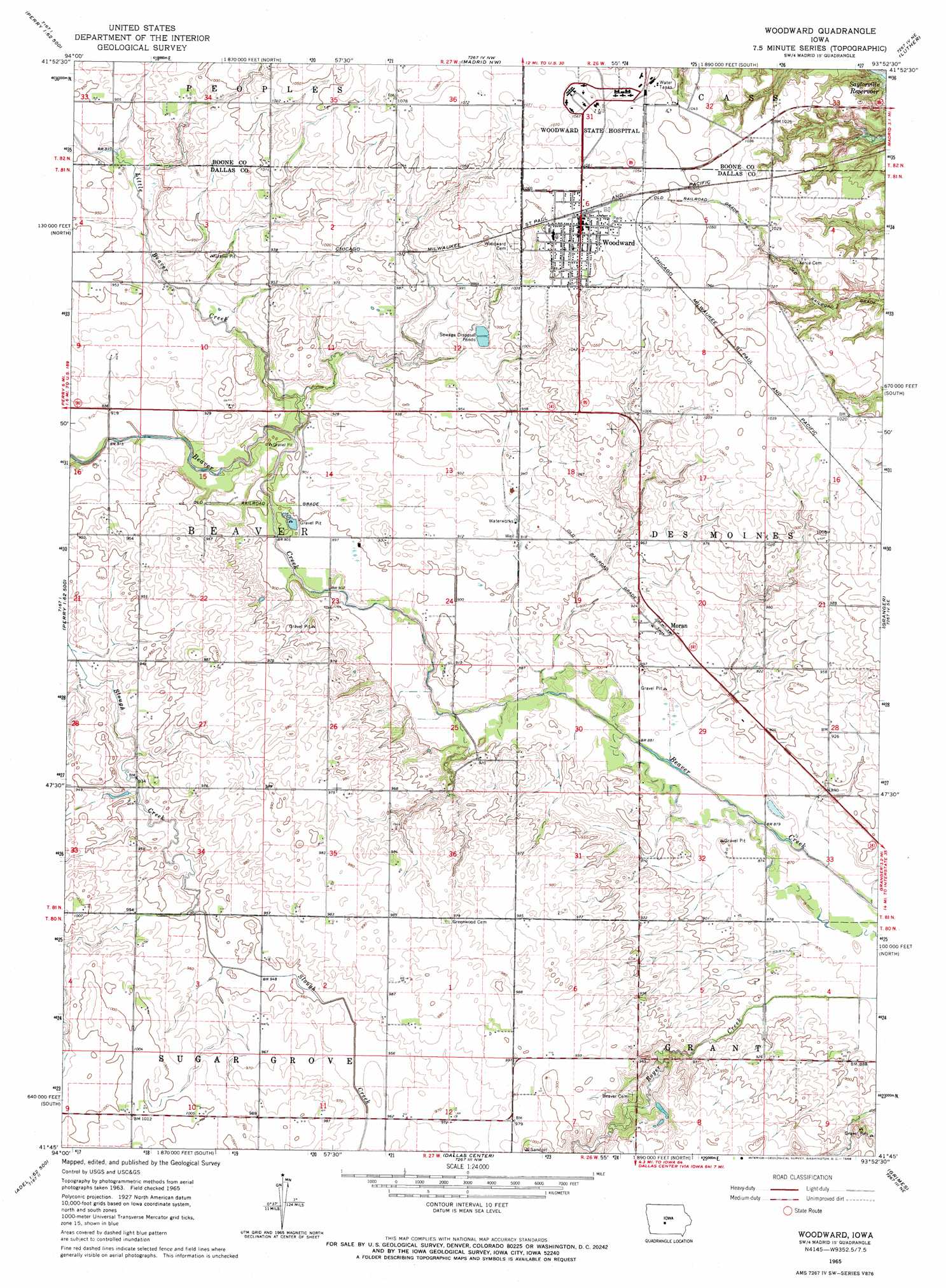
USGS Topo Quad 41093g8 - 1:24,000 scale
| Topo Map Name: | Woodward |
| USGS Topo Quad ID: | 41093g8 |
| Print Size: | ca. 21 1/4" wide x 27" high |
| Southeast Coordinates: | 41.75° N latitude / 93.875° W longitude |
| Map Center Coordinates: | 41.8125° N latitude / 93.9375° W longitude |
| U.S. State: | IA |
| Filename: | o41093g8.jpg |
| Download Map JPG Image: | Woodward topo map 1:24,000 scale |
| Map Type: | Topographic |
| Topo Series: | 7.5´ |
| Map Scale: | 1:24,000 |
| Source of Map Images: | United States Geological Survey (USGS) |
| Alternate Map Versions: |
Woodward IA 1965, updated 1966 Download PDF Buy paper map Woodward IA 2010 Download PDF Buy paper map Woodward IA 2013 Download PDF Buy paper map Woodward IA 2015 Download PDF Buy paper map |
1:24,000 Topo Quads surrounding Woodward
Grand Junction |
Ogden |
Boone West |
Boone East |
Ames West |
Rippey |
Berkley |
Madrid Nw |
Luther |
Slater |
Dawson |
Perry |
Woodward |
Granger |
Polk City |
Adel Nw |
Panther |
Dallas Center |
Grimes |
Des Moines Nw |
Redfield |
Adel |
Waukee |
Commerce |
Des Moines Sw |
> Back to 41093e1 at 1:100,000 scale
> Back to 41092a1 at 1:250,000 scale
> Back to U.S. Topo Maps home
Woodward topo map: Gazetteer
Woodward: Airports
Woodward State Hospital Heliport elevation 323m 1059′Woodward: Populated Places
Moran elevation 285m 935′Woodward elevation 326m 1069′
Xenia elevation 313m 1026′
Woodward: Post Offices
Moran Post Office (historical) elevation 285m 935′Woodward Post Office elevation 314m 1030′
Woodward: Streams
Little Beaver Creek elevation 271m 889′Woodward digital topo map on disk
Buy this Woodward topo map showing relief, roads, GPS coordinates and other geographical features, as a high-resolution digital map file on DVD: