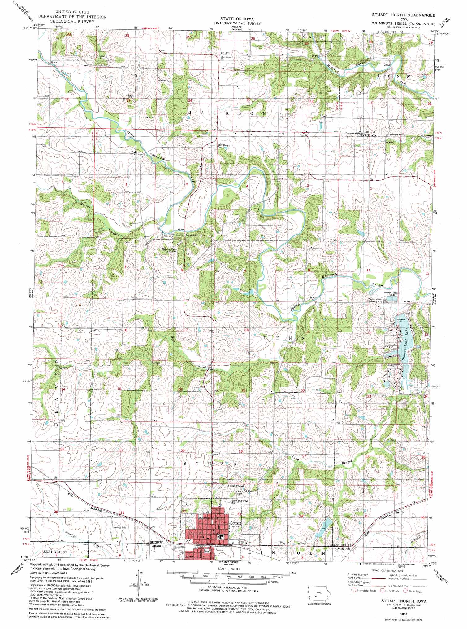
Stuart North Topo Map Iowa
To zoom in, hover over the map of Stuart North
USGS Topo Quad 41094e3 - 1:24,000 scale
| Topo Map Name: | Stuart North |
| USGS Topo Quad ID: | 41094e3 |
| Print Size: | ca. 21 1/4" wide x 27" high |
| Southeast Coordinates: | 41.5° N latitude / 94.25° W longitude |
| Map Center Coordinates: | 41.5625° N latitude / 94.3125° W longitude |
| U.S. State: | IA |
| Filename: | o41094e3.jpg |
| Download Map JPG Image: | Stuart North topo map 1:24,000 scale |
| Map Type: | Topographic |
| Topo Series: | 7.5´ |
| Map Scale: | 1:24,000 |
| Source of Map Images: | United States Geological Survey (USGS) |
| Alternate Map Versions: |
Stuart North IA 1982, updated 1983 Download PDF Buy paper map Stuart North IA 2010 Download PDF Buy paper map Stuart North IA 2013 Download PDF Buy paper map Stuart North IA 2015 Download PDF Buy paper map |
1:24,000 Topo Quads surrounding Stuart North
Bayard |
Bagley |
Yale |
Dawson |
Perry |
Guthrie Center West |
Guthrie Center East |
Panora |
Adel Nw |
Panther |
Casey |
Menlo |
Stuart North |
Redfield |
Adel |
Canby |
Rosserdale |
Stuart South |
Earlham West |
Earlham East |
Fontanelle |
Greenfield |
Arbor Hill |
Pitzer |
Winterset |
> Back to 41094e1 at 1:100,000 scale
> Back to 41094a1 at 1:250,000 scale
> Back to U.S. Topo Maps home
Stuart North topo map: Gazetteer
Stuart North: Airports
Diamondhead Landing Strip elevation 292m 958′Stuart North: Dams
Diamondhead Lake Dam elevation 296m 971′Stuart North: Parks
Lawbaugh City Park elevation 369m 1210′Nations Bridge County Park elevation 302m 990′
Stuart North: Populated Places
Dale elevation 306m 1003′Morrisburgh (historical) elevation 352m 1154′
Stuart elevation 368m 1207′
Stuart North: Post Offices
Dale Post Office (historical) elevation 306m 1003′Stuart Post Office elevation 367m 1204′
West Milton Post Office (historical) elevation 302m 990′
Stuart North: Reservoirs
Diamondhead Lake elevation 296m 971′Stuart North: Streams
Beaver Creek elevation 299m 980′Deer Creek elevation 290m 951′
Long Branch elevation 287m 941′
Stuart North digital topo map on disk
Buy this Stuart North topo map showing relief, roads, GPS coordinates and other geographical features, as a high-resolution digital map file on DVD: