Clarkson Topo Map Nebraska
To zoom in, hover over the map of Clarkson
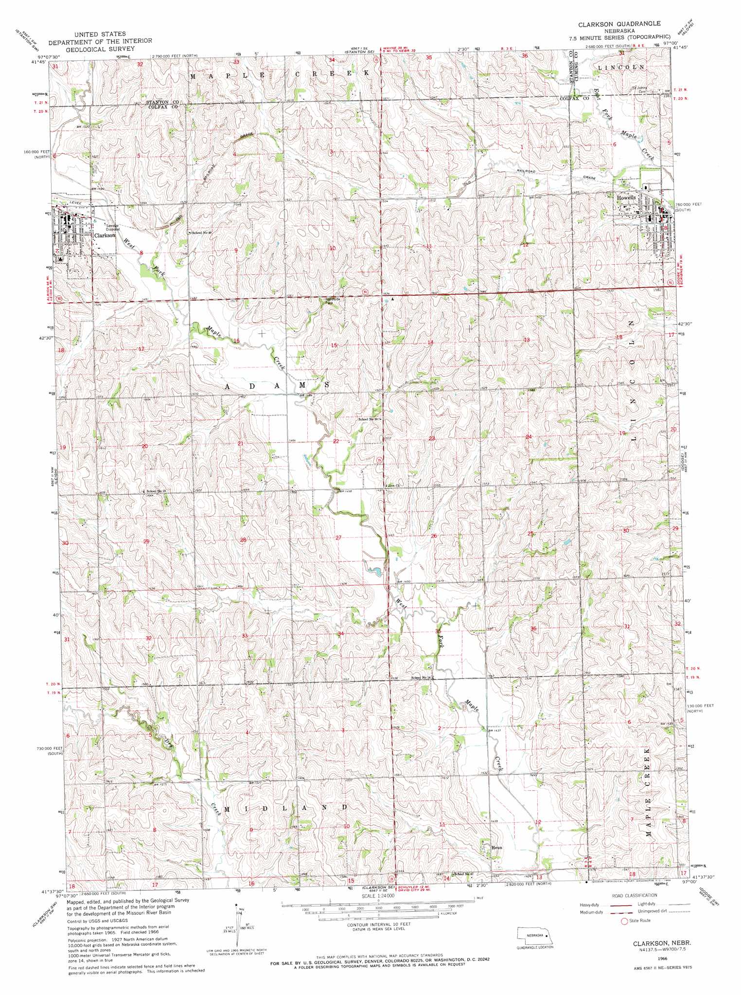
USGS Topo Quad 41097f1 - 1:24,000 scale
| Topo Map Name: | Clarkson |
| USGS Topo Quad ID: | 41097f1 |
| Print Size: | ca. 21 1/4" wide x 27" high |
| Southeast Coordinates: | 41.625° N latitude / 97° W longitude |
| Map Center Coordinates: | 41.6875° N latitude / 97.0625° W longitude |
| U.S. State: | NE |
| Filename: | O41097F1.jpg |
| Download Map JPG Image: | Clarkson topo map 1:24,000 scale |
| Map Type: | Topographic |
| Topo Series: | 7.5´ |
| Map Scale: | 1:24,000 |
| Source of Map Images: | United States Geological Survey (USGS) |
| Alternate Map Versions: |
Clarkson NE 1966, updated 1968 Download PDF Buy paper map Clarkson NE 2011 Download PDF Buy paper map Clarkson NE 2014 Download PDF Buy paper map |
1:24,000 Topo Quads surrounding Clarkson
Madison Ne |
Stanton |
Stanton Ne |
Wisner |
Beemer |
Madison Se |
Stanton Sw |
Stanton Se |
Aloys |
Monterey |
Creston |
Leigh |
Clarkson |
Dodge |
Snyder |
Humphrey Se |
Clarkson Sw |
Clarkson Se |
Dodge Sw |
Webster |
Columbus |
Richland |
Schuyler |
Rogers |
North Bend |
> Back to 41097e1 at 1:100,000 scale
> Back to 41096a1 at 1:250,000 scale
> Back to U.S. Topo Maps home
Clarkson topo map: Gazetteer
Clarkson: Parks
Clarkson City Park elevation 454m 1489′Howells Public Park elevation 445m 1459′
Memorial Park elevation 459m 1505′
Clarkson: Populated Places
Clarkson elevation 456m 1496′Heun elevation 451m 1479′
Howells elevation 445m 1459′
Clarkson: Post Offices
Clarkson Post Office elevation 458m 1502′Heun Post Office (historical) elevation 451m 1479′
Howells Post Office elevation 445m 1459′
Clarkson digital topo map on disk
Buy this Clarkson topo map showing relief, roads, GPS coordinates and other geographical features, as a high-resolution digital map file on DVD: