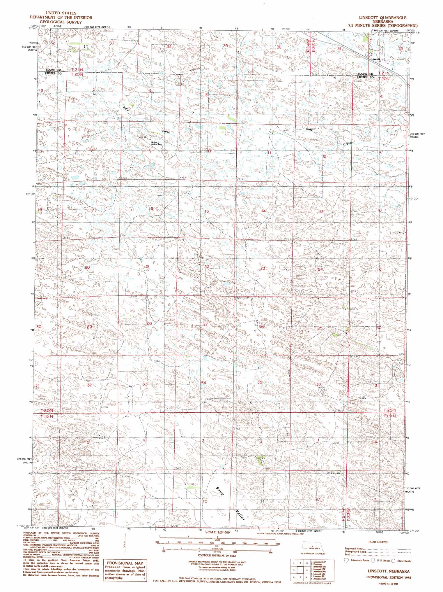
Linscott Topo Map Nebraska
To zoom in, hover over the map of Linscott
USGS Topo Quad 41100f1 - 1:24,000 scale
| Topo Map Name: | Linscott |
| USGS Topo Quad ID: | 41100f1 |
| Print Size: | ca. 21 1/4" wide x 27" high |
| Southeast Coordinates: | 41.625° N latitude / 100° W longitude |
| Map Center Coordinates: | 41.6875° N latitude / 100.0625° W longitude |
| U.S. State: | NE |
| Filename: | O41100f1.jpg |
| Download Map JPG Image: | Linscott topo map 1:24,000 scale |
| Map Type: | Topographic |
| Topo Series: | 7.5´ |
| Map Scale: | 1:24,000 |
| Source of Map Images: | United States Geological Survey (USGS) |
| Alternate Map Versions: |
Linscott NE 1986, updated 1987 Download PDF Buy paper map Linscott NE 2011 Download PDF Buy paper map Linscott NE 2014 Download PDF Buy paper map |
1:24,000 Topo Quads surrounding Linscott
Halsey |
Dunning Nw |
Dunning Ne |
Brewster Nw |
Brewster |
Halsey Se |
Dunning Sw |
Dunning |
Brewster Sw |
Brewster Se |
Hoagland Ne |
Linscott Nw |
Linscott |
Anselmo Nw |
Anselmo Ne |
Hoagland |
Linscott Sw |
Linscott Se |
Anselmo Sw |
Anselmo |
Logan |
Arnold |
Davenport Table |
Callaway Nw |
Merna |
> Back to 41100e1 at 1:100,000 scale
> Back to 41100a1 at 1:250,000 scale
> Back to U.S. Topo Maps home
Linscott topo map: Gazetteer
Linscott: Airports
McGinn Landing Strip elevation 842m 2762′Linscott: Populated Places
Linscott elevation 825m 2706′Linscott: Post Offices
Linscott Post Office (historical) elevation 825m 2706′Linscott digital topo map on disk
Buy this Linscott topo map showing relief, roads, GPS coordinates and other geographical features, as a high-resolution digital map file on DVD: