Anselmo Topo Map Nebraska
To zoom in, hover over the map of Anselmo
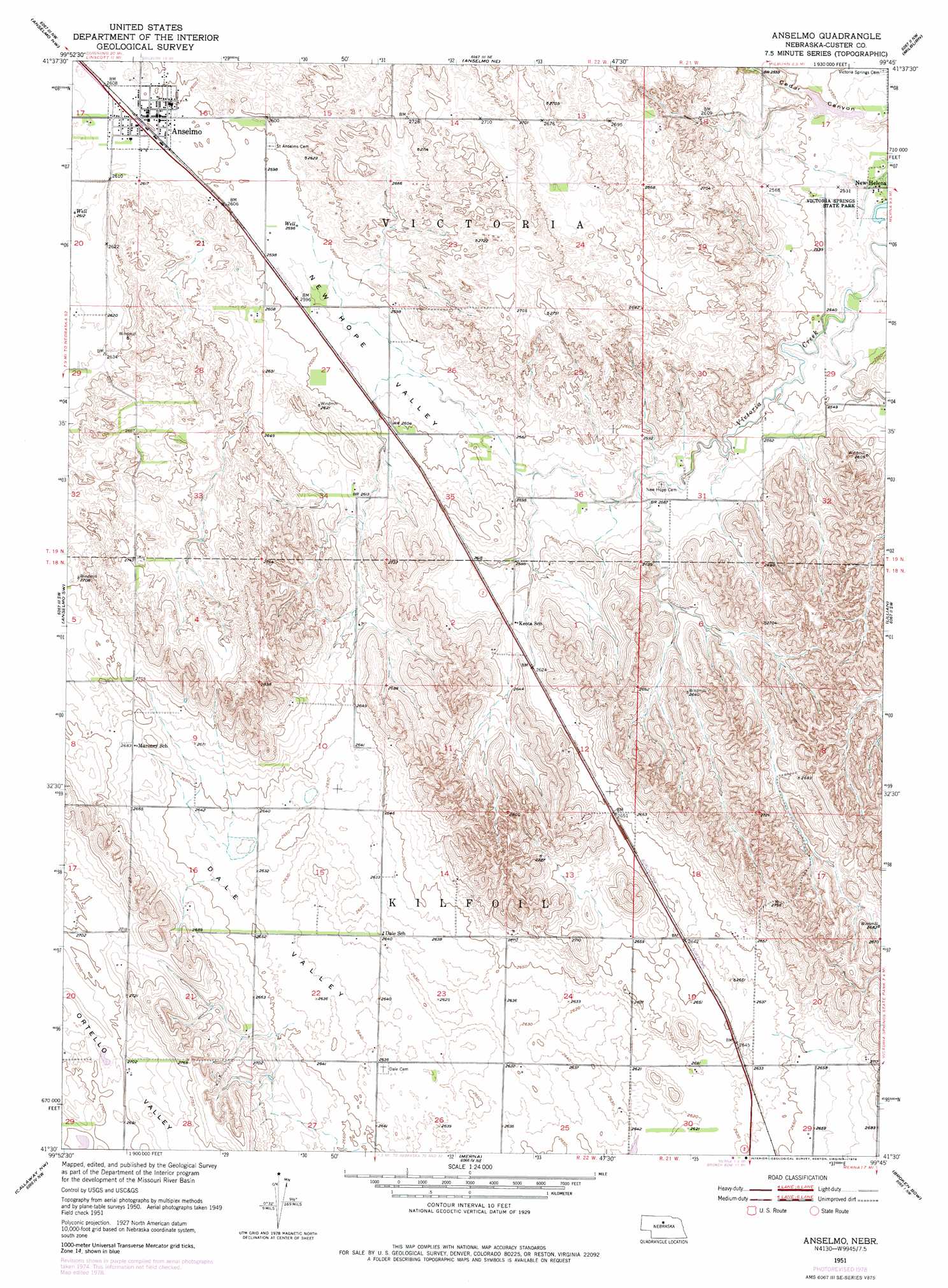
USGS Topo Quad 41099e7 - 1:24,000 scale
| Topo Map Name: | Anselmo |
| USGS Topo Quad ID: | 41099e7 |
| Print Size: | ca. 21 1/4" wide x 27" high |
| Southeast Coordinates: | 41.5° N latitude / 99.75° W longitude |
| Map Center Coordinates: | 41.5625° N latitude / 99.8125° W longitude |
| U.S. State: | NE |
| Filename: | O41099E7.jpg |
| Download Map JPG Image: | Anselmo topo map 1:24,000 scale |
| Map Type: | Topographic |
| Topo Series: | 7.5´ |
| Map Scale: | 1:24,000 |
| Source of Map Images: | United States Geological Survey (USGS) |
| Alternate Map Versions: |
Anselmo NE 1951, updated 1952 Download PDF Buy paper map Anselmo NE 1951, updated 1978 Download PDF Buy paper map Anselmo NE 2011 Download PDF Buy paper map Anselmo NE 2014 Download PDF Buy paper map |
1:24,000 Topo Quads surrounding Anselmo
Dunning |
Brewster Sw |
Brewster Se |
Almeria Sw |
Almeria |
Linscott |
Anselmo Nw |
Anselmo Ne |
Milburn |
Walworth |
Linscott Se |
Anselmo Sw |
Anselmo |
Lillian |
Round Valley |
Davenport Table |
Callaway Nw |
Merna |
Broken Bow |
Broken Bow Ne |
Murphy Table |
Callaway |
Callaway Se |
Broken Bow Sw |
Broken Bow Se |
> Back to 41099e1 at 1:100,000 scale
> Back to 41098a1 at 1:250,000 scale
> Back to U.S. Topo Maps home
Anselmo topo map: Gazetteer
Anselmo: Dams
Sargent Dam elevation 771m 2529′Anselmo: Parks
Victora Springs State Park elevation 769m 2522′Anselmo: Populated Places
Anselmo elevation 794m 2604′Dale (historical) elevation 805m 2641′
New Helena elevation 768m 2519′
Anselmo: Post Offices
Anselmo Post Office elevation 794m 2604′Dale Post Office (historical) elevation 805m 2641′
Keota Post Office (historical) elevation 796m 2611′
New Helena Post Office (historical) elevation 768m 2519′
Anselmo: Reservoirs
Sargent Reservoir elevation 771m 2529′Anselmo: Valleys
New Hope Valley elevation 780m 2559′Anselmo digital topo map on disk
Buy this Anselmo topo map showing relief, roads, GPS coordinates and other geographical features, as a high-resolution digital map file on DVD: