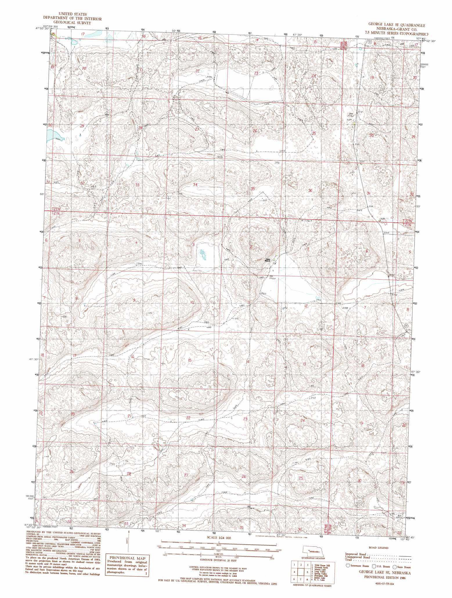
George Lake Se Topo Map Nebraska
To zoom in, hover over the map of George Lake Se
USGS Topo Quad 41101g7 - 1:24,000 scale
| Topo Map Name: | George Lake Se |
| USGS Topo Quad ID: | 41101g7 |
| Print Size: | ca. 21 1/4" wide x 27" high |
| Southeast Coordinates: | 41.75° N latitude / 101.75° W longitude |
| Map Center Coordinates: | 41.8125° N latitude / 101.8125° W longitude |
| U.S. State: | NE |
| Filename: | O41101g7.jpg |
| Download Map JPG Image: | George Lake Se topo map 1:24,000 scale |
| Map Type: | Topographic |
| Topo Series: | 7.5´ |
| Map Scale: | 1:24,000 |
| Source of Map Images: | United States Geological Survey (USGS) |
| Alternate Map Versions: |
George Lake SE NE 1986, updated 1986 Download PDF Buy paper map George Lake SE NE 2011 Download PDF Buy paper map George Lake SE NE 2014 Download PDF Buy paper map |
1:24,000 Topo Quads surrounding George Lake Se
Bangham |
Ashby |
Hyannis North |
Frye Lake |
Whitman |
Alkali Lake |
Wild Horse Hill |
Hyannis South |
Moran Lake |
Bunner Lake |
Curry Lake |
Long Valley |
George Lake Se |
Spring Valley |
Rothwell Lake |
Well Valley |
Bourquim Hill |
Jensen Lake |
K C Lake |
Cheyenne Lake |
Rackett Se |
Velma Sw |
Hulbert Lake |
Arthur |
Lightning Valley |
> Back to 41101e1 at 1:100,000 scale
> Back to 41100a1 at 1:250,000 scale
> Back to U.S. Topo Maps home
No gazetteer data is available for the George Lake Se topo map sheet.
George Lake Se digital topo map on disk
Buy this George Lake Se topo map showing relief, roads, GPS coordinates and other geographical features, as a high-resolution digital map file on DVD: