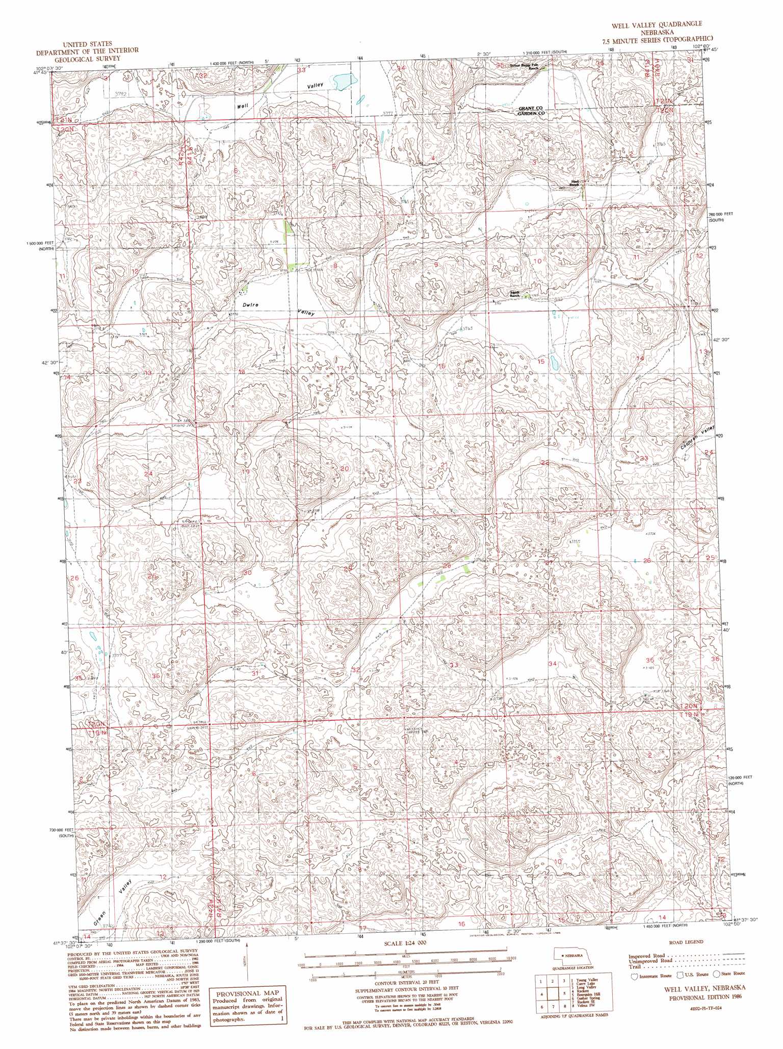
Well Valley Topo Map Nebraska
To zoom in, hover over the map of Well Valley
USGS Topo Quad 41102f1 - 1:24,000 scale
| Topo Map Name: | Well Valley |
| USGS Topo Quad ID: | 41102f1 |
| Print Size: | ca. 21 1/4" wide x 27" high |
| Southeast Coordinates: | 41.625° N latitude / 102° W longitude |
| Map Center Coordinates: | 41.6875° N latitude / 102.0625° W longitude |
| U.S. State: | NE |
| Filename: | O41102F1.jpg |
| Download Map JPG Image: | Well Valley topo map 1:24,000 scale |
| Map Type: | Topographic |
| Topo Series: | 7.5´ |
| Map Scale: | 1:24,000 |
| Source of Map Images: | United States Geological Survey (USGS) |
| Alternate Map Versions: |
Well Valley NE 1986, updated 1986 Download PDF Buy paper map Well Valley NE 2011 Download PDF Buy paper map Well Valley NE 2014 Download PDF Buy paper map |
1:24,000 Topo Quads surrounding Well Valley
Black Lake |
Mccarty Lake |
Alkali Lake |
Wild Horse Hill |
Hyannis South |
Hessey Lake |
Young Valley |
Curry Lake |
Long Valley |
George Lake Se |
Deer Lake |
Rackett |
Well Valley |
Bourquim Hill |
Jensen Lake |
Crescent Lake Se |
Gusher Spring |
Rackett Se |
Velma Sw |
Hulbert Lake |
Oshkosh |
Twin Buttes |
Old Baldy |
Williams Ranch |
Bear Hill |
> Back to 41102e1 at 1:100,000 scale
> Back to 41102a1 at 1:250,000 scale
> Back to U.S. Topo Maps home
Well Valley topo map: Gazetteer
Well Valley: Basins
Dwire Valley elevation 1148m 3766′Green Valley elevation 1142m 3746′
Well Valley elevation 1154m 3786′
Well Valley digital topo map on disk
Buy this Well Valley topo map showing relief, roads, GPS coordinates and other geographical features, as a high-resolution digital map file on DVD:
Eastern Wyoming & Western South Dakota
Buy digital topo maps: Eastern Wyoming & Western South Dakota