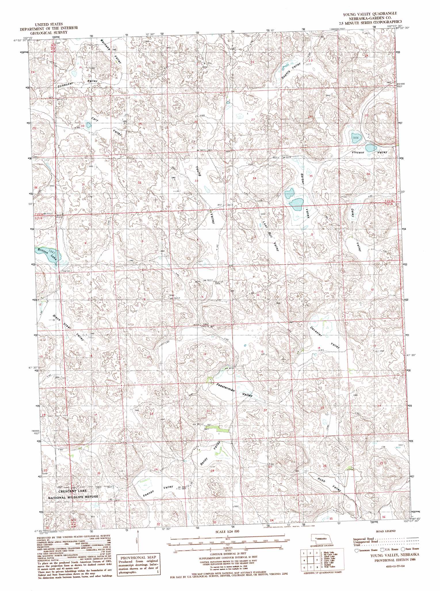
Young Valley Topo Map Nebraska
To zoom in, hover over the map of Young Valley
USGS Topo Quad 41102g2 - 1:24,000 scale
| Topo Map Name: | Young Valley |
| USGS Topo Quad ID: | 41102g2 |
| Print Size: | ca. 21 1/4" wide x 27" high |
| Southeast Coordinates: | 41.75° N latitude / 102.125° W longitude |
| Map Center Coordinates: | 41.8125° N latitude / 102.1875° W longitude |
| U.S. State: | NE |
| Filename: | O41102G2.jpg |
| Download Map JPG Image: | Young Valley topo map 1:24,000 scale |
| Map Type: | Topographic |
| Topo Series: | 7.5´ |
| Map Scale: | 1:24,000 |
| Source of Map Images: | United States Geological Survey (USGS) |
| Alternate Map Versions: |
Young Valley NE 1986, updated 1986 Download PDF Buy paper map Young Valley NE 2011 Download PDF Buy paper map Young Valley NE 2014 Download PDF Buy paper map |
1:24,000 Topo Quads surrounding Young Valley
Lakeside |
Ellsworth |
Gaunt Lake |
Bangham |
Ashby |
Schoonover Lake |
Black Lake |
Mccarty Lake |
Alkali Lake |
Wild Horse Hill |
Mumper |
Hessey Lake |
Young Valley |
Curry Lake |
Long Valley |
Crescent Lake |
Deer Lake |
Rackett |
Well Valley |
Bourquim Hill |
Sugar Loaf Hill |
Crescent Lake Se |
Gusher Spring |
Rackett Se |
Velma Sw |
> Back to 41102e1 at 1:100,000 scale
> Back to 41102a1 at 1:250,000 scale
> Back to U.S. Topo Maps home
Young Valley topo map: Gazetteer
Young Valley: Basins
Bandy Valley elevation 1163m 3815′Barber Valley elevation 1169m 3835′
Black Steer Valley elevation 1169m 3835′
Cary Valley elevation 1182m 3877′
Daley Valley elevation 1171m 3841′
Devasier Valley elevation 1163m 3815′
Feesterman Valley elevation 1163m 3815′
Keenan Valley elevation 1164m 3818′
Lost Bull Valley elevation 1170m 3838′
Robb Valley elevation 1158m 3799′
Schmoker Valley elevation 1187m 3894′
Sophia Valley elevation 1175m 3854′
Vincent Valley elevation 1169m 3835′
Warneke Valley elevation 1183m 3881′
Young Valley elevation 1176m 3858′
Young Valley: Lakes
Britton Lake elevation 1172m 3845′Young Valley digital topo map on disk
Buy this Young Valley topo map showing relief, roads, GPS coordinates and other geographical features, as a high-resolution digital map file on DVD:
Eastern Wyoming & Western South Dakota
Buy digital topo maps: Eastern Wyoming & Western South Dakota