Chicken Creek Sw Topo Map Wyoming
To zoom in, hover over the map of Chicken Creek Sw
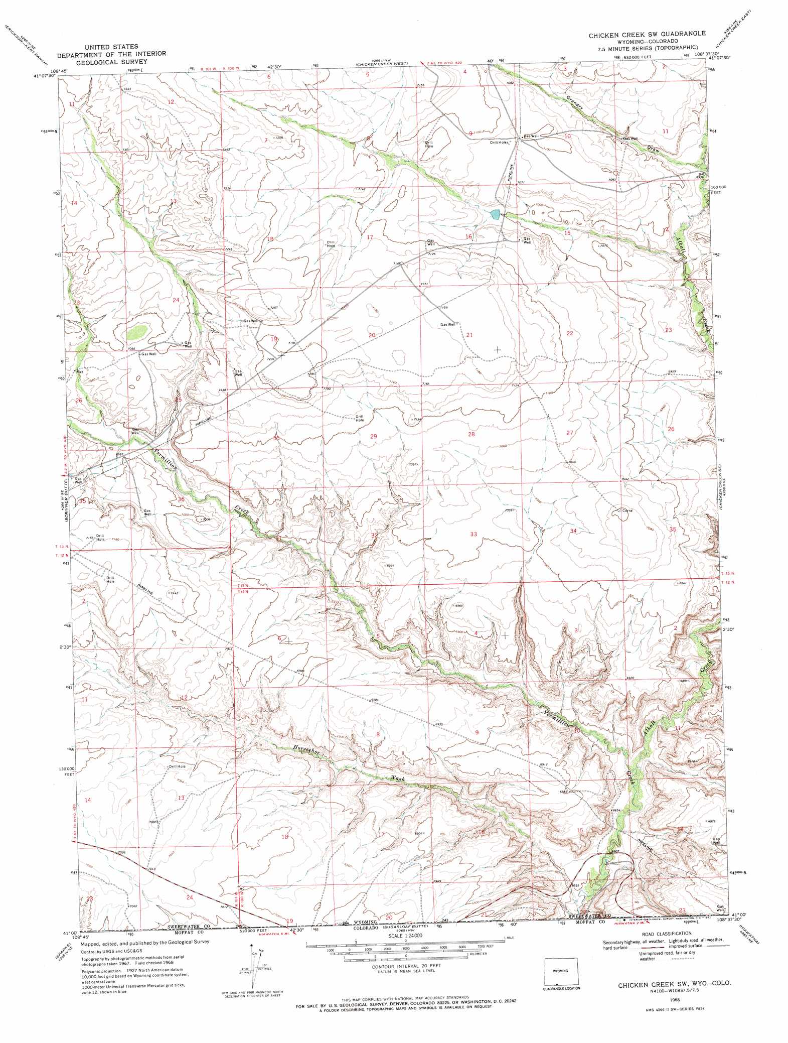
USGS Topo Quad 41108a6 - 1:24,000 scale
| Topo Map Name: | Chicken Creek Sw |
| USGS Topo Quad ID: | 41108a6 |
| Print Size: | ca. 21 1/4" wide x 27" high |
| Southeast Coordinates: | 41° N latitude / 108.625° W longitude |
| Map Center Coordinates: | 41.0625° N latitude / 108.6875° W longitude |
| U.S. States: | WY, CO |
| Filename: | o41108a6.jpg |
| Download Map JPG Image: | Chicken Creek Sw topo map 1:24,000 scale |
| Map Type: | Topographic |
| Topo Series: | 7.5´ |
| Map Scale: | 1:24,000 |
| Source of Map Images: | United States Geological Survey (USGS) |
| Alternate Map Versions: |
Chicken Creek SW WY 1968, updated 1972 Download PDF Buy paper map Chicken Creek SW WY 2010 Download PDF Buy paper map Chicken Creek SW WY 2012 Download PDF Buy paper map Chicken Creek SW WY 2015 Download PDF Buy paper map |
1:24,000 Topo Quads surrounding Chicken Creek Sw
Mud Springs Ranch |
Burley Draw |
Pine Butte |
Sand Butte Rim Se |
Kinney Spring |
Potter Mountain |
Erickson-Kent Ranch |
Chicken Creek West |
Chicken Creek East |
Cow Creek Reservoir |
Four J Rim |
Scrivner Butte |
Chicken Creek Sw |
Chicken Creek Se |
Cow Creek Reservoir Sw |
Beaver Basin |
Sparks |
Sugarloaf Butte |
Hiawatha |
Coffee Pot Spring |
Lodore School |
Big Joe Basin |
Irish Canyon |
G Spring |
Sheepherder Springs |
> Back to 41108a1 at 1:100,000 scale
> Back to 41108a1 at 1:250,000 scale
> Back to U.S. Topo Maps home
Chicken Creek Sw topo map: Gazetteer
Chicken Creek Sw: Mines
Myers Mine elevation 2000m 6561′Chicken Creek Sw: Streams
Alkali Creek elevation 2023m 6637′Chicken Creek Sw: Valleys
Granary Draw elevation 2119m 6952′Horseshoe Wash elevation 2010m 6594′
Chicken Creek Sw digital topo map on disk
Buy this Chicken Creek Sw topo map showing relief, roads, GPS coordinates and other geographical features, as a high-resolution digital map file on DVD: