Sand Butte Rim Se Topo Map Wyoming
To zoom in, hover over the map of Sand Butte Rim Se
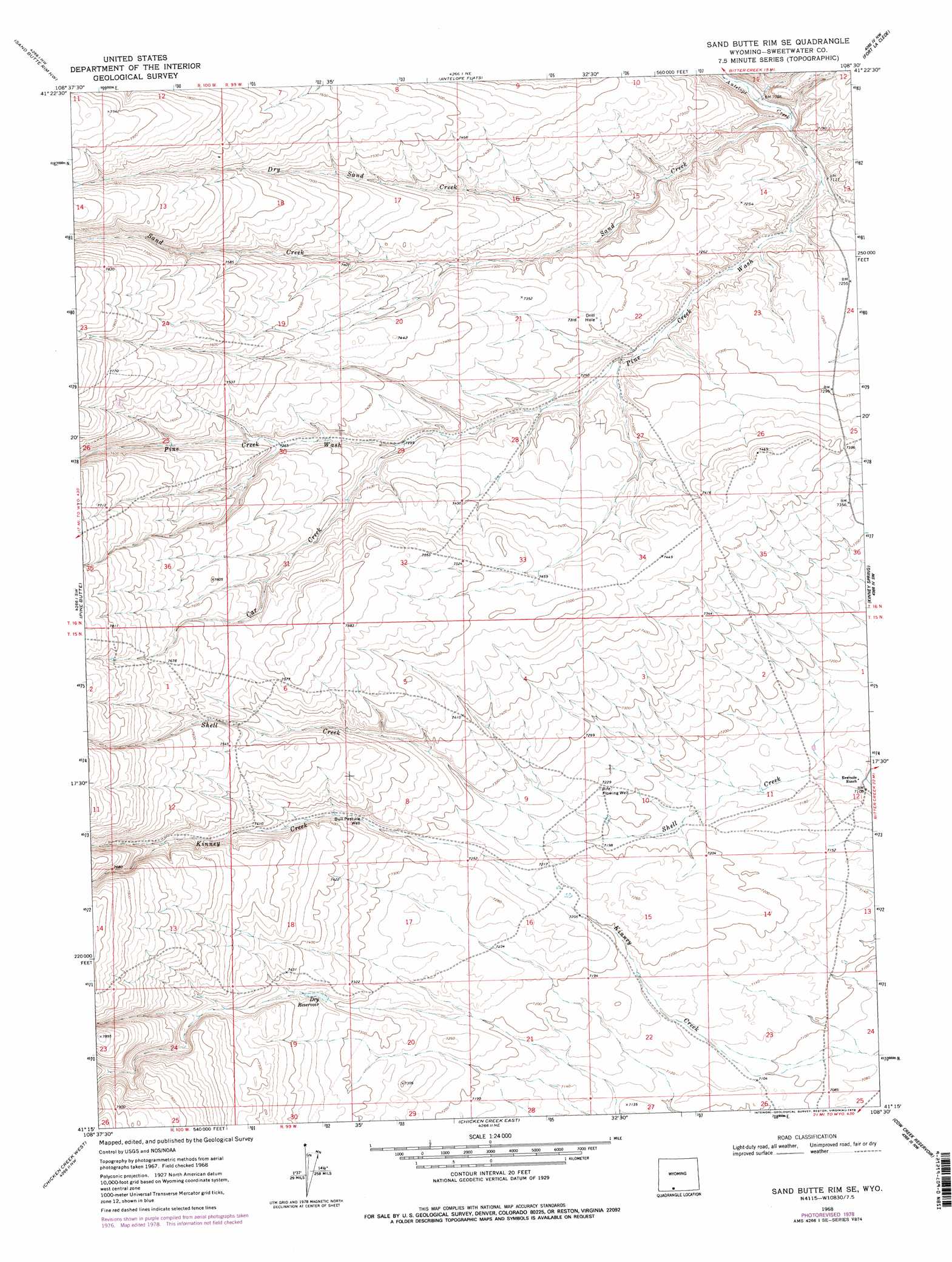
USGS Topo Quad 41108c5 - 1:24,000 scale
| Topo Map Name: | Sand Butte Rim Se |
| USGS Topo Quad ID: | 41108c5 |
| Print Size: | ca. 21 1/4" wide x 27" high |
| Southeast Coordinates: | 41.25° N latitude / 108.5° W longitude |
| Map Center Coordinates: | 41.3125° N latitude / 108.5625° W longitude |
| U.S. State: | WY |
| Filename: | o41108c5.jpg |
| Download Map JPG Image: | Sand Butte Rim Se topo map 1:24,000 scale |
| Map Type: | Topographic |
| Topo Series: | 7.5´ |
| Map Scale: | 1:24,000 |
| Source of Map Images: | United States Geological Survey (USGS) |
| Alternate Map Versions: |
Sand Butte Rim SE WY 1968, updated 1972 Download PDF Buy paper map Sand Butte Rim SE WY 1968, updated 1978 Download PDF Buy paper map Sand Butte Rim SE WY 2012 Download PDF Buy paper map Sand Butte Rim SE WY 2015 Download PDF Buy paper map |
1:24,000 Topo Quads surrounding Sand Butte Rim Se
Point Of Rocks Se |
Black Buttes |
Bitter Creek |
Table Rock |
J O Dugway |
Cooper Ridge Ne |
Sand Butte Rim Nw |
Antelope Flats |
Fort La Clede |
Fort La Clede Ne |
Burley Draw |
Pine Butte |
Sand Butte Rim Se |
Kinney Spring |
Manuel Gap |
Erickson-Kent Ranch |
Chicken Creek West |
Chicken Creek East |
Cow Creek Reservoir |
Monument Valley |
Scrivner Butte |
Chicken Creek Sw |
Chicken Creek Se |
Cow Creek Reservoir Sw |
Upper Powder Spring |
> Back to 41108a1 at 1:100,000 scale
> Back to 41108a1 at 1:250,000 scale
> Back to U.S. Topo Maps home
Sand Butte Rim Se topo map: Gazetteer
Sand Butte Rim Se: Reservoirs
Dry Reservoir elevation 2228m 7309′Sand Butte Rim Se: Streams
Car Creek elevation 2223m 7293′Dry Sand Creek elevation 2188m 7178′
Sand Creek elevation 2163m 7096′
Sand Butte Rim Se: Valleys
Pine Creek Wash elevation 2168m 7112′Sand Butte Rim Se: Wells
Bull Pasture Well elevation 2231m 7319′Rife Flowing Well elevation 2206m 7237′
Sand Butte Rim Se digital topo map on disk
Buy this Sand Butte Rim Se topo map showing relief, roads, GPS coordinates and other geographical features, as a high-resolution digital map file on DVD: