Earnest Butte Topo Map Wyoming
To zoom in, hover over the map of Earnest Butte
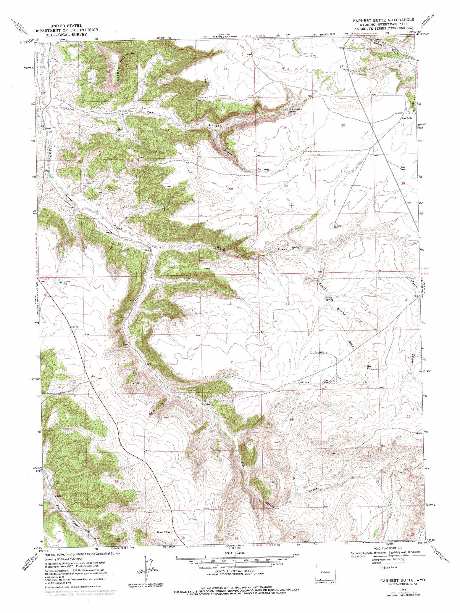
USGS Topo Quad 41109c2 - 1:24,000 scale
| Topo Map Name: | Earnest Butte |
| USGS Topo Quad ID: | 41109c2 |
| Print Size: | ca. 21 1/4" wide x 27" high |
| Southeast Coordinates: | 41.25° N latitude / 109.125° W longitude |
| Map Center Coordinates: | 41.3125° N latitude / 109.1875° W longitude |
| U.S. State: | WY |
| Filename: | o41109c2.jpg |
| Download Map JPG Image: | Earnest Butte topo map 1:24,000 scale |
| Map Type: | Topographic |
| Topo Series: | 7.5´ |
| Map Scale: | 1:24,000 |
| Source of Map Images: | United States Geological Survey (USGS) |
| Alternate Map Versions: |
Earnest Butte WY 1968, updated 1972 Download PDF Buy paper map Earnest Butte WY 1968, updated 1978 Download PDF Buy paper map Earnest Butte WY 2012 Download PDF Buy paper map Earnest Butte WY 2015 Download PDF Buy paper map |
1:24,000 Topo Quads surrounding Earnest Butte
Green River |
Kanda |
Rock Springs |
Baxter |
Point Of Rocks Sw |
Whalen Butte |
Wilkins Peak |
Kappes Canyon |
Lion Bluffs |
Camel Rock |
Sage Creek Basin |
Firehole Basin |
Earnest Butte |
South Baxter |
Mud Springs Ranch |
Sugarloaf Basin |
Big Ridge |
Maxon Ranch |
Titsworth Gap |
Potter Mountain |
Minnies Gap |
Hawks Nest |
Richards Gap |
Red Creek Ranch |
Four J Rim |
> Back to 41109a1 at 1:100,000 scale
> Back to 41108a1 at 1:250,000 scale
> Back to U.S. Topo Maps home
Earnest Butte topo map: Gazetteer
Earnest Butte: Mines
Menkeinney Mine elevation 2249m 7378′Earnest Butte: Springs
Dry Canyon Spring elevation 2247m 7372′South Spring elevation 2269m 7444′
Earnest Butte: Streams
Worm Creek elevation 2070m 6791′Earnest Butte: Summits
Earnest Butte elevation 2240m 7349′Earnest Butte: Valleys
Burnt Canyon elevation 2131m 6991′Dry Canyon elevation 2041m 6696′
Sally Draw elevation 2129m 6984′
South Spring Draw elevation 2242m 7355′
Earnest Butte digital topo map on disk
Buy this Earnest Butte topo map showing relief, roads, GPS coordinates and other geographical features, as a high-resolution digital map file on DVD: