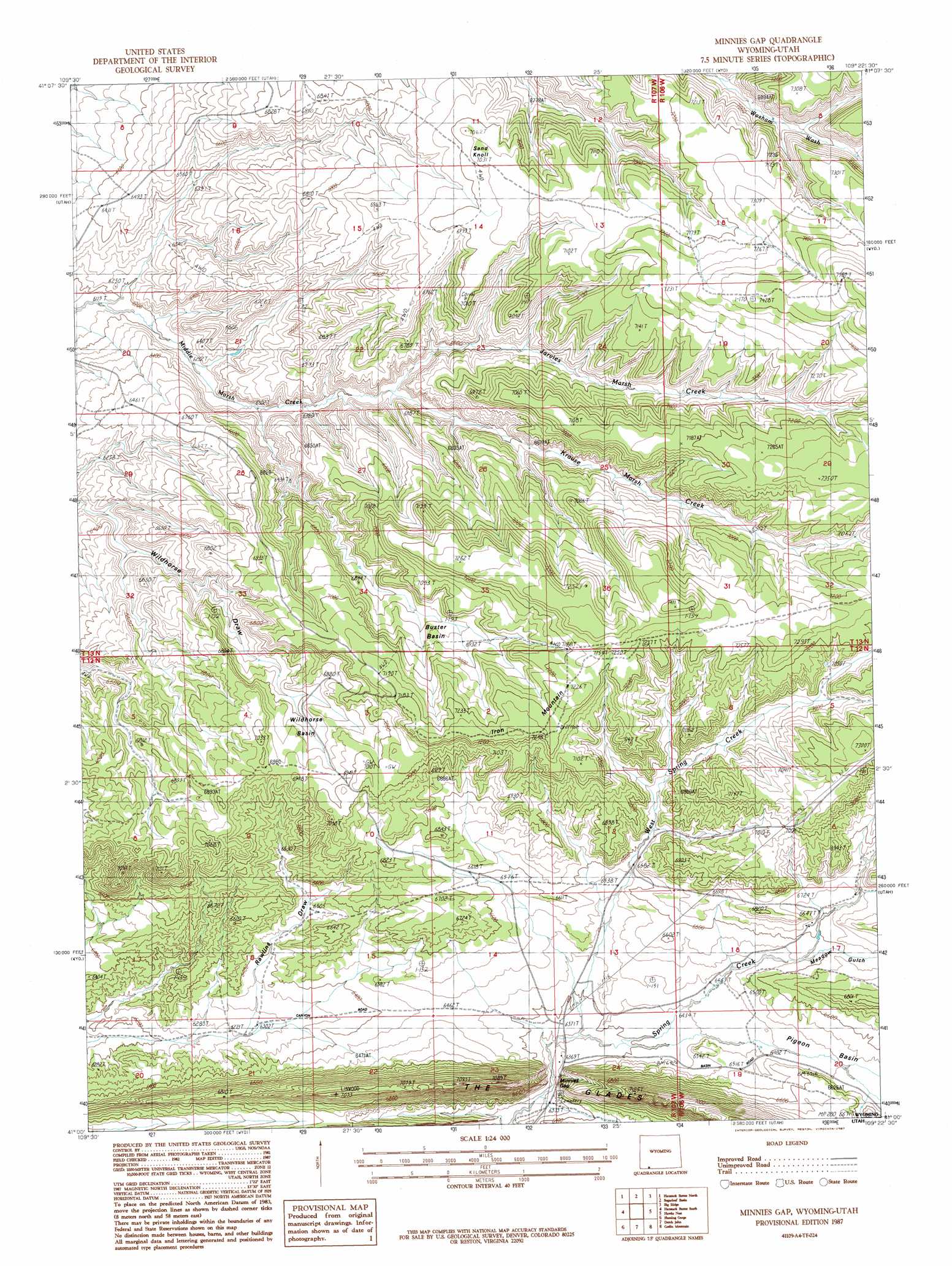
Minnies Gap Topo Map Wyoming
To zoom in, hover over the map of Minnies Gap
USGS Topo Quad 41109a4 - 1:24,000 scale
| Topo Map Name: | Minnies Gap |
| USGS Topo Quad ID: | 41109a4 |
| Print Size: | ca. 21 1/4" wide x 27" high |
| Southeast Coordinates: | 41° N latitude / 109.375° W longitude |
| Map Center Coordinates: | 41.0625° N latitude / 109.4375° W longitude |
| U.S. State: | WY |
| Filename: | o41109a4.jpg |
| Download Map JPG Image: | Minnies Gap topo map 1:24,000 scale |
| Map Type: | Topographic |
| Topo Series: | 7.5´ |
| Map Scale: | 1:24,000 |
| Source of Map Images: | United States Geological Survey (USGS) |
| Alternate Map Versions: |
Minnies Gap WY 1987, updated 1987 Download PDF Buy paper map Minnies Gap WY 2012 Download PDF Buy paper map Minnies Gap WY 2015 Download PDF Buy paper map |
1:24,000 Topo Quads surrounding Minnies Gap
Halfway Hollow West |
Halfway Hollow East |
Sage Creek Basin |
Firehole Basin |
Earnest Butte |
Devils Playground |
Haystack Buttes North |
Sugarloaf Basin |
Big Ridge |
Maxon Ranch |
Linwood Canyon |
Haystack Buttes South |
Minnies Gap |
Hawks Nest |
Richards Gap |
Manila |
Flaming Gorge |
Dutch John |
Goslin Mountain |
Clay Basin |
Elk Park |
East Park Reservoir |
Mount Lena |
Jackson Draw |
Warren Draw |
> Back to 41109a1 at 1:100,000 scale
> Back to 41108a1 at 1:250,000 scale
> Back to U.S. Topo Maps home
Minnies Gap topo map: Gazetteer
Minnies Gap: Basins
Buster Basin elevation 2095m 6873′Wildhorse Basin elevation 2096m 6876′
Minnies Gap: Gaps
Minnies Gap elevation 1933m 6341′Minnies Gap: Mines
Little Mountain Mine elevation 2233m 7326′Minnies Gap: Ridges
The Glades elevation 2125m 6971′Minnies Gap: Streams
Jarvies Marsh Creek elevation 1970m 6463′Krause Marsh Creek elevation 1970m 6463′
West Spring Creek elevation 1941m 6368′
Minnies Gap: Summits
Iron Mountain elevation 2217m 7273′Sand Knoll elevation 2148m 7047′
Minnies Gap: Trails
Canyon Road Trail elevation 1969m 6459′Minnies Gap: Valleys
Meadow Gulch elevation 2002m 6568′Rawlins Draw elevation 1924m 6312′
Minnies Gap digital topo map on disk
Buy this Minnies Gap topo map showing relief, roads, GPS coordinates and other geographical features, as a high-resolution digital map file on DVD: